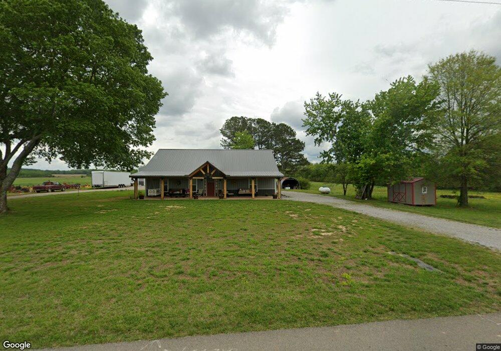
420 Norton Rd Lawrenceburg, TN 38464
Estimated Value: $266,000 - $361,000
--
Bed
--
Bath
1,920
Sq Ft
$168/Sq Ft
Est. Value
About This Home
This home is located at 420 Norton Rd, Lawrenceburg, TN 38464 and is currently estimated at $322,489, approximately $167 per square foot. 420 Norton Rd is a home with nearby schools including Ingram Sowell Elementary School, Lawrenceburg Public Elementary School, and David Crockett Elementary School.
Ownership History
Date
Name
Owned For
Owner Type
Purchase Details
Closed on
Mar 11, 2021
Sold by
Barnett Ray Felton and Barnett Cindy
Bought by
Kerr Edward D and Kerr Glenda A
Current Estimated Value
Purchase Details
Closed on
Feb 1, 2000
Sold by
Ratliff Elizabeth P
Bought by
Ray Barnett
Purchase Details
Closed on
Jan 25, 2000
Bought by
First Farmers & Merchants
Purchase Details
Closed on
Aug 23, 1994
Sold by
Dexter Honser
Bought by
Rattiff Elizabeth P
Purchase Details
Closed on
Nov 19, 1993
Create a Home Valuation Report for This Property
The Home Valuation Report is an in-depth analysis detailing your home's value as well as a comparison with similar homes in the area
Home Values in the Area
Average Home Value in this Area
Purchase History
| Date | Buyer | Sale Price | Title Company |
|---|---|---|---|
| Kerr Edward D | $15,000 | None Available | |
| Ray Barnett | $13,000 | -- | |
| First Farmers & Merchants | $21,918 | -- | |
| Rattiff Elizabeth P | $18,000 | -- | |
| -- | $5,000 | -- |
Source: Public Records
Tax History Compared to Growth
Tax History
| Year | Tax Paid | Tax Assessment Tax Assessment Total Assessment is a certain percentage of the fair market value that is determined by local assessors to be the total taxable value of land and additions on the property. | Land | Improvement |
|---|---|---|---|---|
| 2025 | $1,280 | $63,675 | $0 | $0 |
| 2024 | $1,280 | $63,675 | $2,775 | $60,900 |
| 2023 | $1,280 | $63,675 | $2,775 | $60,900 |
| 2022 | $1,280 | $63,675 | $2,775 | $60,900 |
| 2021 | $130 | $4,400 | $2,900 | $1,500 |
| 2020 | $130 | $4,400 | $2,900 | $1,500 |
| 2019 | $130 | $4,400 | $2,900 | $1,500 |
| 2018 | $130 | $4,400 | $2,900 | $1,500 |
| 2017 | $130 | $4,400 | $2,900 | $1,500 |
| 2016 | $130 | $4,400 | $2,900 | $1,500 |
| 2015 | $121 | $4,400 | $2,900 | $1,500 |
| 2014 | $122 | $4,450 | $2,900 | $1,550 |
Source: Public Records
Map
Nearby Homes
- 1950 Norton Rd
- 206 State Ave
- 380 Lanning Rd
- 260 Wesley Chapel Rd
- 2600 Clanton Rd
- 145 Lantz Rd
- 786 Hillview Dr
- 79 Bishop Rd
- 2342 Pulaski Hwy
- 111 Grandview Dr
- 2073 Choates Creek Rd
- 0 Lanning Rd
- 2290 Grandview Dr
- 33 Bishop Rd
- 123 Quail Dr
- 729 Weakley Creek Rd
- 107 Pond Dr
- 1408 Baker Ln
- 2167 Powdermill Hill Rd
- 1448 Baker Ln
- 711 Norton Rd
- 921 Norton Rd
- 980 Norton Rd
- 1000 Norton Rd
- 220 Norton Rd
- 4088 Airport Dr
- 1131 Norton Rd
- 103 Michael Cir
- 1120 Norton Rd
- 105 Michael Cir
- 2 Michael Cir
- 113 Michael Cir
- 100 Michael Cir
- 104 Michael Cir
- 0 Michael Cir
- 0 Airport Rd
- 106 Michael Cir
- 108 Michael Cir
- 110 Michael Cir
- 155 Michael Cir