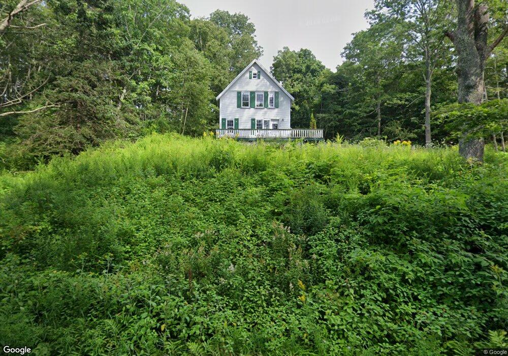
420 Ocean Point Rd East Boothbay, ME 04544
Estimated Value: $345,185 - $600,000
2
Beds
1
Bath
484
Sq Ft
$1,039/Sq Ft
Est. Value
About This Home
This home is located at 420 Ocean Point Rd, East Boothbay, ME 04544 and is currently estimated at $503,046, approximately $1,039 per square foot. 420 Ocean Point Rd is a home located in Lincoln County with nearby schools including Boothbay Region Elementary School and Boothbay Region High School.
Ownership History
Date
Name
Owned For
Owner Type
Purchase Details
Closed on
Apr 24, 2025
Sold by
Monahan William C and Mccue Melissa
Bought by
William Colby Monahan Ret and Monahan
Current Estimated Value
Purchase Details
Closed on
Oct 16, 2019
Sold by
George June R and Wilmington Svgs Fund Soc
Bought by
Wilmington Svgs Fund Soc
Create a Home Valuation Report for This Property
The Home Valuation Report is an in-depth analysis detailing your home's value as well as a comparison with similar homes in the area
Home Values in the Area
Average Home Value in this Area
Purchase History
| Date | Buyer | Sale Price | Title Company |
|---|---|---|---|
| William Colby Monahan Ret | -- | None Available | |
| William Colby Monahan Ret | -- | None Available | |
| Wilmington Svgs Fund Soc | -- | -- | |
| Wilmington Svgs Fund Soc | -- | -- |
Source: Public Records
Tax History Compared to Growth
Tax History
| Year | Tax Paid | Tax Assessment Tax Assessment Total Assessment is a certain percentage of the fair market value that is determined by local assessors to be the total taxable value of land and additions on the property. | Land | Improvement |
|---|---|---|---|---|
| 2024 | $2,255 | $198,651 | $142,208 | $56,443 |
| 2023 | $1,996 | $198,651 | $142,208 | $56,443 |
| 2022 | $1,303 | $140,068 | $105,966 | $34,102 |
| 2021 | $1,338 | $140,068 | $105,966 | $34,102 |
| 2020 | $1,345 | $140,068 | $105,966 | $34,102 |
| 2019 | $1,988 | $210,413 | $142,208 | $68,205 |
| 2018 | $1,957 | $210,413 | $142,208 | $68,205 |
| 2017 | $1,608 | $174,800 | $74,100 | $100,700 |
| 2016 | $1,538 | $174,800 | $74,100 | $100,700 |
| 2015 | $1,530 | $174,800 | $74,100 | $100,700 |
| 2014 | $1,486 | $174,800 | $74,100 | $100,700 |
Source: Public Records
Map
Nearby Homes
- 12 Westwind Dr
- 5 Massachusetts Ave
- 239 Ocean Point Rd
- 44 King Phillips Trail
- 210 Ocean Point Rd
- 127 Appalachee Rd
- 23 Meadow Cove Rd
- 35 Rice Rd
- 98 Meadow Cove Rd
- 28 & 31 Will Alley Rd
- 74 & 76 Bay St
- 19 Hill Rd
- 31 Bay St
- Lts 23A&24 Birch Island
- Birch Island
- 25 Pineview Ridge Rd
- 37 Townsend Ave
- 66 Townsend Ave
- 27 Townsend Ave
- 34 Townsend Ave
- 420 Ocean Point Rd
- 25 Farnham Point Rd
- 7 Farnham Point Rd
- 411 Ocean Point Rd
- 415 Ocean Point Rd
- 4 Westwind Ln
- 4 Wave Crest Dr Unit C-5
- 20 Ruff Wave Dr
- 407 Ocean Point Rd
- 4 Farnham Point Rd
- 16 Farnham Point Rd
- 429 Ocean Point Rd
- 401 Ocean Point Rd
- 5 Westwind Dr
- 9,11 Westwind Dr
- 10 Westwind Dr
- 396 Ocean Point Rd
- 397 Ocean Point Rd
- 9-11 Westwind Rd
- 25 Rock Lobster Rd