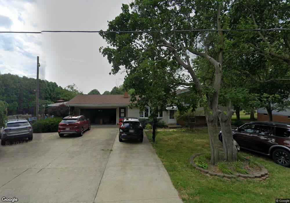
4201 Meese Rd Louisville, OH 44641
Estimated Value: $335,783 - $351,000
3
Beds
3
Baths
2,176
Sq Ft
$157/Sq Ft
Est. Value
About This Home
This home is located at 4201 Meese Rd, Louisville, OH 44641 and is currently estimated at $341,196, approximately $156 per square foot. 4201 Meese Rd is a home located in Stark County with nearby schools including Louisville High School and St. Thomas Aquinas High School & Middle School.
Ownership History
Date
Name
Owned For
Owner Type
Purchase Details
Closed on
Jul 29, 2019
Sold by
Jones Ronald D and Jones Kristin L
Bought by
Jones Ronald D and Jones Kristin L
Current Estimated Value
Purchase Details
Closed on
Jun 21, 2005
Sold by
Katich George S and Katich Allison B
Bought by
Jones Ronald D and Jones Kristin L
Home Financials for this Owner
Home Financials are based on the most recent Mortgage that was taken out on this home.
Original Mortgage
$195,750
Outstanding Balance
$102,588
Interest Rate
5.82%
Mortgage Type
Fannie Mae Freddie Mac
Estimated Equity
$238,608
Purchase Details
Closed on
Nov 16, 1992
Create a Home Valuation Report for This Property
The Home Valuation Report is an in-depth analysis detailing your home's value as well as a comparison with similar homes in the area
Home Values in the Area
Average Home Value in this Area
Purchase History
| Date | Buyer | Sale Price | Title Company |
|---|---|---|---|
| Jones Ronald D | -- | None Available | |
| Jones Ronald D | $217,500 | -- | |
| -- | -- | -- |
Source: Public Records
Mortgage History
| Date | Status | Borrower | Loan Amount |
|---|---|---|---|
| Open | Jones Ronald D | $195,750 |
Source: Public Records
Tax History Compared to Growth
Tax History
| Year | Tax Paid | Tax Assessment Tax Assessment Total Assessment is a certain percentage of the fair market value that is determined by local assessors to be the total taxable value of land and additions on the property. | Land | Improvement |
|---|---|---|---|---|
| 2025 | -- | $113,050 | $20,020 | $93,030 |
| 2024 | -- | $113,050 | $20,020 | $93,030 |
| 2023 | $3,566 | $73,330 | $14,140 | $59,190 |
| 2022 | $3,574 | $73,330 | $14,140 | $59,190 |
| 2021 | $3,584 | $73,330 | $14,140 | $59,190 |
| 2020 | $3,001 | $64,860 | $12,740 | $52,120 |
| 2019 | $3,007 | $64,870 | $12,740 | $52,130 |
| 2018 | $3,004 | $64,870 | $12,740 | $52,130 |
| 2017 | $3,030 | $62,450 | $11,940 | $50,510 |
| 2016 | $2,832 | $59,690 | $11,940 | $47,750 |
| 2015 | $2,840 | $59,690 | $11,940 | $47,750 |
| 2014 | $677 | $52,060 | $10,400 | $41,660 |
| 2013 | $1,342 | $52,060 | $10,400 | $41,660 |
Source: Public Records
Map
Nearby Homes
- 1812 E Broad St
- 2110 Edmar St
- 1715 High St
- 2015 E Main St
- 641 S Nickelplate St
- 3390 Meese Rd NE
- 0 Michigan Blvd
- 308 Superior St
- 520 S Silver St
- 728 E Broad St
- 908 Sand Lot Cir
- 1170 Winding Ridge Ave
- 510 S Bauman Ct
- 204 E Broad St
- 325 Lincoln Ave
- 107 E Broad St
- 910 Crosswyck Cir
- 8225 Georgetown St
- 5495 Meese Rd NE
- 1702 View Pointe Ave
- 4221 Meese Rd
- 4221 Meese Rd NE
- 2205 Briarwood St
- 2215 Briarwood St
- 2133 Briarwood St
- 808 Meese Rd
- 2125 Briarwood St
- 814 Meese Rd
- 4255 Meese Rd
- 814 Meese Rd NE
- 2202 Briarwood St
- 2212 Briarwood St
- 822 Meese Rd
- 2128 Briarwood St
- 832 Meese Rd
- 2105 Briarwood St
- 2118 Briarwood St
- 4234 Meese Rd NE
- 4272 Meese Rd NE
- 4272 Meese Rd NE