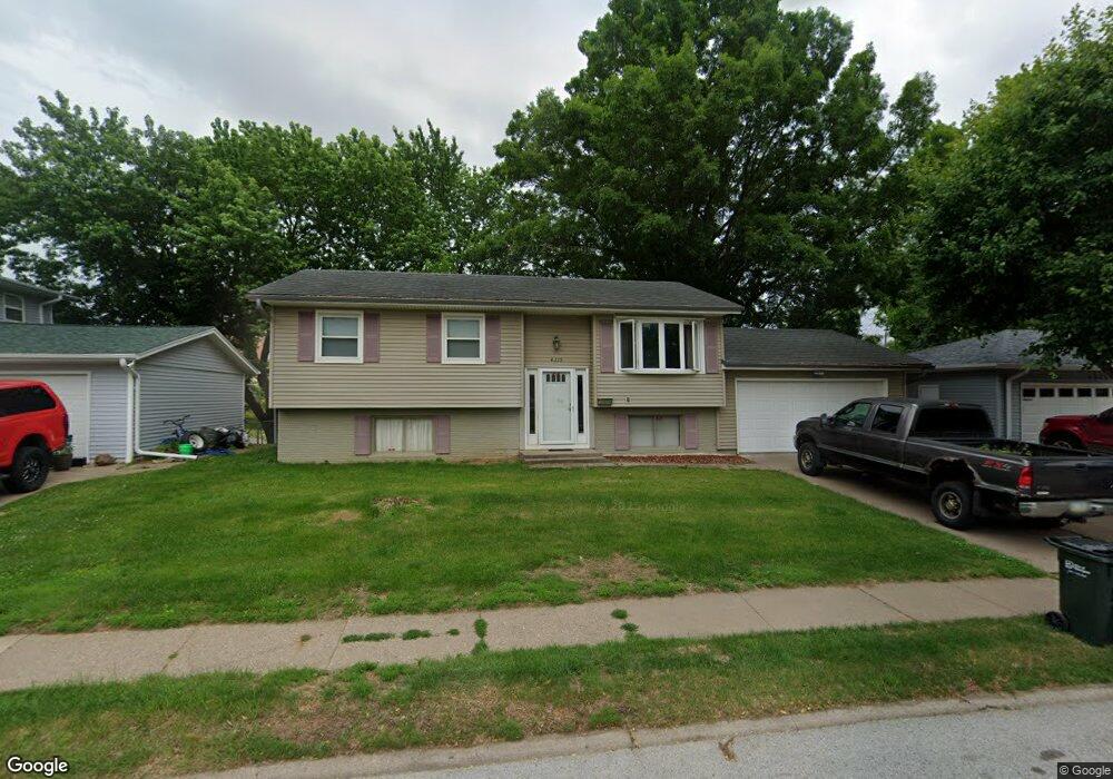
4215 Warren St Davenport, IA 52806
North Side NeighborhoodEstimated Value: $203,000 - $222,000
3
Beds
2
Baths
982
Sq Ft
$213/Sq Ft
Est. Value
About This Home
This home is located at 4215 Warren St, Davenport, IA 52806 and is currently estimated at $209,017, approximately $212 per square foot. 4215 Warren St is a home located in Scott County with nearby schools including Cumberland Hall School, Harrison Elementary School, and Academy Of Continuing Education.
Ownership History
Date
Name
Owned For
Owner Type
Purchase Details
Closed on
Mar 31, 2006
Sold by
Schlenker Robert E
Bought by
Gasser Gregory J
Current Estimated Value
Home Financials for this Owner
Home Financials are based on the most recent Mortgage that was taken out on this home.
Original Mortgage
$109,250
Outstanding Balance
$64,727
Interest Rate
7%
Mortgage Type
Adjustable Rate Mortgage/ARM
Estimated Equity
$144,290
Create a Home Valuation Report for This Property
The Home Valuation Report is an in-depth analysis detailing your home's value as well as a comparison with similar homes in the area
Home Values in the Area
Average Home Value in this Area
Purchase History
| Date | Buyer | Sale Price | Title Company |
|---|---|---|---|
| Gasser Gregory J | $115,000 | None Available |
Source: Public Records
Mortgage History
| Date | Status | Borrower | Loan Amount |
|---|---|---|---|
| Open | Gasser Gregory J | $109,250 |
Source: Public Records
Tax History Compared to Growth
Tax History
| Year | Tax Paid | Tax Assessment Tax Assessment Total Assessment is a certain percentage of the fair market value that is determined by local assessors to be the total taxable value of land and additions on the property. | Land | Improvement |
|---|---|---|---|---|
| 2025 | $2,926 | $192,580 | $34,410 | $158,170 |
| 2024 | $2,852 | $173,970 | $34,410 | $139,560 |
| 2023 | $3,124 | $173,970 | $34,410 | $139,560 |
| 2022 | $3,024 | $155,130 | $25,020 | $130,110 |
| 2021 | $3,024 | $149,840 | $25,020 | $124,820 |
| 2020 | $2,926 | $143,490 | $25,020 | $118,470 |
| 2019 | $2,980 | $141,380 | $25,020 | $116,360 |
| 2018 | $2,682 | $141,380 | $25,020 | $116,360 |
| 2017 | $728 | $130,800 | $25,020 | $105,780 |
| 2016 | $2,674 | $130,800 | $0 | $0 |
| 2015 | $2,674 | $124,430 | $0 | $0 |
| 2014 | $2,570 | $124,430 | $0 | $0 |
| 2013 | $2,522 | $0 | $0 | $0 |
| 2012 | -- | $119,400 | $31,380 | $88,020 |
Source: Public Records
Map
Nearby Homes
- 4449 Royal Oaks Dr
- 7 Vista Ct
- 4612 Warren St Unit 5
- 4804 Northwest Blvd
- 4757 Willow Cir
- 4743 Willow Cir
- 405 Westerfield Rd
- 1336 W 38th Place
- 1453 W 41st St
- 4618 Fillmore Ln
- 4610 N Ripley St
- 825 Northbrook Dr
- 1344 W 37th St
- 611 Northbrook Dr
- 710 Northbrook Dr
- 1517 W Kimberly Rd
- 4942 Brown St
- 315 Colony Dr
- 4717 N Harrison St
- 4705 N Sturdevant St
- 4223 Warren St
- 4209 Warren St
- 4227 Warren St
- 4205 Warren St
- 4216 Warren St
- 4220 Warren St
- 4208 Warren St
- 4233 Warren St
- 4228 Warren St
- 4125 Warren St
- 4023 Lillie Ave
- 4023 Lillie Ave Unit 604
- 4023 Lillie Ave Unit 502
- 4023 Lillie Ave Unit 411
- 4023 Lillie Ave Unit 408
- 4023 Lillie Ave Unit 405
- 4023 Lillie Ave Unit 103
- 4023 Lillie Ave Unit 203
- 4023 Lillie Ave Unit 603
- 4023 Lillie Ave Unit 602