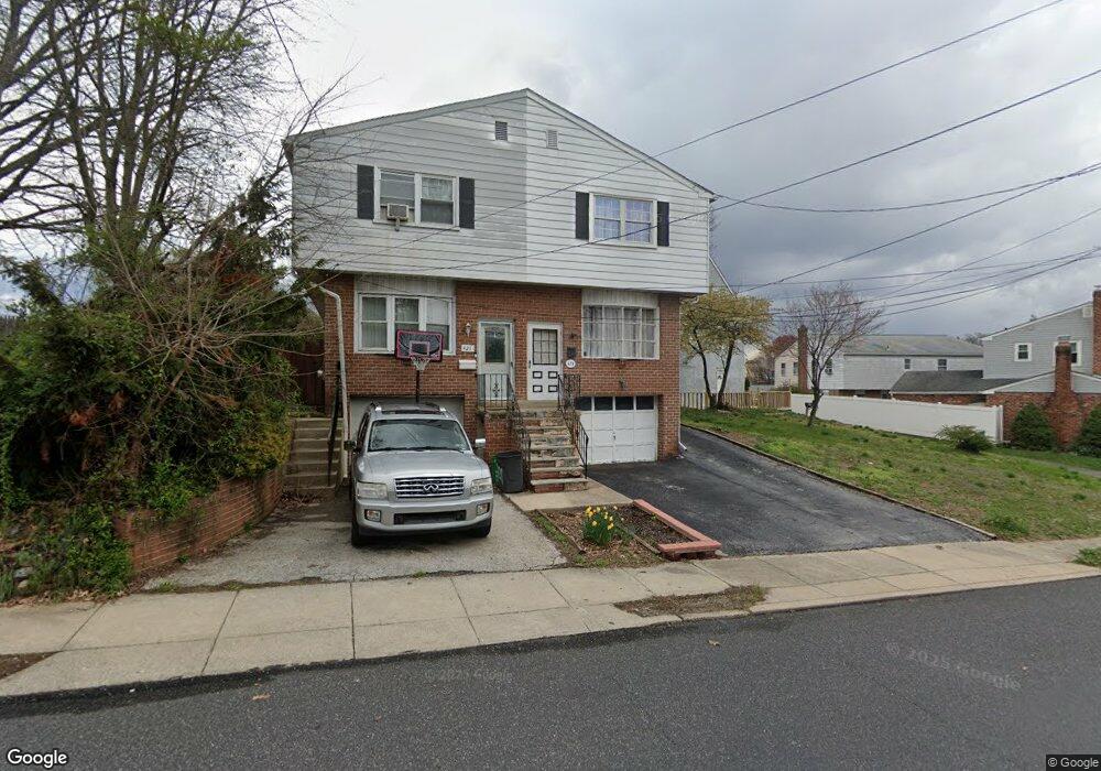
423 Ashland Ave Folcroft, PA 19032
Estimated Value: $231,929 - $264,000
3
Beds
2
Baths
1,346
Sq Ft
$182/Sq Ft
Est. Value
About This Home
This home is located at 423 Ashland Ave, Folcroft, PA 19032 and is currently estimated at $245,232, approximately $182 per square foot. 423 Ashland Ave is a home located in Delaware County with nearby schools including Delcroft School, Academy Park High School, and Liberty Baptist Academy.
Ownership History
Date
Name
Owned For
Owner Type
Purchase Details
Closed on
Oct 28, 2002
Sold by
Miller Helen A
Bought by
Petrocelli Bernard P
Current Estimated Value
Home Financials for this Owner
Home Financials are based on the most recent Mortgage that was taken out on this home.
Original Mortgage
$101,753
Outstanding Balance
$42,682
Interest Rate
6.04%
Estimated Equity
$202,550
Create a Home Valuation Report for This Property
The Home Valuation Report is an in-depth analysis detailing your home's value as well as a comparison with similar homes in the area
Home Values in the Area
Average Home Value in this Area
Purchase History
| Date | Buyer | Sale Price | Title Company |
|---|---|---|---|
| Petrocelli Bernard P | $104,900 | -- |
Source: Public Records
Mortgage History
| Date | Status | Borrower | Loan Amount |
|---|---|---|---|
| Open | Petrocelli Bernard P | $101,753 |
Source: Public Records
Tax History Compared to Growth
Tax History
| Year | Tax Paid | Tax Assessment Tax Assessment Total Assessment is a certain percentage of the fair market value that is determined by local assessors to be the total taxable value of land and additions on the property. | Land | Improvement |
|---|---|---|---|---|
| 2025 | $5,058 | $122,080 | $23,990 | $98,090 |
| 2024 | $5,058 | $122,080 | $23,990 | $98,090 |
| 2023 | $4,917 | $122,080 | $23,990 | $98,090 |
| 2022 | $4,652 | $122,080 | $23,990 | $98,090 |
| 2021 | $6,605 | $122,080 | $23,990 | $98,090 |
| 2020 | $4,274 | $74,430 | $18,370 | $56,060 |
| 2019 | $4,178 | $74,430 | $18,370 | $56,060 |
| 2018 | $4,077 | $74,430 | $0 | $0 |
| 2017 | $3,883 | $74,430 | $0 | $0 |
| 2016 | $408 | $74,430 | $0 | $0 |
| 2015 | $417 | $74,430 | $0 | $0 |
| 2014 | $408 | $74,430 | $0 | $0 |
Source: Public Records
Map
Nearby Homes
- 1836 Shallcross Ave
- 128 E Cooke Ave
- 41 Railroad Ave
- 511 Garfield Ave
- 111 E Oak Ln
- 1525 Elmwood Ave
- 435 Willows Ave
- 8 Stuart Ave
- 46 E Knowles Ave
- 4 N Chester Pike
- 3 W Cooke Ave
- 726 Grant Rd
- 1110 Tribbett Ave
- 125 N Scott Ave
- 819 Grant Rd
- 211 Sharon Park Dr
- 100 E Glenolden Ave Unit B6
- 100 E Glenolden Ave Unit R9
- 100 E Glenolden Ave Unit E12
- 23 W Knowles Ave
- 421 Ashland Ave
- 425 Ashland Ave
- 417 Ashland Ave
- 415 Ashland Ave
- 413 Ashland Ave
- 427 Ashland Ave
- 1726 Shallcross Ave
- 1724 Shallcross Ave
- 420 Ashland Ave
- 418 Ashland Ave
- 500 Ashland Ave
- 416 Ashland Ave
- 420 Dalmas Ave
- 414 Ashland Ave
- 418 Dalmas Ave
- 424 Dalmas Ave
- 504 Ashland Ave
- 416 Dalmas Ave
- 1741 Elmwood Ave
- 506 Ashland Ave