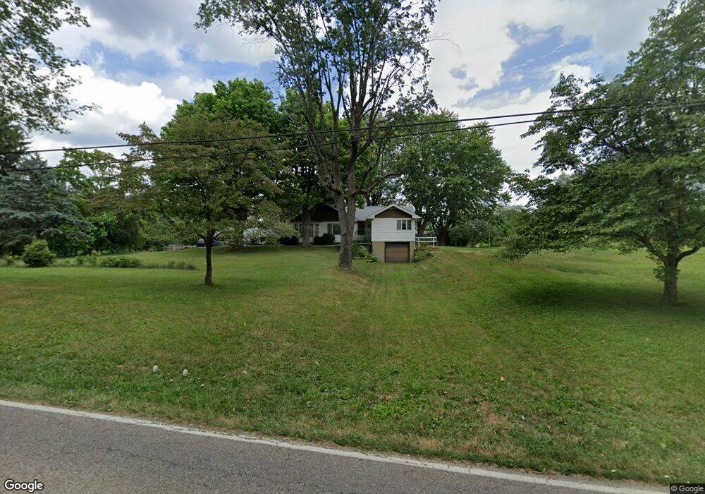
4234 Meese Rd NE Louisville, OH 44641
Estimated Value: $173,000 - $295,143
3
Beds
1
Bath
1,066
Sq Ft
$204/Sq Ft
Est. Value
About This Home
This home is located at 4234 Meese Rd NE, Louisville, OH 44641 and is currently estimated at $217,536, approximately $204 per square foot. 4234 Meese Rd NE is a home located in Stark County with nearby schools including Louisville High School and St. Thomas Aquinas High School & Middle School.
Ownership History
Date
Name
Owned For
Owner Type
Purchase Details
Closed on
Oct 17, 2007
Sold by
Brunotte Rebecca I and Iceman Catherine A
Bought by
Ingram Robert D and Rocher Ingram Aileen
Current Estimated Value
Home Financials for this Owner
Home Financials are based on the most recent Mortgage that was taken out on this home.
Original Mortgage
$40,000
Interest Rate
6.38%
Mortgage Type
Unknown
Create a Home Valuation Report for This Property
The Home Valuation Report is an in-depth analysis detailing your home's value as well as a comparison with similar homes in the area
Home Values in the Area
Average Home Value in this Area
Purchase History
| Date | Buyer | Sale Price | Title Company |
|---|---|---|---|
| Ingram Robert D | $88,000 | Attorney |
Source: Public Records
Mortgage History
| Date | Status | Borrower | Loan Amount |
|---|---|---|---|
| Closed | Ingram Robert D | $40,000 |
Source: Public Records
Tax History Compared to Growth
Tax History
| Year | Tax Paid | Tax Assessment Tax Assessment Total Assessment is a certain percentage of the fair market value that is determined by local assessors to be the total taxable value of land and additions on the property. | Land | Improvement |
|---|---|---|---|---|
| 2025 | $2,148 | $94,920 | $52,010 | $42,910 |
| 2024 | $1,719 | $92,890 | $52,010 | $40,880 |
| 2023 | $4,927 | $62,830 | $32,410 | $30,420 |
| 2022 | $1,567 | $62,830 | $32,410 | $30,420 |
| 2021 | $3,142 | $62,830 | $32,410 | $30,420 |
| 2020 | $2,627 | $55,340 | $29,190 | $26,150 |
| 2019 | $2,639 | $55,360 | $29,200 | $26,160 |
| 2018 | $2,632 | $55,360 | $29,200 | $26,160 |
| 2017 | $2,453 | $49,250 | $24,920 | $24,330 |
| 2016 | $2,401 | $49,250 | $24,920 | $24,330 |
| 2015 | $2,408 | $49,250 | $24,920 | $24,330 |
| 2014 | $268 | $42,930 | $21,740 | $21,190 |
| 2013 | $1,138 | $42,930 | $21,740 | $21,190 |
Source: Public Records
Map
Nearby Homes
- 1812 E Broad St
- 2110 Edmar St
- 1715 High St
- 2015 E Main St
- 3390 Meese Rd NE
- 641 S Nickelplate St
- 0 Michigan Blvd
- 308 Superior St
- 520 S Silver St
- 728 E Broad St
- 908 Sand Lot Cir
- 1170 Winding Ridge Ave
- 325 Lincoln Ave
- 510 S Bauman Ct
- 204 E Broad St
- 107 E Broad St
- 910 Crosswyck Cir
- 5495 Meese Rd NE
- 8225 Georgetown St
- 1702 View Pointe Ave
- 4272 Meese Rd NE
- 4272 Meese Rd NE
- 4255 Meese Rd
- 4221 Meese Rd
- 4221 Meese Rd NE
- 4328 Meese Rd NE
- 808 Meese Rd
- 4201 Meese Rd
- 814 Meese Rd NE
- 814 Meese Rd
- 2215 Briarwood St
- 4356 Meese Rd
- 2205 Briarwood St
- 2135 Ashbrook Ave
- 822 Meese Rd
- 2134 Ashbrook Ave
- 2133 Briarwood St
- 832 Meese Rd
- 2125 Ashbrook Ave
- 528 Brookfield Cir