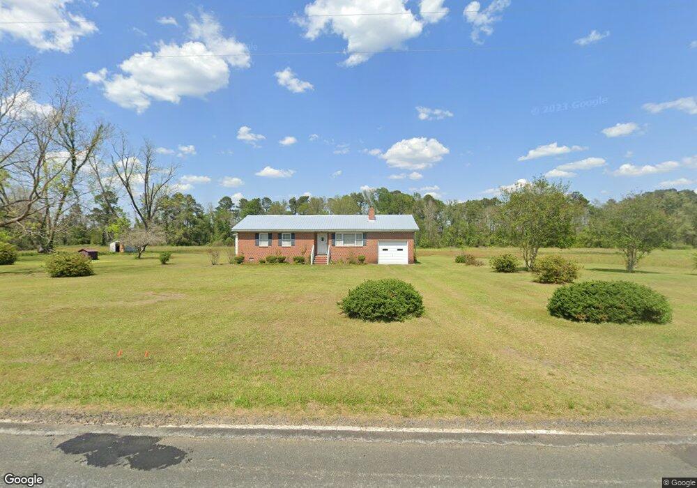
4248 Wire Rd Saint George, SC 29477
Estimated Value: $212,000 - $323,000
3
Beds
2
Baths
1,364
Sq Ft
$188/Sq Ft
Est. Value
About This Home
This home is located at 4248 Wire Rd, Saint George, SC 29477 and is currently estimated at $255,802, approximately $187 per square foot. 4248 Wire Rd is a home located in Dorchester County with nearby schools including Williams Memorial Elementary School, St. George Middle School, and Harleyville-Ridgeville Middle.
Ownership History
Date
Name
Owned For
Owner Type
Purchase Details
Closed on
Sep 23, 2024
Sold by
Quattlebaum Ronald W and Quattlebaum Nancy M
Bought by
Quattlebaum Nicholas Ronald
Current Estimated Value
Purchase Details
Closed on
Sep 12, 2022
Sold by
Fralix Frances M
Bought by
Quattlebaum Ronald W and Quattlebaum Nancy M
Home Financials for this Owner
Home Financials are based on the most recent Mortgage that was taken out on this home.
Original Mortgage
$190,000
Outstanding Balance
$160,807
Interest Rate
4.58%
Mortgage Type
New Conventional
Estimated Equity
$94,995
Create a Home Valuation Report for This Property
The Home Valuation Report is an in-depth analysis detailing your home's value as well as a comparison with similar homes in the area
Home Values in the Area
Average Home Value in this Area
Purchase History
| Date | Buyer | Sale Price | Title Company |
|---|---|---|---|
| Quattlebaum Nicholas Ronald | -- | None Listed On Document | |
| Quattlebaum Ronald W | $200,000 | -- |
Source: Public Records
Mortgage History
| Date | Status | Borrower | Loan Amount |
|---|---|---|---|
| Open | Quattlebaum Ronald W | $190,000 |
Source: Public Records
Tax History Compared to Growth
Tax History
| Year | Tax Paid | Tax Assessment Tax Assessment Total Assessment is a certain percentage of the fair market value that is determined by local assessors to be the total taxable value of land and additions on the property. | Land | Improvement |
|---|---|---|---|---|
| 2025 | $1,358 | $8,492 | $1,600 | $6,892 |
| 2024 | $1,358 | $11,393 | $2,400 | $8,993 |
| 2023 | $1,358 | $11,393 | $2,400 | $8,993 |
| 2022 | $2,568 | $6,490 | $1,280 | $5,210 |
| 2021 | $503 | $6,490 | $1,280 | $5,210 |
| 2020 | $405 | $3,760 | $740 | $3,020 |
| 2019 | $405 | $3,760 | $740 | $3,020 |
| 2018 | $590 | $3,760 | $740 | $3,020 |
| 2017 | $513 | $5,090 | $1,100 | $3,990 |
| 2016 | $500 | $5,090 | $1,100 | $3,990 |
| 2015 | $498 | $5,090 | $1,100 | $3,990 |
| 2014 | $404 | $110,800 | $0 | $0 |
| 2013 | -- | $4,430 | $0 | $0 |
Source: Public Records
Map
Nearby Homes
- 0 Maple Branch Rd Unit Road 25012478
- 0 Maple Branch Rd Unit 169720
- 122 Orchid Loop
- 003 Old Spell Rd Unit 3
- 000000 Old Spell Rd
- 005 Old Spell Rd Unit 5
- 0000 Old Spell Rd
- 1796 Highway 15 S
- 7518 Augusta Hwy Hwy61 Hwy
- 000 Misty Ridge Ln
- 00 Misty Ridge Ln
- 00 Bluebird Trail
- 371 Tiny Ln
- 0 Augusta Hwy Unit 25016568
- 000 State Road S-15-50
- 298 Old Bell Rd
- 0 Palm St
- 0 Echo Ln Unit 25022214
- 0 Seven Acres Rd Unit 169717
- 171 Autumn Run Rd
- 4258 Wire Rd
- 4214 Wire Rd
- 4331 Wire Rd
- 4345 Wire Rd
- 4385 Wire Rd
- 4359 Wire Rd
- 4319 Wire Rd
- 4331 Wire Rd
- 130 Edisto River Rd
- 0 Appleby Rd Unit Off
- 0 Cowtail Rd Unit 1304471
- 0 Cowtail Rd
- 104 Canal St
- 194 Cowtail Rd
- 182 Edisto River Rd
- 186 Edisto River Rd
- 155 Cowtail Rd
- 0 I-95 & Hwy 178
- 0 I-95 & Hwy 178 (Exit 82)
- 225 Cowtail Rd