Estimated Value: $197,247 - $252,000
4
Beds
2
Baths
1,496
Sq Ft
$148/Sq Ft
Est. Value
About This Home
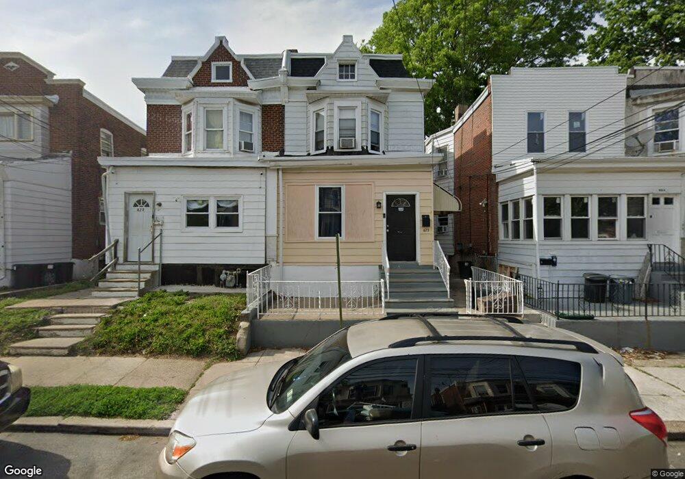
This home is located at 425 Pusey Ave, Darby, PA 19023 and is currently estimated at $220,812, approximately $147 per square foot. 425 Pusey Ave is a home located in Delaware County with nearby schools including Harris School, Academy Park High School, and Blessed Virgin Mary School.
Ownership History
Date
Name
Owned For
Owner Type
Purchase Details
Closed on
Jun 6, 2012
Sold by
Secretary Of Housing & Urban Development
Bought by
City Re Llc
Current Estimated Value
Purchase Details
Closed on
Jul 6, 2011
Sold by
Gmac Mortgage Llc
Bought by
Secretary Of Housing & Urban Development
Purchase Details
Closed on
Jul 15, 2010
Sold by
Bey Norma
Bought by
Gmac Mortgage Llc
Purchase Details
Closed on
Jun 9, 2005
Sold by
Moore Randy
Bought by
Bey Norma
Home Financials for this Owner
Home Financials are based on the most recent Mortgage that was taken out on this home.
Original Mortgage
$84,333
Interest Rate
5.79%
Mortgage Type
FHA
Create a Home Valuation Report for This Property
The Home Valuation Report is an in-depth analysis detailing your home's value as well as a comparison with similar homes in the area
Home Values in the Area
Average Home Value in this Area
Purchase History
| Date | Buyer | Sale Price | Title Company |
|---|---|---|---|
| City Re Llc | $24,000 | None Available | |
| Secretary Of Housing & Urban Development | -- | None Available | |
| Gmac Mortgage Llc | -- | None Available | |
| Bey Norma | $85,000 | Commonwealth Title |
Source: Public Records
Mortgage History
| Date | Status | Borrower | Loan Amount |
|---|---|---|---|
| Previous Owner | Bey Norma | $84,333 |
Source: Public Records
Tax History Compared to Growth
Tax History
| Year | Tax Paid | Tax Assessment Tax Assessment Total Assessment is a certain percentage of the fair market value that is determined by local assessors to be the total taxable value of land and additions on the property. | Land | Improvement |
|---|---|---|---|---|
| 2025 | $4,039 | $89,190 | $22,010 | $67,180 |
| 2024 | $4,039 | $89,190 | $22,010 | $67,180 |
| 2023 | $3,932 | $89,190 | $22,010 | $67,180 |
| 2022 | $3,783 | $89,190 | $22,010 | $67,180 |
| 2021 | $5,210 | $89,190 | $22,010 | $67,180 |
| 2020 | $2,588 | $40,720 | $15,890 | $24,830 |
| 2019 | $2,495 | $40,720 | $15,890 | $24,830 |
| 2018 | $2,440 | $40,720 | $0 | $0 |
| 2017 | $2,394 | $40,720 | $0 | $0 |
| 2016 | $223 | $40,720 | $0 | $0 |
| 2015 | $228 | $40,720 | $0 | $0 |
| 2014 | $228 | $40,720 | $0 | $0 |
Source: Public Records
Map
Nearby Homes
- 209 Pusey Ave
- 418 Pusey Ave Unit 95
- 105 Jackson Ave
- 17 Kern St
- 238 Jackson Ave
- 212 Pusey Ave
- 71 Burnside Ave
- 118 Juliana Terrace
- 235 Felton Ave
- 515 Andrews Ave
- 439 Beechwood Ave
- 411 Chester Pike
- 230 Felton Ave
- 112 Pusey Ave
- 113 Hillside Ave
- 605 Andrews Ave
- 211 Ridley Ave
- 416 Jackson Ave
- 200 Barker Ave
- 228 Bartlett Ave