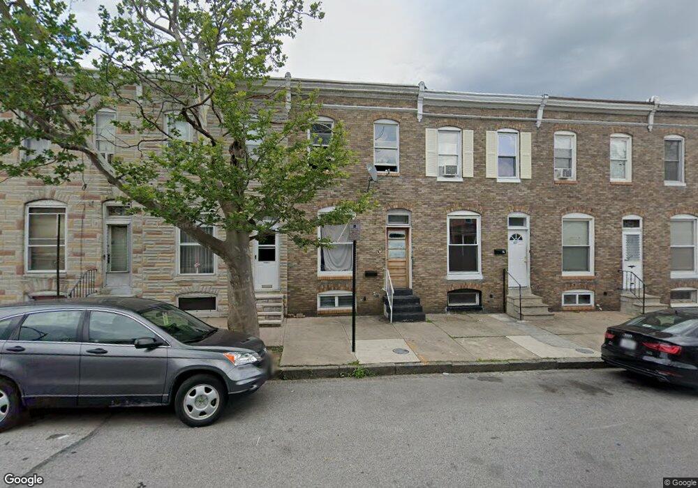
425 S Bentalou St Baltimore, MD 21223
Carrollton Ridge NeighborhoodEstimated Value: $69,820 - $76,000
--
Bed
1
Bath
1,204
Sq Ft
$61/Sq Ft
Est. Value
About This Home
This home is located at 425 S Bentalou St, Baltimore, MD 21223 and is currently estimated at $72,910, approximately $60 per square foot. 425 S Bentalou St is a home located in Baltimore City with nearby schools including Booker T. Washington Middle School, Edmondson Westside High School, and Digital Harbor High School.
Ownership History
Date
Name
Owned For
Owner Type
Purchase Details
Closed on
Jun 7, 2022
Sold by
Atlas Properties 2020 Llc
Bought by
Spazio Llc
Current Estimated Value
Purchase Details
Closed on
Oct 28, 2021
Sold by
Ramoth Home Solutions Llc
Bought by
Atlas Properties 2020 Llc
Purchase Details
Closed on
Mar 26, 2020
Sold by
Turner Davard and Tnt Equity Llc
Bought by
Ramoth Home Solutions Llc
Purchase Details
Closed on
Oct 20, 1995
Sold by
Reck James G
Bought by
Andercyk James S
Create a Home Valuation Report for This Property
The Home Valuation Report is an in-depth analysis detailing your home's value as well as a comparison with similar homes in the area
Home Values in the Area
Average Home Value in this Area
Purchase History
| Date | Buyer | Sale Price | Title Company |
|---|---|---|---|
| Spazio Llc | $61,750 | -- | |
| Spazio Llc | $61,750 | None Listed On Document | |
| Atlas Properties 2020 Llc | $50,000 | Castle Title | |
| Ramoth Home Solutions Llc | $13,000 | Commerce Title Company Inc | |
| Andercyk James S | $22,000 | -- |
Source: Public Records
Tax History Compared to Growth
Tax History
| Year | Tax Paid | Tax Assessment Tax Assessment Total Assessment is a certain percentage of the fair market value that is determined by local assessors to be the total taxable value of land and additions on the property. | Land | Improvement |
|---|---|---|---|---|
| 2025 | $925 | $44,733 | -- | -- |
| 2024 | $925 | $39,367 | $0 | $0 |
| 2023 | $802 | $34,000 | $7,000 | $27,000 |
| 2022 | $732 | $31,000 | $0 | $0 |
| 2021 | $661 | $28,000 | $0 | $0 |
| 2020 | $590 | $25,000 | $5,000 | $20,000 |
| 2019 | $509 | $21,667 | $0 | $0 |
| 2018 | $433 | $18,333 | $0 | $0 |
| 2017 | $354 | $15,000 | $0 | $0 |
| 2016 | $592 | $15,000 | $0 | $0 |
| 2015 | $592 | $15,000 | $0 | $0 |
| 2014 | $592 | $25,000 | $0 | $0 |
Source: Public Records
Map
Nearby Homes
- 419 Furrow St
- 423 Furrow St
- 411 Furrow St
- 420 S Smallwood St
- 426 S Smallwood St
- 406 S Smallwood St
- 2202 Ashton St
- 2241 Ramsay St
- 452 Furrow St
- 454 Furrow St
- 347 S Smallwood St
- 342 S Smallwood St
- 328 Furrow St
- 430 S Bentalou St
- 510 S Smallwood St
- 408 S Bentalou St
- 478 S Bentalou St
- 480 S Bentalou St
- 406 S Pulaski St
- 2228 Christian St
- 423 S Bentalou St
- 421 S Bentalou St
- 427 S Bentalou St
- 419 S Bentalou St
- 429 S Bentalou St
- 417 S Bentalou St
- 431 S Bentalou St
- 415 S Bentalou St
- 433 S Bentalou St
- 413 S Bentalou St
- 436 Furrow St
- 438 Furrow St
- 434 Furrow St
- 440 Furrow St
- 432 Furrow St
- 435 S Bentalou St
- 411 S Bentalou St
- 442 Furrow St
- 430 Furrow St
- 444 Furrow St