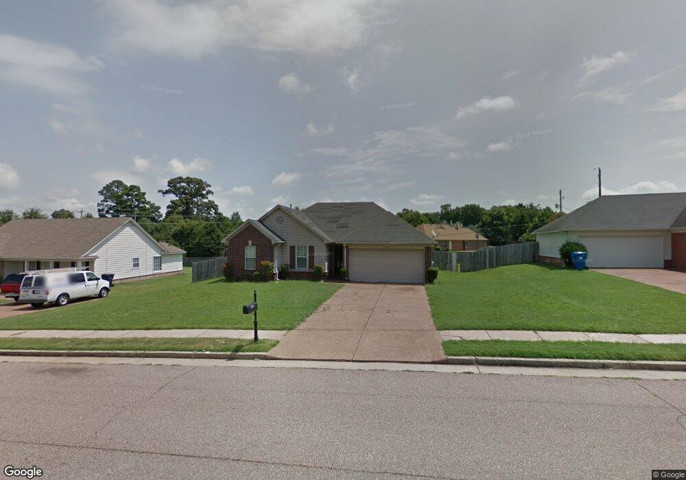
4256 Rosswood Dr Memphis, TN 38128
Raleigh NeighborhoodEstimated Value: $153,509 - $167,000
3
Beds
2
Baths
1,235
Sq Ft
$132/Sq Ft
Est. Value
About This Home
This home is located at 4256 Rosswood Dr, Memphis, TN 38128 and is currently estimated at $163,127, approximately $132 per square foot. 4256 Rosswood Dr is a home located in Shelby County with nearby schools including Lucy Elementary School, Woodstock Middle School, and Bolton High School.
Ownership History
Date
Name
Owned For
Owner Type
Purchase Details
Closed on
Nov 16, 2001
Sold by
Halliburton Barbara L J
Bought by
Halliburton Benjamin R and Halliburton Barbara L J
Current Estimated Value
Home Financials for this Owner
Home Financials are based on the most recent Mortgage that was taken out on this home.
Original Mortgage
$112,108
Outstanding Balance
$43,397
Interest Rate
6.89%
Mortgage Type
FHA
Estimated Equity
$119,730
Purchase Details
Closed on
Sep 17, 2001
Sold by
Hyneman Bronze Llc
Bought by
Jernigan Barbara L
Home Financials for this Owner
Home Financials are based on the most recent Mortgage that was taken out on this home.
Original Mortgage
$112,108
Outstanding Balance
$43,397
Interest Rate
6.89%
Mortgage Type
FHA
Estimated Equity
$119,730
Create a Home Valuation Report for This Property
The Home Valuation Report is an in-depth analysis detailing your home's value as well as a comparison with similar homes in the area
Home Values in the Area
Average Home Value in this Area
Purchase History
| Date | Buyer | Sale Price | Title Company |
|---|---|---|---|
| Halliburton Benjamin R | -- | -- | |
| Jernigan Barbara L | $112,995 | Southern Escrow Title Compan |
Source: Public Records
Mortgage History
| Date | Status | Borrower | Loan Amount |
|---|---|---|---|
| Open | Jernigan Barbara L | $112,108 | |
| Closed | Jernigan Barbara L | $4,484 |
Source: Public Records
Tax History Compared to Growth
Tax History
| Year | Tax Paid | Tax Assessment Tax Assessment Total Assessment is a certain percentage of the fair market value that is determined by local assessors to be the total taxable value of land and additions on the property. | Land | Improvement |
|---|---|---|---|---|
| 2025 | $947 | $29,500 | $4,500 | $25,000 |
| 2024 | $947 | $27,925 | $4,125 | $23,800 |
| 2023 | $947 | $27,925 | $4,125 | $23,800 |
| 2022 | $947 | $27,925 | $4,125 | $23,800 |
| 2021 | $963 | $27,925 | $4,125 | $23,800 |
| 2020 | $791 | $19,525 | $4,125 | $15,400 |
| 2019 | $791 | $19,525 | $4,125 | $15,400 |
| 2018 | $791 | $19,525 | $4,125 | $15,400 |
| 2017 | $802 | $19,525 | $4,125 | $15,400 |
| 2016 | $798 | $18,250 | $0 | $0 |
| 2014 | $798 | $18,250 | $0 | $0 |
Source: Public Records
Map
Nearby Homes
- 4350 Shadow Leaf Cove S
- 4335 N Grand Cedar Ln
- 4136 Hampton Manor Ln
- 4409 E Hunters Glen St
- 3953 Otter Dr
- 4087 Singleton Pkwy
- 3928 Springfield Dr
- 3914 Springfield Dr
- 4563 Blue River Dr
- 4841 Northdale Dr
- 3885 Lakemont Dr
- 4626 St Elmo Ave
- 4807 Royal Run Dr
- 0 Singleton Park Unit 10193357
- 4236 Appian Dr
- 3836 Lakehurst Dr
- 4118 Austin Peay Hwy
- 0 Egypt Central Rd Unit RTC3009208
- 0 Egypt Central Rd Unit 10198246
- 4693 Waterfront Oak Dr
- 4264 Rosswood Dr
- 4248 Rosswood Dr
- 4659 Sun Mist Cove
- 4654 Sun Mist Cove
- 4240 Rosswood Dr
- 4276 Rosswood Dr
- 4650 Sun Ridge Dr
- 4623 Cedar Branch Cir
- 4620 Sun Ridge Dr
- 4658 Sun Ridge Dr
- 4660 Sun Mist Cove
- 4669 Sun Mist Cove
- 4620 Cedar Branch Cir
- 4613 Cedar Branch Cir
- 4612 Sun Ridge Dr
- 4664 Sun Ridge Dr
- 4641 Sun Ridge Dr
- 4668 Sun Mist Cove
- 0 Rosswood Rd Unit 10021864
- 0 Rosswood Rd Unit 10110713