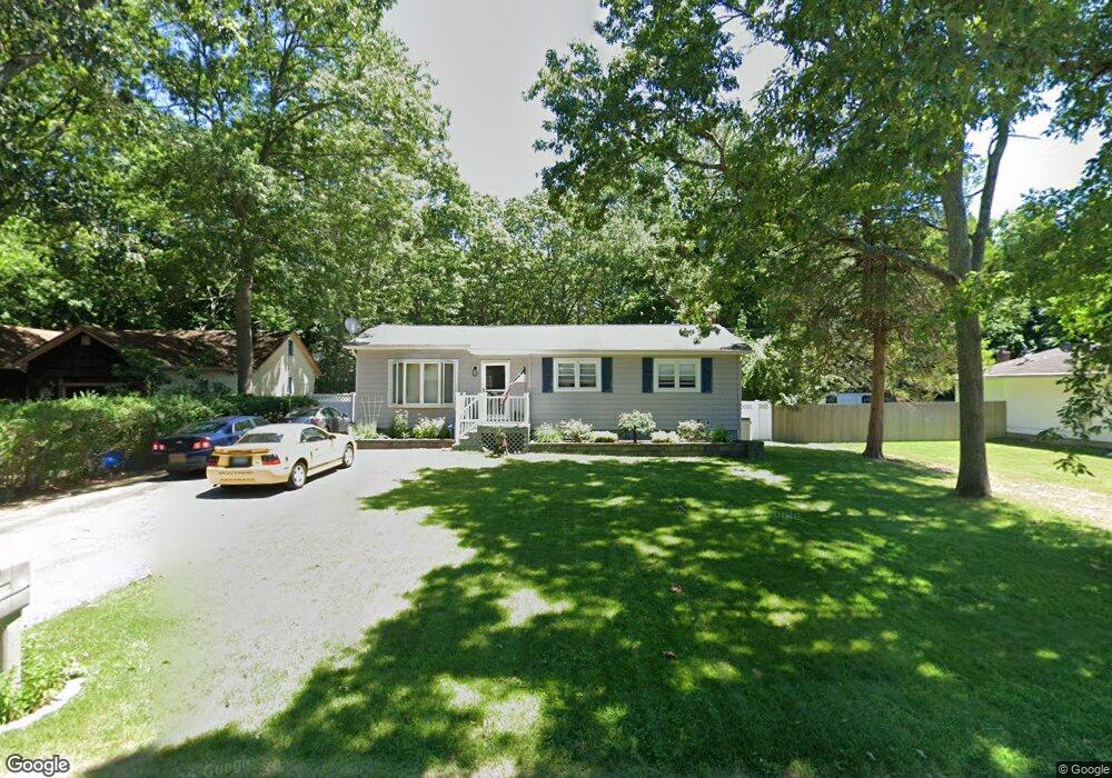
426 Rowlinson Dr Shirley, NY 11967
Estimated Value: $468,000 - $491,000
3
Beds
1
Bath
1,016
Sq Ft
$473/Sq Ft
Est. Value
About This Home
This home is located at 426 Rowlinson Dr, Shirley, NY 11967 and is currently estimated at $480,920, approximately $473 per square foot. 426 Rowlinson Dr is a home located in Suffolk County with nearby schools including Longwood Junior High School, Longwood Middle School, and Longwood Senior High School.
Ownership History
Date
Name
Owned For
Owner Type
Purchase Details
Closed on
Feb 18, 2005
Sold by
Keppel Dennis
Bought by
Bertoni Joseph
Current Estimated Value
Purchase Details
Closed on
Nov 15, 2000
Sold by
Linneman George J
Bought by
Keppel Dennis and Keppel Donna
Home Financials for this Owner
Home Financials are based on the most recent Mortgage that was taken out on this home.
Original Mortgage
$98,000
Interest Rate
7.7%
Purchase Details
Closed on
Oct 21, 1999
Sold by
Bowie John M and Bowie Patricia M
Bought by
Linneman George J
Home Financials for this Owner
Home Financials are based on the most recent Mortgage that was taken out on this home.
Original Mortgage
$103,100
Interest Rate
7.77%
Mortgage Type
FHA
Create a Home Valuation Report for This Property
The Home Valuation Report is an in-depth analysis detailing your home's value as well as a comparison with similar homes in the area
Home Values in the Area
Average Home Value in this Area
Purchase History
| Date | Buyer | Sale Price | Title Company |
|---|---|---|---|
| Bertoni Joseph | $260,000 | Ronald Farr | |
| Keppel Dennis | $135,000 | Chicago Title Insurance Co | |
| Linneman George J | $104,000 | -- |
Source: Public Records
Mortgage History
| Date | Status | Borrower | Loan Amount |
|---|---|---|---|
| Previous Owner | Keppel Dennis | $98,000 | |
| Previous Owner | Linneman George J | $103,100 |
Source: Public Records
Tax History Compared to Growth
Tax History
| Year | Tax Paid | Tax Assessment Tax Assessment Total Assessment is a certain percentage of the fair market value that is determined by local assessors to be the total taxable value of land and additions on the property. | Land | Improvement |
|---|---|---|---|---|
| 2024 | $6,658 | $1,750 | $150 | $1,600 |
| 2023 | $6,658 | $1,750 | $150 | $1,600 |
| 2022 | $5,942 | $1,750 | $150 | $1,600 |
| 2021 | $5,942 | $1,750 | $150 | $1,600 |
| 2020 | $6,119 | $1,750 | $150 | $1,600 |
| 2019 | $6,119 | $0 | $0 | $0 |
| 2018 | $5,779 | $1,750 | $150 | $1,600 |
| 2017 | $5,779 | $1,750 | $150 | $1,600 |
| 2016 | $5,721 | $1,750 | $150 | $1,600 |
| 2015 | -- | $1,750 | $150 | $1,600 |
| 2014 | -- | $1,750 | $150 | $1,600 |
Source: Public Records
Map
Nearby Homes
- 444 Puritan Dr
- Lot Avondale Dr
- 380 Wellwood Dr
- 461 Avondale Dr
- 509 Lockwood Dr
- 206 Crestwood Dr
- 459 Wellwood Dr
- 500 Boxwood Dr
- 473 Sleepy Hollow Dr
- 334 Carnation Dr
- 1330 William Floyd Pkwy
- 411 Glen Dr
- 8 Stratler Dr
- 68 Crestwood Dr
- 8 & 11 William Floyd Pkwy
- 187 Carleton Dr E
- 561 Birch Hollow Dr
- 576 Boxwood Dr
- 1276 William Floyd Pkwy
- 588 Boxwood Dr
- 430 Rowlinson Dr
- 424 Rowlinson Dr
- 434 Rowlinson Dr
- 418 Rowlinson Dr
- 429 Puritan Dr
- 421 Puritan Dr
- 433 Rowlinson Dr
- 438 Rowlinson Dr
- 425 Rowlinson Dr
- 431 Puritan Dr
- 423 Rowlinson Dr
- 417 Puritan Dr
- 133 Crestwood Dr
- 137 Crestwood Dr
- 435 Puritan Dr
- 435 Rowlinson Dr
- 127 Crestwood Dr
- 141 Crestwood Dr
- 440 Rowlinson Dr
- 143 Crestwood Dr