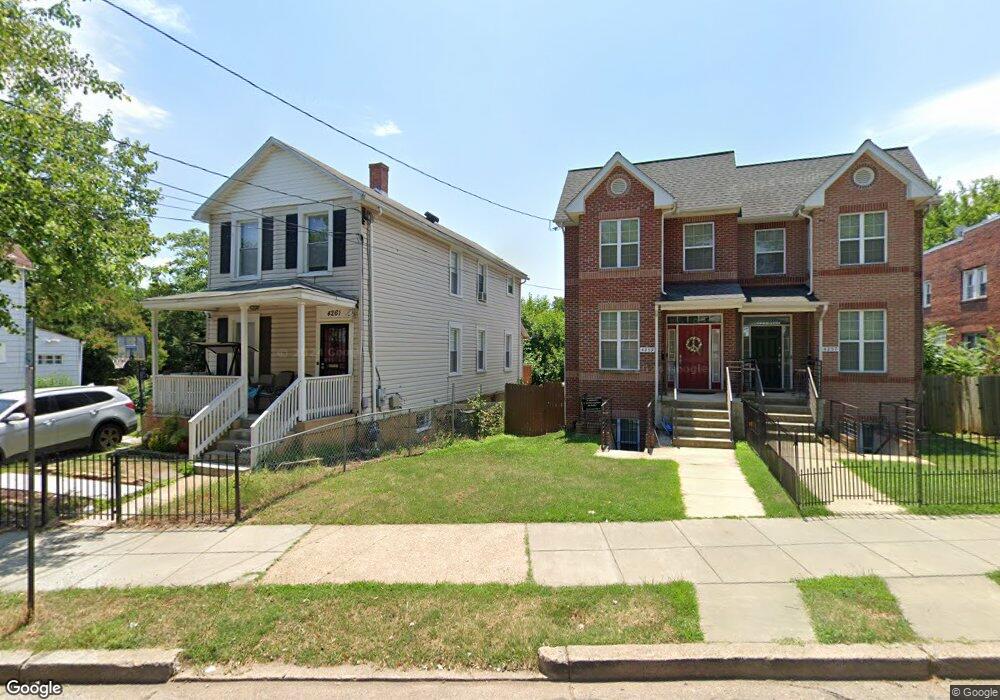
4261 Brooks St NE Washington, DC 20019
Mahaning Heights NeighborhoodEstimated Value: $428,000 - $469,000
3
Beds
3
Baths
2,235
Sq Ft
$200/Sq Ft
Est. Value
About This Home
This home is located at 4261 Brooks St NE, Washington, DC 20019 and is currently estimated at $447,605, approximately $200 per square foot. 4261 Brooks St NE is a home located in District of Columbia with nearby schools including Smothers Elementary School, Kelly Miller Middle School, and H.D. Woodson High School.
Ownership History
Date
Name
Owned For
Owner Type
Purchase Details
Closed on
Mar 7, 2003
Sold by
Madison Properties Inc
Bought by
Holman Bobbie
Current Estimated Value
Purchase Details
Closed on
Aug 13, 2002
Sold by
Sec Housing And Urban Dev
Bought by
Brown Elijah and Mcbryde,Cheryl
Home Financials for this Owner
Home Financials are based on the most recent Mortgage that was taken out on this home.
Original Mortgage
$60,000
Interest Rate
6.61%
Create a Home Valuation Report for This Property
The Home Valuation Report is an in-depth analysis detailing your home's value as well as a comparison with similar homes in the area
Home Values in the Area
Average Home Value in this Area
Purchase History
| Date | Buyer | Sale Price | Title Company |
|---|---|---|---|
| Holman Bobbie | $175,000 | -- | |
| Brown Elijah | $50,000 | -- |
Source: Public Records
Mortgage History
| Date | Status | Borrower | Loan Amount |
|---|---|---|---|
| Previous Owner | Brown Elijah | $60,000 |
Source: Public Records
Tax History Compared to Growth
Tax History
| Year | Tax Paid | Tax Assessment Tax Assessment Total Assessment is a certain percentage of the fair market value that is determined by local assessors to be the total taxable value of land and additions on the property. | Land | Improvement |
|---|---|---|---|---|
| 2025 | $2,875 | $428,030 | $158,250 | $269,780 |
| 2024 | $2,832 | $423,010 | $154,280 | $268,730 |
| 2023 | $2,598 | $404,310 | $149,050 | $255,260 |
| 2022 | $2,403 | $373,310 | $146,430 | $226,880 |
| 2021 | $2,203 | $356,040 | $144,300 | $211,740 |
| 2020 | $2,008 | $339,270 | $137,090 | $202,180 |
| 2019 | $1,832 | $314,360 | $134,020 | $180,340 |
| 2018 | $1,677 | $293,540 | $0 | $0 |
| 2017 | $1,531 | $270,070 | $0 | $0 |
| 2016 | $1,398 | $259,730 | $0 | $0 |
| 2015 | $1,273 | $225,280 | $0 | $0 |
| 2014 | $1,168 | $207,560 | $0 | $0 |
Source: Public Records
Map
Nearby Homes
- 4267 Brooks St NE
- 4380 Benning Rd NE
- 4223 Benning Rd NE
- 4212 Benning Rd NE Unit 6
- 4212 Benning Rd NE Unit 5
- 4264 Clay St NE
- 4243 Dix St NE
- 4272 E Capitol St NE Unit 2
- 4411 Dix St NE
- 4270 E Capitol St NE Unit 104
- 4270 E Capitol St NE Unit 301
- 4506 Brooks St NE
- 4253 Eads St NE
- 4521 Clay St NE
- 4110 Ames St NE Unit 101
- 4614 Brooks St NE
- 4138 E Capitol St NE
- 4228 Eads St NE
- 504 45th St NE
- 4511 Eads St NE
- 4259 Brooks St NE
- 4257 Brooks St NE
- 4265 Brooks St NE
- 4255 Brooks St NE
- 4253 Brooks St NE
- 4253 Brooks St NE Unit B
- 4269 Brooks St NE
- 4271 Brooks St NE
- 4225 Brooks St NE
- 210 43rd Rd NE
- 210 43rd Rd NE Unit B2
- 210 43rd Rd NE Unit 304
- 210 43rd Rd NE Unit 101
- 210 43rd Rd NE Unit 201
- 210 43rd Rd NE Unit 103
- 210 43rd Rd NE Unit B3
- 210 43rd Rd NE Unit 102
- 210 43rd Rd NE Unit 303
- 210 43rd Rd NE Unit 302
- 210 43rd Rd NE Unit 301