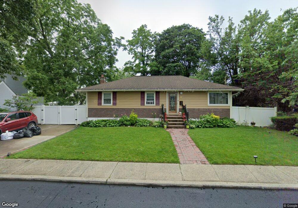
427 Scaneateles Ave West Hempstead, NY 11552
Estimated Value: $554,000 - $715,992
--
Bed
2
Baths
1,284
Sq Ft
$495/Sq Ft
Est. Value
About This Home
This home is located at 427 Scaneateles Ave, West Hempstead, NY 11552 and is currently estimated at $634,996, approximately $494 per square foot. 427 Scaneateles Ave is a home located in Nassau County with nearby schools including Davison Avenue Intermediate School, Maurice W. Downing Primary K-2 School, and Howard T Herber Middle School.
Ownership History
Date
Name
Owned For
Owner Type
Purchase Details
Closed on
Jan 22, 2010
Sold by
Morrison Jamie L and Proctor Lucille R
Bought by
Chery Jean Bernard and Chery Rose Mary
Current Estimated Value
Home Financials for this Owner
Home Financials are based on the most recent Mortgage that was taken out on this home.
Original Mortgage
$298,432
Outstanding Balance
$198,899
Interest Rate
5.25%
Mortgage Type
FHA
Estimated Equity
$436,097
Create a Home Valuation Report for This Property
The Home Valuation Report is an in-depth analysis detailing your home's value as well as a comparison with similar homes in the area
Home Values in the Area
Average Home Value in this Area
Purchase History
| Date | Buyer | Sale Price | Title Company |
|---|---|---|---|
| Chery Jean Bernard | $309,000 | -- |
Source: Public Records
Mortgage History
| Date | Status | Borrower | Loan Amount |
|---|---|---|---|
| Open | Chery Jean Bernard | $298,432 |
Source: Public Records
Tax History Compared to Growth
Tax History
| Year | Tax Paid | Tax Assessment Tax Assessment Total Assessment is a certain percentage of the fair market value that is determined by local assessors to be the total taxable value of land and additions on the property. | Land | Improvement |
|---|---|---|---|---|
| 2025 | $13,445 | $450 | $188 | $262 |
| 2024 | $4,520 | $450 | $188 | $262 |
| 2023 | $12,808 | $450 | $188 | $262 |
| 2022 | $12,808 | $449 | $188 | $261 |
| 2021 | $17,190 | $424 | $177 | $247 |
| 2020 | $12,578 | $618 | $449 | $169 |
| 2019 | $12,326 | $618 | $449 | $169 |
| 2018 | $11,639 | $618 | $0 | $0 |
| 2017 | $6,905 | $618 | $449 | $169 |
| 2016 | $10,541 | $618 | $449 | $169 |
| 2015 | $3,402 | $618 | $380 | $238 |
| 2014 | $3,402 | $618 | $380 | $238 |
| 2013 | $3,203 | $618 | $380 | $238 |
Source: Public Records
Map
Nearby Homes
- 10 Pinebrook Ave
- 394 Pinebrook Ave
- 1070 Mahopac Rd
- 461 Pinebrook Ave
- 1024 Mahopac Rd
- 7 Hopatcong Ave
- 419 Coolidge Ave
- 966 Woodfield Rd
- 486 Champlain Ave
- 362 Langdon Blvd
- 402 Clinton Ave
- 1025 Ontario Rd
- 5 Juliette Rd
- 312 Coventry Rd S
- 529 Clinton Ave
- 301 Coventry Rd N
- 49 Carol St
- 924 Otsego Ct
- 501 Lafayette Ave
- 492 Pershing Blvd
- 421 Scaneateles Ave
- 11 Scaneateles Ave
- 430 Pinebrook Ave
- 430 Pinebrook Ave
- 12 Pinebrook Ave
- 436 Pinebrook Ave
- 415 Scaneateles Ave
- 432 Scaneateles Ave
- 424 Scaneateles Ave
- 442 Pinebrook Ave
- 418 Scaneateles Ave
- 1073 Mahopac Rd
- 449 Scaneateles Ave
- 440 Scaneateles Ave
- 412 Scaneateles Ave
- 407 Scaneateles Ave
- 456 Pinebrook Ave
- 42 Scaneateles Ave
- 423 Canandaigua Ave
- 429 Canandaigua Ave