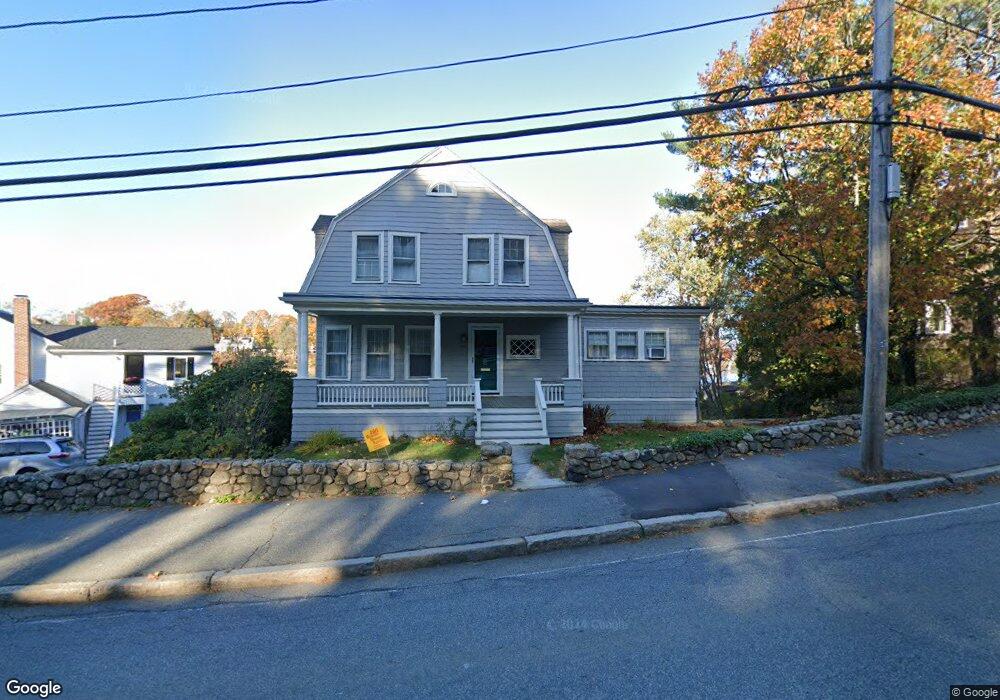
428 Washington St Gloucester, MA 01930
Estimated Value: $700,000 - $940,681
3
Beds
3
Baths
1,618
Sq Ft
$522/Sq Ft
Est. Value
About This Home
This home is located at 428 Washington St, Gloucester, MA 01930 and is currently estimated at $844,920, approximately $522 per square foot. 428 Washington St is a home located in Essex County with nearby schools including Beeman Memorial, Ralph B O'maley Middle School, and Faith Christian School.
Ownership History
Date
Name
Owned For
Owner Type
Purchase Details
Closed on
Apr 28, 2008
Sold by
Lindsay Mark and Lindsay Martha M
Bought by
Lindsay Tr Mark
Current Estimated Value
Purchase Details
Closed on
Aug 12, 2003
Sold by
Cunningham Robert W
Bought by
Lindsay Mark
Create a Home Valuation Report for This Property
The Home Valuation Report is an in-depth analysis detailing your home's value as well as a comparison with similar homes in the area
Home Values in the Area
Average Home Value in this Area
Purchase History
| Date | Buyer | Sale Price | Title Company |
|---|---|---|---|
| Lindsay Tr Mark | -- | -- | |
| Lindsay Mark | -- | -- | |
| Cunningham Robert W | -- | -- |
Source: Public Records
Mortgage History
| Date | Status | Borrower | Loan Amount |
|---|---|---|---|
| Open | Cunningham Robert W | $25,000 | |
| Previous Owner | Cunningham Robert W | $50,000 |
Source: Public Records
Tax History Compared to Growth
Tax History
| Year | Tax Paid | Tax Assessment Tax Assessment Total Assessment is a certain percentage of the fair market value that is determined by local assessors to be the total taxable value of land and additions on the property. | Land | Improvement |
|---|---|---|---|---|
| 2025 | $9,782 | $1,006,400 | $517,100 | $489,300 |
| 2024 | $9,550 | $981,500 | $492,200 | $489,300 |
| 2023 | $8,989 | $848,800 | $420,400 | $428,400 |
| 2022 | $8,658 | $738,100 | $365,400 | $372,700 |
| 2021 | $8,360 | $672,000 | $332,100 | $339,900 |
| 2020 | $8,275 | $671,100 | $332,100 | $339,000 |
| 2019 | $7,872 | $620,300 | $316,600 | $303,700 |
| 2018 | $7,603 | $588,000 | $308,900 | $279,100 |
| 2017 | $7,378 | $559,400 | $294,400 | $265,000 |
| 2016 | $7,043 | $517,500 | $281,300 | $236,200 |
| 2015 | $6,739 | $493,700 | $274,900 | $218,800 |
Source: Public Records
Map
Nearby Homes
- 49 Thurston Point Rd
- 18 Cherry St
- 109 Riverview Rd
- 65 Poplar St
- 19 Mystic Ave
- 78 Grove St
- 6 Beauport Ave
- 196 Washington St
- 672 Washington St
- 3 Stone Ct
- 40 Sargent St
- 15 Harvard St
- 33 Maplewood Ave Unit 21
- 119 Pleasant St
- 6 River Rd
- 145 Essex Ave Unit 610
- 8 Summer St Unit 103
- 188 Atlantic St
- 4 Mount Vernon St
- 226 Atlantic St
- 432 Washington St
- 434 Washington St
- 426 Washington St Unit 3
- 426 Washington St Unit A
- 426 Washington St Unit 2
- 424 Washington St Unit 2
- 424 Washington St Unit 1
- 424 Washington St
- 449 Washington St
- 447 Washington St
- 439 Washington St
- 451 Washington St
- 420 Washington St
- 455 Washington St
- 437 Washington St
- 3 Echo Ave
- 433 Washington St
- 442 Washington St
- 3R Echo Ave
- 1 Echo Ave