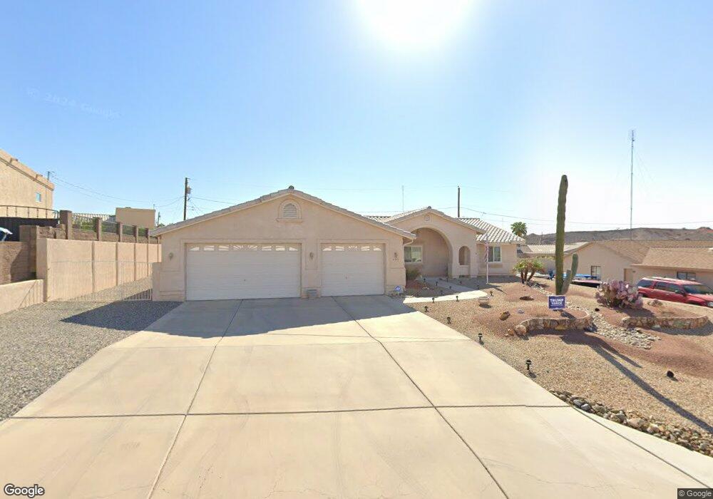
4290 Comstock Dr Lake Havasu City, AZ 86406
Estimated Value: $500,723 - $573,000
3
Beds
2
Baths
1,820
Sq Ft
$294/Sq Ft
Est. Value
About This Home
This home is located at 4290 Comstock Dr, Lake Havasu City, AZ 86406 and is currently estimated at $534,681, approximately $293 per square foot. 4290 Comstock Dr is a home located in Mohave County with nearby schools including Jamaica Elementary School, Thunderbolt Middle School, and Lake Havasu High School.
Ownership History
Date
Name
Owned For
Owner Type
Purchase Details
Closed on
Sep 30, 2025
Sold by
Angle Larry C and Angle Diane L
Bought by
Angle Family Trust and Angle
Current Estimated Value
Purchase Details
Closed on
Jan 29, 2001
Sold by
Arizona Coast Development Llc
Bought by
Angle Larry C and Angle Diane L
Home Financials for this Owner
Home Financials are based on the most recent Mortgage that was taken out on this home.
Original Mortgage
$130,050
Interest Rate
7.12%
Mortgage Type
New Conventional
Purchase Details
Closed on
Oct 5, 1999
Sold by
Mishler Richard and Mishler Betty Joyce
Bought by
Arizona Coast Development Llc
Create a Home Valuation Report for This Property
The Home Valuation Report is an in-depth analysis detailing your home's value as well as a comparison with similar homes in the area
Home Values in the Area
Average Home Value in this Area
Purchase History
| Date | Buyer | Sale Price | Title Company |
|---|---|---|---|
| Angle Family Trust | -- | None Listed On Document | |
| Angle Larry C | $136,900 | First American Title | |
| Arizona Coast Development Llc | $12,000 | First American Title |
Source: Public Records
Mortgage History
| Date | Status | Borrower | Loan Amount |
|---|---|---|---|
| Previous Owner | Angle Larry C | $130,050 |
Source: Public Records
Tax History Compared to Growth
Tax History
| Year | Tax Paid | Tax Assessment Tax Assessment Total Assessment is a certain percentage of the fair market value that is determined by local assessors to be the total taxable value of land and additions on the property. | Land | Improvement |
|---|---|---|---|---|
| 2026 | -- | -- | -- | -- |
| 2025 | $1,635 | $42,451 | $0 | $0 |
| 2024 | $1,635 | $45,774 | $0 | $0 |
| 2023 | $1,635 | $39,018 | $0 | $0 |
| 2022 | $1,575 | $28,054 | $0 | $0 |
| 2021 | $1,778 | $26,728 | $0 | $0 |
| 2019 | $1,690 | $23,283 | $0 | $0 |
| 2018 | $1,634 | $22,209 | $0 | $0 |
| 2017 | $1,606 | $21,272 | $0 | $0 |
| 2016 | $1,422 | $19,173 | $0 | $0 |
| 2015 | $1,384 | $16,869 | $0 | $0 |
Source: Public Records
Map
Nearby Homes
- 4241 Highlander Ave
- 971 Red Rock Rd
- 4160 Carlsbad Dr
- 4136 Carlsbad Dr Unit 19
- 4110 Columbia Dr
- 4199 Highlander Ave
- 4097 Columbia Dr
- 4160 Peruvian Dr
- 4156 Peruvian Dr
- 4150 Peruvian Dr
- 4145 Mercury Dr
- 4125 Peruvian Dr
- 1357 Mcculloch Blvd S
- 3920 Doeskin Ln
- 4166 Mercury Dr
- 1310 Pueblo Dr
- 1481 Mojave Dr
- 4061 Lakeview Rd
- 990 Mcculloch Blvd S
- 711 Mcculloch Blvd S
- 4298 Comstock Dr
- 4280 Comstock Dr
- 4291 Colville Dr
- 4281 Colville Dr
- 4297 Colville Dr
- 4280 Trotwood Dr
- 4271 Colville Dr
- 4270 Comstock Dr
- 4271 Colville Dr
- 4287 Trotwood Dr
- 4293 Trotwood Dr
- 4261 Colville Dr
- 4281 Trotwood Dr
- 4270 Trotwood Dr
- 4260 Comstock Dr
- 4299 Trotwood Dr
- 4281 Comstock Dr
- 4273 Trotwood Dr
- 4284 Colville Dr
- 4270 Colville Dr