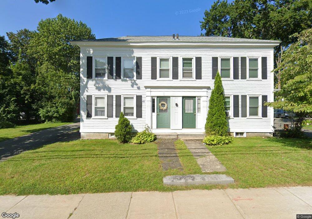
43 South Rd Unit 45 Bedford, MA 01730
Estimated Value: $1,449,947 - $1,511,000
10
Beds
5
Baths
5,288
Sq Ft
$280/Sq Ft
Est. Value
About This Home
This home is located at 43 South Rd Unit 45, Bedford, MA 01730 and is currently estimated at $1,478,737, approximately $279 per square foot. 43 South Rd Unit 45 is a home located in Middlesex County with nearby schools including Lt. Elezer Davis Elementary School, Lt .Job Lane Elementary School, and John Glenn Middle School.
Ownership History
Date
Name
Owned For
Owner Type
Purchase Details
Closed on
Jul 16, 2019
Sold by
Blake Bruce M and Blake Dorothy S
Bought by
43-45 South Road Nt
Current Estimated Value
Purchase Details
Closed on
Jun 25, 2008
Sold by
43-45 S Road Bedf Mass and Blake
Bought by
Blake Bruce M and Blake Dorothy S
Home Financials for this Owner
Home Financials are based on the most recent Mortgage that was taken out on this home.
Original Mortgage
$417,000
Interest Rate
6.07%
Mortgage Type
Purchase Money Mortgage
Purchase Details
Closed on
Apr 13, 2005
Sold by
Blake Bruce M and Saunders Martha J
Bought by
43-45 South Rd Nt and Blake
Purchase Details
Closed on
Oct 13, 1994
Sold by
Blake Robert C
Bought by
Saunders Martha J
Home Financials for this Owner
Home Financials are based on the most recent Mortgage that was taken out on this home.
Original Mortgage
$104,000
Interest Rate
8.43%
Mortgage Type
Purchase Money Mortgage
Create a Home Valuation Report for This Property
The Home Valuation Report is an in-depth analysis detailing your home's value as well as a comparison with similar homes in the area
Home Values in the Area
Average Home Value in this Area
Purchase History
| Date | Buyer | Sale Price | Title Company |
|---|---|---|---|
| 43-45 South Road Nt | -- | -- | |
| Blake Bruce M | -- | -- | |
| Blake Bruce M | -- | -- | |
| Blake Bruce M | -- | -- | |
| 43-45 South Rd Nt | -- | -- | |
| 43-45 South Rd Nt | -- | -- | |
| Saunders Martha J | $93,333 | -- |
Source: Public Records
Mortgage History
| Date | Status | Borrower | Loan Amount |
|---|---|---|---|
| Previous Owner | Blake Bruce M | $417,000 | |
| Previous Owner | Saunders Martha J | $104,000 |
Source: Public Records
Tax History Compared to Growth
Tax History
| Year | Tax Paid | Tax Assessment Tax Assessment Total Assessment is a certain percentage of the fair market value that is determined by local assessors to be the total taxable value of land and additions on the property. | Land | Improvement |
|---|---|---|---|---|
| 2025 | $166 | $1,378,900 | $607,200 | $771,700 |
| 2024 | $15,602 | $1,313,300 | $578,300 | $735,000 |
| 2023 | $15,554 | $1,246,300 | $547,900 | $698,400 |
| 2022 | $16,129 | $1,187,700 | $547,900 | $639,800 |
| 2021 | $16,070 | $1,187,700 | $547,900 | $639,800 |
| 2020 | $15,021 | $1,139,700 | $521,500 | $618,200 |
| 2019 | $13,649 | $1,053,200 | $521,500 | $531,700 |
| 2018 | $10,223 | $744,000 | $454,900 | $289,100 |
| 2017 | $11,629 | $785,200 | $468,700 | $316,500 |
| 2016 | $10,389 | $679,900 | $426,100 | $253,800 |
| 2015 | $9,940 | $679,900 | $426,100 | $253,800 |
| 2014 | $10,689 | $680,400 | $405,800 | $274,600 |
Source: Public Records
Map
Nearby Homes
- 22 Springs Rd
- 10 Webber Ave Unit 1A
- 10 Webber Ave Unit 3C
- 10 Webber Ave Unit 4D
- 36 Loomis St Unit 104
- 36 Loomis St Unit 301
- 36 Loomis St Unit 404
- 29 Hancock St
- 10 Nickerson Rd
- 10 Carlisle Rd Unit 12
- 62 Carlisle Rd
- 186 Concord Rd
- 75 Page Rd Unit 24
- 1 Harvard Dr
- 22 Selfridge Rd
- 45 Shawsheen Rd Unit 28
- 25 Pickman Dr Unit 25
- 24 Gray Terrace
- 45 Winterberry Way
- 37 Pine St
- 51 South Rd
- 46 South Rd Unit 48
- 46-48 South Rd
- 46-48 South Rd Unit 46-48
- 48 South Rd
- 40 South Rd Unit 42
- 52 South Rd
- 56 South Rd Unit 58
- 56 South Rd Unit 1
- 33 South Rd
- 57 South Rd
- 6 Maple St
- 8 Maple St
- 6 Foster Rd
- 10 Foster Rd
- 24 South Rd Unit 1ST FLOOR
- 24 South Rd Unit 2nd FLOOR
- 24 South Rd Unit 1A Office
- 24 South Rd Unit 1
- 24 South Rd Unit 26