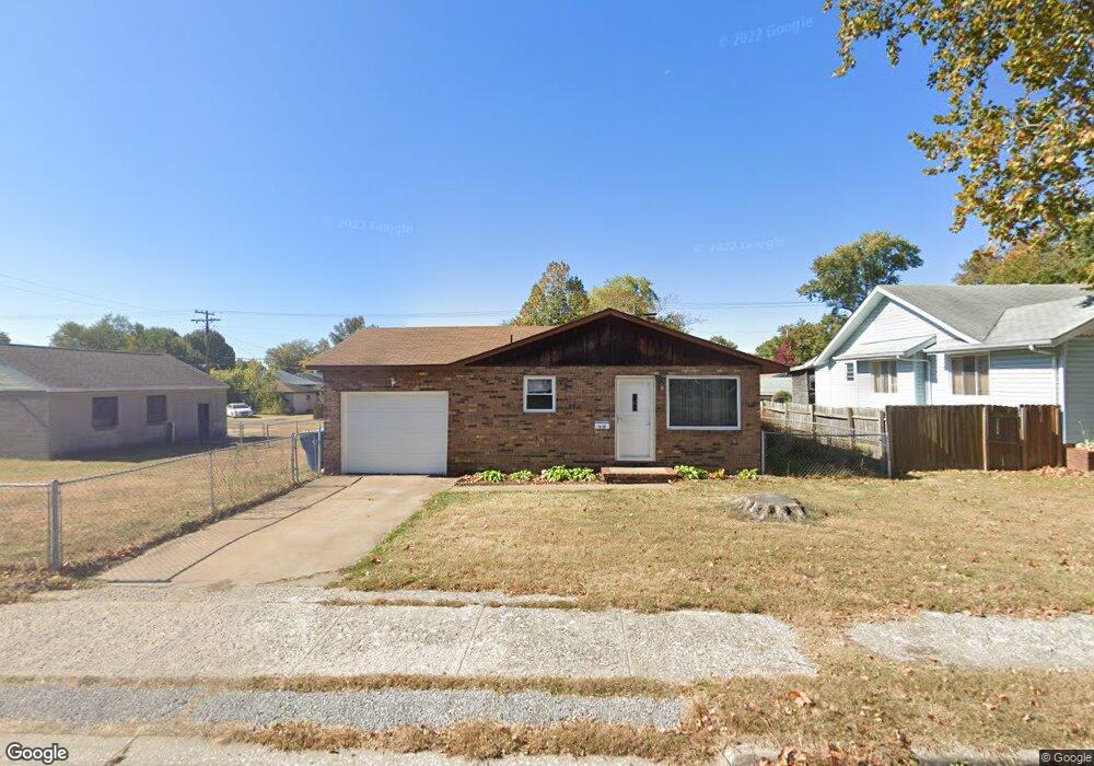
430 N 1st St Wood River, IL 62095
Estimated Value: $104,000 - $150,000
3
Beds
1
Bath
960
Sq Ft
$127/Sq Ft
Est. Value
About This Home
This home is located at 430 N 1st St, Wood River, IL 62095 and is currently estimated at $121,735, approximately $126 per square foot. 430 N 1st St is a home located in Madison County with nearby schools including Lewis-Clark Elementary School and East Alton-Wood River High School.
Ownership History
Date
Name
Owned For
Owner Type
Purchase Details
Closed on
Oct 16, 2012
Sold by
Fannie Mae
Bought by
Nalley Anthony K
Current Estimated Value
Home Financials for this Owner
Home Financials are based on the most recent Mortgage that was taken out on this home.
Original Mortgage
$29,600
Interest Rate
5.6%
Mortgage Type
Future Advance Clause Open End Mortgage
Purchase Details
Closed on
Sep 23, 2004
Sold by
Droste John C and Droste Teresa S
Bought by
Nalley Anthony K
Home Financials for this Owner
Home Financials are based on the most recent Mortgage that was taken out on this home.
Original Mortgage
$74,942
Interest Rate
5.93%
Mortgage Type
FHA
Create a Home Valuation Report for This Property
The Home Valuation Report is an in-depth analysis detailing your home's value as well as a comparison with similar homes in the area
Home Values in the Area
Average Home Value in this Area
Purchase History
| Date | Buyer | Sale Price | Title Company |
|---|---|---|---|
| Nalley Anthony K | $33,000 | None Available | |
| Nalley Anthony K | $77,000 | Community Title & Escrow Ltd |
Source: Public Records
Mortgage History
| Date | Status | Borrower | Loan Amount |
|---|---|---|---|
| Closed | Nalley Anthony K | $29,600 | |
| Previous Owner | Nalley Anthony K | $74,942 |
Source: Public Records
Tax History Compared to Growth
Tax History
| Year | Tax Paid | Tax Assessment Tax Assessment Total Assessment is a certain percentage of the fair market value that is determined by local assessors to be the total taxable value of land and additions on the property. | Land | Improvement |
|---|---|---|---|---|
| 2024 | $2,494 | $29,070 | $5,710 | $23,360 |
| 2023 | $2,494 | $27,100 | $5,320 | $21,780 |
| 2022 | $2,366 | $25,010 | $4,910 | $20,100 |
| 2021 | $1,614 | $23,310 | $4,580 | $18,730 |
| 2020 | $1,557 | $22,450 | $4,410 | $18,040 |
| 2019 | $1,485 | $21,780 | $4,280 | $17,500 |
| 2018 | $1,291 | $19,210 | $4,070 | $15,140 |
| 2017 | $1,192 | $18,750 | $3,970 | $14,780 |
| 2016 | $1,175 | $18,750 | $3,970 | $14,780 |
| 2015 | $1,168 | $18,550 | $3,930 | $14,620 |
| 2014 | $1,168 | $18,550 | $3,930 | $14,620 |
| 2013 | $1,168 | $18,820 | $3,990 | $14,830 |
Source: Public Records
Map
Nearby Homes
- 469 N 1st St
- 72 E Acton Ave
- 41 W Penning Ave
- 242 E Lorena Ave
- 71 Carstens Ave
- 537 Tipton Ave
- 411 E Ferguson Ave
- 523 E Acton Ave
- 458 N 6th St
- 503 E Ferguson Ave
- 545 E Acton Ave
- 726 Rice St
- 777 Condit St
- 623 E Lorena Ave
- 830 N Wood River Ave
- 810 Halloran Ave
- 805 State St
- 833 State St
- 523 Wilson Ave
- 527 Metzger Ave
- 436 N 1st St
- 426 N 1st St
- 440 N 1st St
- 102 Eula Ave
- 446 N 1st St
- 75 E Jennings Ave
- 431 Whitelaw Ave
- 423 Whitelaw Ave
- 79 E Jennings Ave
- 419 N 1st St
- 437 Whitelaw Ave
- 73 E Jennings Ave
- 59 E Jennings Ave
- 447 Whitelaw Ave
- 456 N 1st St
- 104 Eula Ave
- 441 N 1st St
- 449 Whitelaw Ave
- 101 E Jennings Ave
- 449 N 1st St