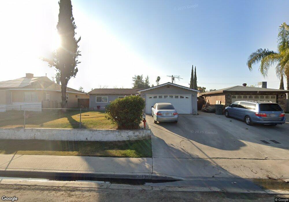
4301 Deborah Ave Bakersfield, CA 93307
Rexland Acres NeighborhoodEstimated Value: $287,266 - $311,000
3
Beds
2
Baths
1,182
Sq Ft
$252/Sq Ft
Est. Value
About This Home
This home is located at 4301 Deborah Ave, Bakersfield, CA 93307 and is currently estimated at $297,817, approximately $251 per square foot. 4301 Deborah Ave is a home located in Kern County with nearby schools including Leo G. Pauly Elementary School, Sequoia Middle School, and South High School.
Ownership History
Date
Name
Owned For
Owner Type
Purchase Details
Closed on
Nov 15, 2004
Sold by
Borquez Navor and Luna Maria
Bought by
Borquez Navor V and Luna Maria A
Current Estimated Value
Home Financials for this Owner
Home Financials are based on the most recent Mortgage that was taken out on this home.
Original Mortgage
$46,700
Interest Rate
5.67%
Mortgage Type
New Conventional
Create a Home Valuation Report for This Property
The Home Valuation Report is an in-depth analysis detailing your home's value as well as a comparison with similar homes in the area
Home Values in the Area
Average Home Value in this Area
Purchase History
| Date | Buyer | Sale Price | Title Company |
|---|---|---|---|
| Borquez Navor V | -- | Ticor Title |
Source: Public Records
Mortgage History
| Date | Status | Borrower | Loan Amount |
|---|---|---|---|
| Closed | Borquez Navor V | $46,700 |
Source: Public Records
Tax History Compared to Growth
Tax History
| Year | Tax Paid | Tax Assessment Tax Assessment Total Assessment is a certain percentage of the fair market value that is determined by local assessors to be the total taxable value of land and additions on the property. | Land | Improvement |
|---|---|---|---|---|
| 2025 | $1,864 | $119,046 | $25,355 | $93,691 |
| 2024 | $1,808 | $116,712 | $24,858 | $91,854 |
| 2023 | $1,808 | $114,424 | $24,371 | $90,053 |
| 2022 | $1,732 | $112,182 | $23,894 | $88,288 |
| 2021 | $1,643 | $109,983 | $23,426 | $86,557 |
| 2020 | $1,599 | $108,856 | $23,186 | $85,670 |
| 2019 | $1,566 | $108,856 | $23,186 | $85,670 |
| 2018 | $1,515 | $104,632 | $22,287 | $82,345 |
| 2017 | $1,501 | $102,581 | $21,850 | $80,731 |
| 2016 | $1,381 | $100,571 | $21,422 | $79,149 |
| 2015 | $1,378 | $99,062 | $21,101 | $77,961 |
| 2014 | $1,338 | $97,122 | $20,688 | $76,434 |
Source: Public Records
Map
Nearby Homes
- 4300 Kenny St
- 4600 Lantados St
- 4205 Lantados St
- 609 White Ln
- 4519 Vern St
- 4208 Santa Cruz St
- 4404 Brunswick St
- 904 San Vicente Dr
- 4508 Axminster St
- 4209 Alexander St
- 3809 Edith Ln
- 3905 Fambrough Dr
- 1320 White Ln
- 1404 Ivan Ave
- 499 Pacheco Rd Unit 155
- 499 Pacheco Rd Unit 255
- 499 Pacheco Rd Unit 126
- 499 Pacheco Rd Unit 214
- 3601 S Chester Ave Unit 56
- 3601 S Chester Ave Unit 12
- 4225 Deborah Ave
- 4305 Deborah Ave
- 4312 Lantados St
- 4308 Lantados St Unit B
- 4221 Deborah Ave
- 4309 Deborah Ave
- 4400 Lantados St
- 4304 Lantados St Unit B
- 4224 Deborah Ave
- 4300 Deborah Ave
- 4217 Deborah Ave
- 4313 Deborah Ave
- 4220 Deborah Ave
- 4404 Lantados St
- 4304 Deborah Ave
- 4300 Lantados St
- 4216 Deborah Ave
- 4308 Deborah St
- 4308 Deborah Ave
- 4317 Deborah Ave