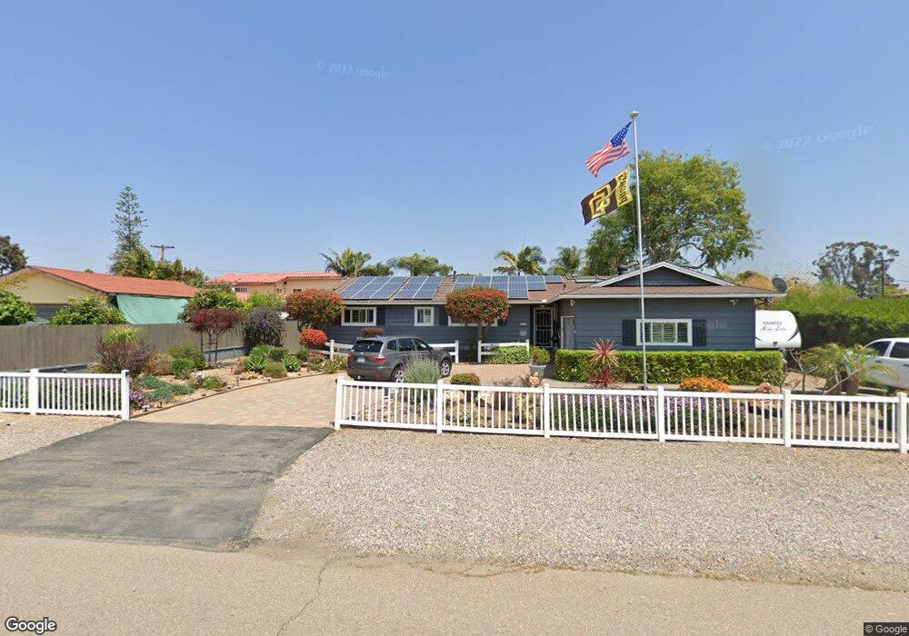
431 Hawthorne Ave El Cajon, CA 92020
Fletcher Hills NeighborhoodEstimated Value: $912,000 - $1,108,000
4
Beds
2
Baths
1,976
Sq Ft
$524/Sq Ft
Est. Value
About This Home
This home is located at 431 Hawthorne Ave, El Cajon, CA 92020 and is currently estimated at $1,034,614, approximately $523 per square foot. 431 Hawthorne Ave is a home located in San Diego County with nearby schools including Northmont Elementary School, Parkway Academy, and Grossmont High School.
Ownership History
Date
Name
Owned For
Owner Type
Purchase Details
Closed on
Sep 26, 2025
Sold by
Stewart Peter C and Stewart Sheryl Ann
Bought by
Stewart Family Trust and Stewart
Current Estimated Value
Purchase Details
Closed on
Dec 16, 2020
Sold by
Stewart Peter C and Stewart Sheryl Ann
Bought by
Stewart Peter C and Stewart Sheryl Ann
Home Financials for this Owner
Home Financials are based on the most recent Mortgage that was taken out on this home.
Original Mortgage
$212,000
Interest Rate
2.8%
Mortgage Type
New Conventional
Purchase Details
Closed on
Mar 30, 2006
Sold by
Stewart Peter C and Stewart Sheryl Ann
Bought by
Stewart Peter C and Stewart Sheryl Ann
Home Financials for this Owner
Home Financials are based on the most recent Mortgage that was taken out on this home.
Original Mortgage
$487,000
Interest Rate
5.75%
Mortgage Type
Purchase Money Mortgage
Purchase Details
Closed on
Jul 27, 1999
Sold by
Stewart Family Trust No 3 05-13-91 and Peter C
Bought by
Stewart Peter C and Stewart Sheryl Ann
Home Financials for this Owner
Home Financials are based on the most recent Mortgage that was taken out on this home.
Original Mortgage
$42,378
Interest Rate
7.64%
Purchase Details
Closed on
Dec 29, 1998
Sold by
Stewart Peter C and Stewart Sheryl Ann
Bought by
Stewart Peter C and Stewart Sheryl Ann
Home Financials for this Owner
Home Financials are based on the most recent Mortgage that was taken out on this home.
Original Mortgage
$187,500
Interest Rate
6.78%
Purchase Details
Closed on
Oct 27, 1993
Sold by
Stewart Pete C and Stewart Sheryl
Bought by
Stewart Peter C and Stewart Sheryl Ann
Purchase Details
Closed on
Aug 5, 1993
Sold by
Stewart Peter C and Stewart Sheryl Ann
Bought by
Stewart Pete C and Stewart Sheryl
Home Financials for this Owner
Home Financials are based on the most recent Mortgage that was taken out on this home.
Original Mortgage
$172,500
Interest Rate
4.87%
Purchase Details
Closed on
Sep 24, 1986
Create a Home Valuation Report for This Property
The Home Valuation Report is an in-depth analysis detailing your home's value as well as a comparison with similar homes in the area
Home Values in the Area
Average Home Value in this Area
Purchase History
| Date | Buyer | Sale Price | Title Company |
|---|---|---|---|
| Stewart Family Trust | -- | None Listed On Document | |
| Stewart Peter C | -- | None Listed On Document | |
| Stewart Peter C | -- | Unisource | |
| Stewart Peter C | -- | Fidelity National Title Co | |
| Stewart Peter C | -- | Commonwealth Land Title Co | |
| Stewart Peter C | -- | Old Republic Title Company | |
| Stewart Peter C | -- | Old Republic Title Company | |
| Stewart Peter C | -- | -- | |
| Stewart Pete C | -- | Chicago Title Company | |
| -- | $155,500 | -- |
Source: Public Records
Mortgage History
| Date | Status | Borrower | Loan Amount |
|---|---|---|---|
| Previous Owner | Stewart Peter C | $212,000 | |
| Previous Owner | Stewart Peter C | $487,000 | |
| Previous Owner | Stewart Peter C | $42,378 | |
| Previous Owner | Stewart Peter C | $187,500 | |
| Previous Owner | Stewart Pete C | $172,500 |
Source: Public Records
Tax History Compared to Growth
Tax History
| Year | Tax Paid | Tax Assessment Tax Assessment Total Assessment is a certain percentage of the fair market value that is determined by local assessors to be the total taxable value of land and additions on the property. | Land | Improvement |
|---|---|---|---|---|
| 2025 | $4,375 | $309,821 | $109,583 | $200,238 |
| 2024 | $4,375 | $303,747 | $107,435 | $196,312 |
| 2023 | $4,292 | $297,792 | $105,329 | $192,463 |
| 2022 | $4,464 | $291,954 | $103,264 | $188,690 |
| 2021 | $4,377 | $286,231 | $101,240 | $184,991 |
| 2020 | $4,085 | $283,297 | $100,202 | $183,095 |
| 2019 | $3,176 | $277,743 | $98,238 | $179,505 |
| 2018 | $3,109 | $272,298 | $96,312 | $175,986 |
| 2017 | $3,062 | $266,960 | $94,424 | $172,536 |
| 2016 | $2,961 | $261,726 | $92,573 | $169,153 |
| 2015 | $2,939 | $257,796 | $91,183 | $166,613 |
| 2014 | $2,880 | $252,747 | $89,397 | $163,350 |
Source: Public Records
Map
Nearby Homes
- 302 Travelodge Dr
- 364 Travelodge Dr
- 275 Hihill Way
- 274 S Pierce St Unit 17
- 168 S Pierce St
- 1280 W Main St Unit 24
- 1280 W Main St Unit 6
- 1498 Berenda Place
- 1894 Wedgemere Rd
- 6110 Amaya Dr
- 198 Croydon Ln
- 578 Millar Ave
- 346 El Monte Rd
- 370 N Cuyamaca St
- 6045 Broadmoor Dr
- 1681 Hillsmont Dr
- 1673 Hillsmont Dr
- 5995 Broadmoor Dr
- 927 W Main St
- 9348 Horton Dr
- 447 Hawthorne Ave
- 1555 Murray Ave
- 436 Live Oak Dr
- 402 Hawthorne Ave
- 448 Live Oak Dr
- 461 Hawthorne Ave
- 1503 Murray Ave
- 448 Hawthorne Ave
- 462 Live Oak Dr
- 1595 Murray Ave
- 1560 Murray Ave
- 1544 Murray Ave
- 462 Hawthorne Ave
- 473 Hawthorne Ave
- 1580 Murray Ave
- 1520 Murray Ave
- 474 Live Oak Dr
- 1592 Murray Ave
- 1597 Murray Ave
- 474 Hawthorne Ave