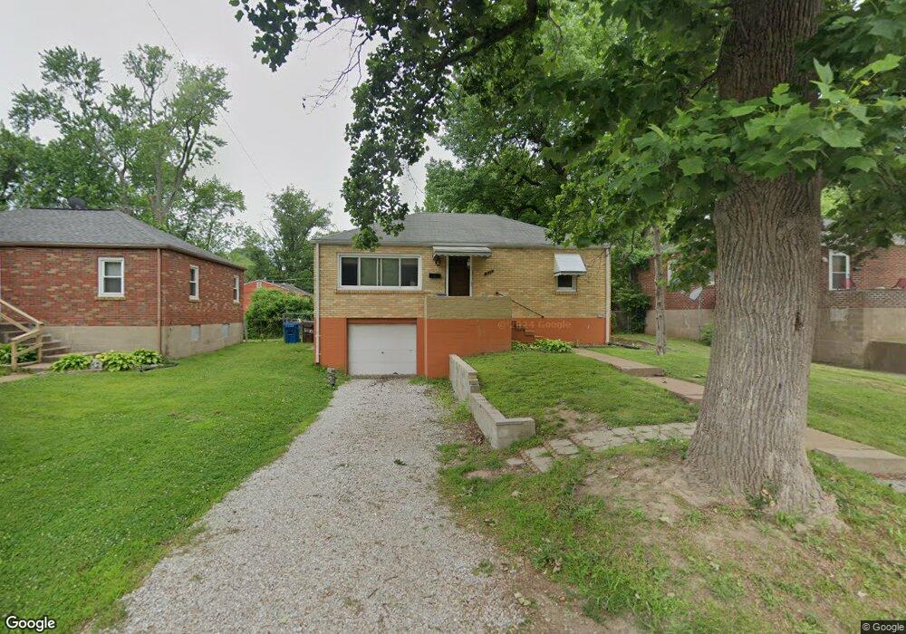
431 Warford Ave Saint Louis, MO 63135
Estimated Value: $74,000 - $97,000
2
Beds
1
Bath
840
Sq Ft
$99/Sq Ft
Est. Value
About This Home
This home is located at 431 Warford Ave, Saint Louis, MO 63135 and is currently estimated at $82,948, approximately $98 per square foot. 431 Warford Ave is a home located in St. Louis County with nearby schools including Ferguson Middle School, Johnson Wabash Elementary School, and McCluer High School.
Ownership History
Date
Name
Owned For
Owner Type
Purchase Details
Closed on
Aug 9, 2012
Sold by
Secretary Of Housing & Urban Development
Bought by
Jaggie Ashley J
Current Estimated Value
Purchase Details
Closed on
Apr 12, 2012
Sold by
U S Bank National Association
Bought by
Secretary Of Housing & Urban Development
Purchase Details
Closed on
Mar 15, 2012
Sold by
Overstreet Joan
Bought by
U S Bank National Association
Purchase Details
Closed on
Mar 27, 2009
Sold by
Okeefe Matthew and Okeefe Rebecca N
Bought by
Overstreet Joan
Home Financials for this Owner
Home Financials are based on the most recent Mortgage that was taken out on this home.
Original Mortgage
$49,094
Interest Rate
5.14%
Mortgage Type
FHA
Purchase Details
Closed on
Jul 7, 2005
Sold by
Finnegan Jeffrey W
Bought by
Okeefe Matthew and Okeefe Rebecca N
Create a Home Valuation Report for This Property
The Home Valuation Report is an in-depth analysis detailing your home's value as well as a comparison with similar homes in the area
Home Values in the Area
Average Home Value in this Area
Purchase History
| Date | Buyer | Sale Price | Title Company |
|---|---|---|---|
| Jaggie Ashley J | $13,617 | None Available | |
| Secretary Of Housing & Urban Development | $47,851 | None Available | |
| U S Bank National Association | $53,808 | None Available | |
| Overstreet Joan | -- | First American Title Ins Co | |
| Okeefe Matthew | $23,000 | Clt |
Source: Public Records
Mortgage History
| Date | Status | Borrower | Loan Amount |
|---|---|---|---|
| Previous Owner | Overstreet Joan | $49,094 |
Source: Public Records
Tax History Compared to Growth
Tax History
| Year | Tax Paid | Tax Assessment Tax Assessment Total Assessment is a certain percentage of the fair market value that is determined by local assessors to be the total taxable value of land and additions on the property. | Land | Improvement |
|---|---|---|---|---|
| 2025 | $739 | $13,300 | $1,940 | $11,360 |
| 2024 | $739 | $9,980 | $1,560 | $8,420 |
| 2023 | $735 | $9,980 | $1,560 | $8,420 |
| 2022 | $639 | $7,510 | $1,160 | $6,350 |
| 2021 | $619 | $7,510 | $1,160 | $6,350 |
| 2020 | $872 | $9,650 | $1,560 | $8,090 |
| 2019 | $856 | $9,650 | $1,560 | $8,090 |
| 2018 | $626 | $6,220 | $1,200 | $5,020 |
| 2017 | $614 | $6,220 | $1,200 | $5,020 |
| 2016 | $824 | $8,310 | $1,580 | $6,730 |
| 2015 | $829 | $8,310 | $1,580 | $6,730 |
| 2014 | $881 | $8,750 | $1,620 | $7,130 |
Source: Public Records
Map
Nearby Homes
- 439 Warford Ave
- 415 Warford Ave
- 614 January Ave
- 218 N Marguerite Ave
- 601 Chanslor Ave
- 138 N Marguerite Ave
- 806 Rolwes Ave
- 127 Thoroughman Ave
- 111 Royal Ave
- 324 Newell Dr
- 213 Henquin Dr
- 810 Airport Rd
- 222 Wooster Dr
- 53 N Dade Ave
- 28 N Harvey Ave
- 716 Nancy Place
- 116 Henquin Dr
- 206 Thoroughman Ave
- 117 Henquin Dr
- 6130 Wulff Dr
- 435 Warford Ave
- 427 Warford Ave
- 423 Warford Ave
- 438440 Warford Ave
- 434436 Warford Ave
- 412 Warfield Ave
- 416 Warfield Ave
- 408 Warfield Ave
- 420 Warfield Ave
- 419 Warford Ave
- 434 Warford Ave
- 434 Warford 436 Ave
- 424 Warfield Ave
- 438 Warford Ave
- 438 Warford 440 Ave
- 406 Warfield Ave
- 426 Warford Ave
- 447 Warford Ave
- 442 Warford Ave
- 428 Warfield Ave