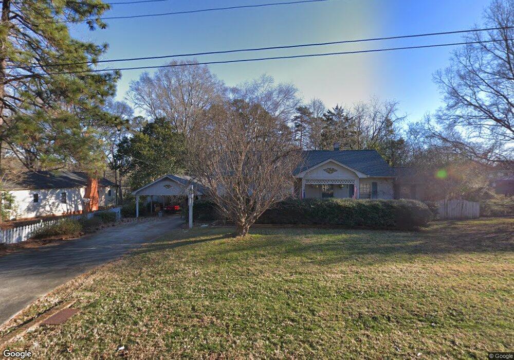
4316 Hillside Dr Mint Hill, NC 28227
Estimated Value: $370,912 - $395,000
3
Beds
1
Bath
1,244
Sq Ft
$306/Sq Ft
Est. Value
About This Home
This home is located at 4316 Hillside Dr, Mint Hill, NC 28227 and is currently estimated at $380,637, approximately $305 per square foot. 4316 Hillside Dr is a home with nearby schools including Bain Elementary, Mint Hill Middle School, and Independence High.
Ownership History
Date
Name
Owned For
Owner Type
Purchase Details
Closed on
Oct 31, 2014
Sold by
Burnette Donna Newell and Burnette Herman T
Bought by
Mint Hill Historical Society Inc
Current Estimated Value
Home Financials for this Owner
Home Financials are based on the most recent Mortgage that was taken out on this home.
Original Mortgage
$97,750
Outstanding Balance
$75,591
Interest Rate
4.26%
Mortgage Type
New Conventional
Estimated Equity
$305,046
Purchase Details
Closed on
Jun 20, 1997
Sold by
Newell Herman Franklin and Newell Ruby F
Bought by
Burnette Donna Newell
Create a Home Valuation Report for This Property
The Home Valuation Report is an in-depth analysis detailing your home's value as well as a comparison with similar homes in the area
Home Values in the Area
Average Home Value in this Area
Purchase History
| Date | Buyer | Sale Price | Title Company |
|---|---|---|---|
| Mint Hill Historical Society Inc | $115,000 | None Available | |
| Burnette Donna Newell | -- | -- |
Source: Public Records
Mortgage History
| Date | Status | Borrower | Loan Amount |
|---|---|---|---|
| Open | Mint Hill Historical Society Inc | $97,750 |
Source: Public Records
Tax History Compared to Growth
Tax History
| Year | Tax Paid | Tax Assessment Tax Assessment Total Assessment is a certain percentage of the fair market value that is determined by local assessors to be the total taxable value of land and additions on the property. | Land | Improvement |
|---|---|---|---|---|
| 2025 | -- | $342,500 | $208,500 | $134,000 |
| 2024 | -- | $342,500 | $208,500 | $134,000 |
| 2023 | $40 | $342,500 | $208,500 | $134,000 |
| 2022 | $40 | $301,100 | $242,400 | $58,700 |
| 2021 | $40 | $301,100 | $242,400 | $58,700 |
| 2020 | $40 | $301,100 | $242,400 | $58,700 |
| 2019 | $34 | $301,100 | $242,400 | $58,700 |
| 2018 | $1,307 | $117,000 | $106,900 | $10,100 |
| 2017 | $1,294 | $117,000 | $106,900 | $10,100 |
| 2016 | $21 | $117,000 | $106,900 | $10,100 |
| 2015 | -- | $117,000 | $106,900 | $10,100 |
| 2014 | $1,285 | $117,000 | $106,900 | $10,100 |
Source: Public Records
Map
Nearby Homes
- 7701 Matthews-Mint Hill Rd
- 3215 Lisburn St
- 5108 Kinsbridge Dr
- 4317 Wilgrove Mint Hill Rd
- 4309 Wilgrove Mint Hill Rd
- 5010 Kinsbridge Dr
- 7914 Nelson Rd
- 8024 Fairview Rd
- 15018 Camus Ct
- 13216 Lawyers Rd
- 12017 Mariner Dr
- 8320 Blair Rd
- 7913 Large Oak Ln
- 8405 Fairview Rd
- 17049 Malone Ln
- 7830 Large Oak Ln
- 18209 Middle Springs Ln
- Newell Plan at Whitley Preserve - Enclave Collection
- Lemley Plan at Whitley Preserve - Park Collection
- Wyngate Plan at Whitley Preserve - Park Collection
- 4324 Hillside Dr
- 4330 Hillside Dr
- 7804 Pinewood Cir
- 3011 Lisburn St
- 3007 Lisburn St
- 3015 Lisburn St
- 7705 Pinewood Cir
- 7639 McEwen Lake Ln
- 3023 Lisburn St
- 3027 Lisburn St Unit 69
- 3027 Lisburn St
- 3019 Lisburn St
- 7741 Matthews Mint Hill Rd
- 7741 Matthews Mint Hill Rd Unit 3a
- 3031 Lisburn St
- 7521 Matthews Mint Hill Rd
- 7521 Matthews Mint Hill Rd Unit 7521
- 7623 McEwen Lake Ln
- 7725 Pinewood Cir
- 3018 Lisburn St