Estimated Value: $274,370 - $309,000
3
Beds
1
Bath
1,660
Sq Ft
$179/Sq Ft
Est. Value
About This Home
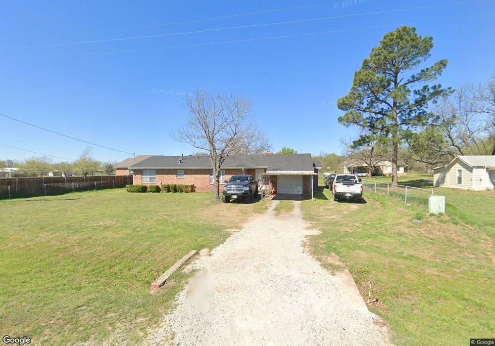
This home is located at 432 S Allen St, Boyd, TX 76023 and is currently estimated at $297,593, approximately $179 per square foot. 432 S Allen St is a home located in Wise County with nearby schools including Boyd Elementary School, Boyd Middle School, and Boyd High School.
Ownership History
Date
Name
Owned For
Owner Type
Purchase Details
Closed on
Apr 17, 2024
Sold by
Cannon John George
Bought by
John And Claudia Cannon Revocable Trust and Cannon
Current Estimated Value
Purchase Details
Closed on
Feb 14, 2014
Sold by
Lisby Harold Wayne and Lisby Richardson Deborah Sue
Bought by
Cannon John G
Home Financials for this Owner
Home Financials are based on the most recent Mortgage that was taken out on this home.
Original Mortgage
$60,000
Interest Rate
4.56%
Mortgage Type
New Conventional
Purchase Details
Closed on
Apr 6, 2010
Sold by
Lisby H M
Bought by
Cannon John G
Create a Home Valuation Report for This Property
The Home Valuation Report is an in-depth analysis detailing your home's value as well as a comparison with similar homes in the area
Home Values in the Area
Average Home Value in this Area
Purchase History
| Date | Buyer | Sale Price | Title Company |
|---|---|---|---|
| John And Claudia Cannon Revocable Trust | -- | None Listed On Document | |
| Cannon John G | -- | Guardian Title Co | |
| Cannon John G | -- | -- |
Source: Public Records
Mortgage History
| Date | Status | Borrower | Loan Amount |
|---|---|---|---|
| Previous Owner | Cannon John G | $60,000 |
Source: Public Records
Tax History Compared to Growth
Tax History
| Year | Tax Paid | Tax Assessment Tax Assessment Total Assessment is a certain percentage of the fair market value that is determined by local assessors to be the total taxable value of land and additions on the property. | Land | Improvement |
|---|---|---|---|---|
| 2025 | $6,595 | $346,699 | $88,500 | $258,199 |
| 2024 | $6,595 | $347,119 | $88,500 | $258,619 |
| 2023 | $6,526 | $351,746 | $88,500 | $263,246 |
| 2022 | $4,459 | $207,804 | $22,125 | $185,679 |
| 2021 | $3,697 | $166,160 | $22,130 | $144,030 |
| 2020 | $3,573 | $159,970 | $22,130 | $137,840 |
| 2019 | $3,163 | $137,610 | $23,600 | $114,010 |
| 2018 | $2,957 | $126,970 | $22,130 | $104,840 |
| 2017 | $2,835 | $118,390 | $22,130 | $96,260 |
| 2016 | $2,571 | $107,350 | $22,130 | $85,220 |
| 2015 | -- | $102,170 | $22,130 | $80,040 |
| 2014 | -- | $102,430 | $22,130 | $80,300 |
Source: Public Records
Map
Nearby Homes
- 420 S Evans St
- 213 S Allen St
- 213 S Hitt St
- 205 S Allen St
- 207 W Morton Ave
- 3397 2048 Hwy
- 405 Edgewood Terrace
- TBD S Atwood
- tbd S Oak St
- 213 S Atwood St
- 18 Acres Highway 114 Rd
- 110 Gerber Ln
- 139 Gerber Ln
- 198 Bay Meadows Ln
- 525 Highway 114 Rd
- 424 Green Meadow Dr
- 100 N Agnew St
- 113 N Wilson St
- 201 Cemetery Rd
- TBD E Rock Island Ave
- 440 S Allen St
- 426 S Allen St
- 420 S Allen St
- 416 S Allen St
- 421 S Evans St
- 5XX S Allen St
- 501 S Allen St
- 435 S Allen St
- 433 S Ewing St
- 429 S Allen St
- 537 S Allen St
- 453 S Ewing St
- 425 S Allen St
- 416 S Evans St
- 429 S Ewing St
- 541 S Allen St
- 541 S Allen St Unit B
- 541 S Allen St Unit A
- 461 S Ewing St
- 477 S Ewing St