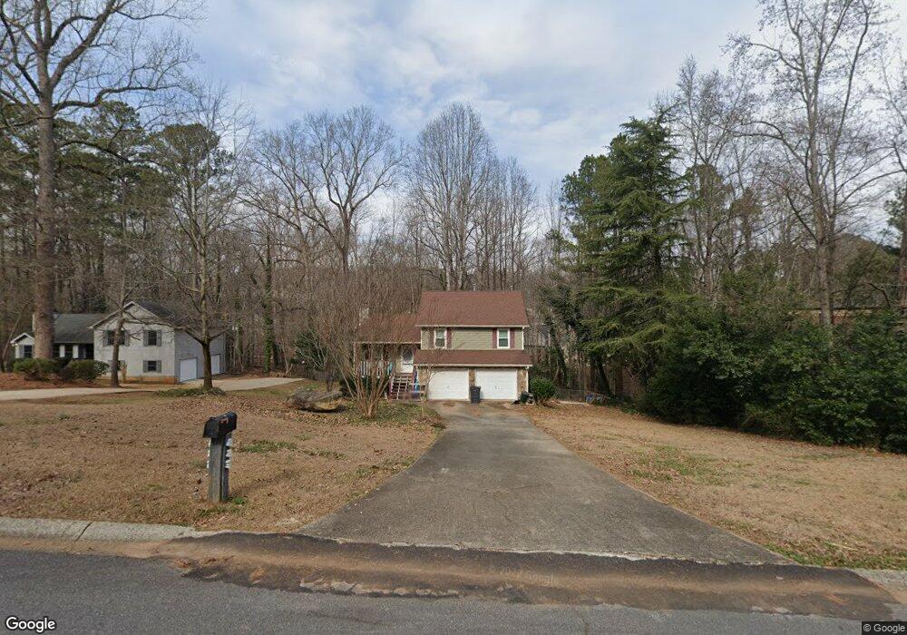
435 Ashwood Dr Unit 1 Lawrenceville, GA 30043
Estimated Value: $304,072 - $335,000
3
Beds
2
Baths
1,044
Sq Ft
$306/Sq Ft
Est. Value
About This Home
This home is located at 435 Ashwood Dr Unit 1, Lawrenceville, GA 30043 and is currently estimated at $319,018, approximately $305 per square foot. 435 Ashwood Dr Unit 1 is a home located in Gwinnett County with nearby schools including Taylor Elementary School, Creekland Middle School, and Collins Hill High School.
Ownership History
Date
Name
Owned For
Owner Type
Purchase Details
Closed on
Oct 29, 2013
Sold by
White James N
Bought by
White James N and White Jo Ellen
Current Estimated Value
Purchase Details
Closed on
Oct 8, 2004
Sold by
Nicholson Matthew M
Bought by
White James N
Home Financials for this Owner
Home Financials are based on the most recent Mortgage that was taken out on this home.
Original Mortgage
$102,550
Interest Rate
5%
Mortgage Type
New Conventional
Purchase Details
Closed on
Feb 27, 2001
Sold by
Crisler James F and Crisler Karen A
Bought by
Nicholson Matthew M
Home Financials for this Owner
Home Financials are based on the most recent Mortgage that was taken out on this home.
Original Mortgage
$115,150
Interest Rate
7.12%
Mortgage Type
FHA
Create a Home Valuation Report for This Property
The Home Valuation Report is an in-depth analysis detailing your home's value as well as a comparison with similar homes in the area
Home Values in the Area
Average Home Value in this Area
Purchase History
| Date | Buyer | Sale Price | Title Company |
|---|---|---|---|
| White James N | -- | -- | |
| White James N | $128,200 | -- | |
| Nicholson Matthew M | $117,000 | -- |
Source: Public Records
Mortgage History
| Date | Status | Borrower | Loan Amount |
|---|---|---|---|
| Previous Owner | White James N | $102,550 | |
| Previous Owner | Nicholson Matthew M | $115,150 |
Source: Public Records
Tax History Compared to Growth
Tax History
| Year | Tax Paid | Tax Assessment Tax Assessment Total Assessment is a certain percentage of the fair market value that is determined by local assessors to be the total taxable value of land and additions on the property. | Land | Improvement |
|---|---|---|---|---|
| 2024 | $4,799 | $125,800 | $25,600 | $100,200 |
| 2023 | $4,799 | $115,680 | $25,600 | $90,080 |
| 2022 | $3,892 | $101,280 | $23,200 | $78,080 |
| 2021 | $2,941 | $73,400 | $15,600 | $57,800 |
| 2020 | $2,957 | $73,400 | $15,600 | $57,800 |
| 2019 | $2,539 | $64,400 | $12,480 | $51,920 |
| 2018 | $2,537 | $64,400 | $12,480 | $51,920 |
| 2016 | $2,025 | $49,280 | $10,400 | $38,880 |
| 2015 | $1,754 | $40,960 | $10,400 | $30,560 |
| 2014 | -- | $35,880 | $10,400 | $25,480 |
Source: Public Records
Map
Nearby Homes
- 1450 Ashbrook Dr
- 1436 Sage Brook Ct
- 1490 Ashbrook Dr
- 525 Ashwood Dr
- 524 Meadowfield Ct
- 1452 Lawrenceville Suwanee Rd
- 1320 Green Oak Cir
- 664 Stampmill Ct
- 1464 Claredon Dr
- 1540 Ox Bridge Ct NW
- 1264 Watercrest Cir
- 362 Inwood Trail
- 530 Oxford Crest Ct Unit 2
- 1565 Watercrest Cir
- 1605 Watercrest Cir
- 1445 Watercrest Cir
- 1401 Dorchester Dr
- 374 Oak Springs Dr
- 415 Ashwood Dr Unit 1
- 455 Ashwood Dr
- 465 Ashwood Dr
- 1149 Ashbrook Dr
- 1159 Ashbrook Dr Unit 2
- 1159 Ashbooke
- 454 Ashwood Dr
- 444 Ashwood Dr Unit 1
- 464 Ashwood Dr Unit 1
- 1139 Ashbrook Dr
- 1437 Shadwood Ct
- 434 Ashwood Dr
- 475 Ashwood Dr
- 474 Ashwood Dr Unit 6
- 474 Ashwood Dr
- 424 Ashwood Dr
- 1778 Hanover West Ct
- 1788 Hanover West Ct
- 1788 Hanover West Ct Unit 14
- 1797 Hanover West Ct Unit 4