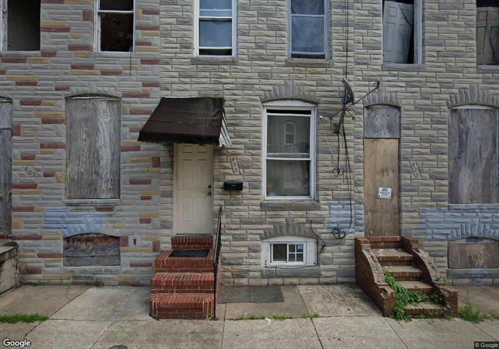
435 Furrow St Baltimore, MD 21223
Carrollton Ridge NeighborhoodEstimated Value: $33,363 - $42,000
2
Beds
1
Bath
958
Sq Ft
$39/Sq Ft
Est. Value
About This Home
This home is located at 435 Furrow St, Baltimore, MD 21223 and is currently estimated at $37,682, approximately $39 per square foot. 435 Furrow St is a home located in Baltimore City with nearby schools including Booker T. Washington Middle School, Edmondson Westside High School, and Digital Harbor High School.
Ownership History
Date
Name
Owned For
Owner Type
Purchase Details
Closed on
Sep 24, 2021
Sold by
Embert Investments Llc
Bought by
Patamatt Llc
Current Estimated Value
Purchase Details
Closed on
Aug 6, 2021
Sold by
Batty Personal Monik
Bought by
Embert Investments Llc
Purchase Details
Closed on
Nov 5, 2020
Sold by
Windham Jesse
Bought by
Embert Investments Llc
Purchase Details
Closed on
Mar 25, 2010
Sold by
Secretary Of Housing And Urban
Bought by
Windham Jesse
Purchase Details
Closed on
Apr 6, 2009
Sold by
Wachovia Bank National
Bought by
Secretary Of Housing And Urban and Development , The
Purchase Details
Closed on
Jun 1, 2004
Sold by
Two Putt Llc
Bought by
Paul Neva
Purchase Details
Closed on
Jul 18, 2002
Sold by
Brown Robert L
Bought by
435 Furrow Street
Create a Home Valuation Report for This Property
The Home Valuation Report is an in-depth analysis detailing your home's value as well as a comparison with similar homes in the area
Home Values in the Area
Average Home Value in this Area
Purchase History
| Date | Buyer | Sale Price | Title Company |
|---|---|---|---|
| Patamatt Llc | $55,000 | None Listed On Document | |
| Embert Investments Llc | $9,000 | New Title Company Name | |
| Embert Investments Llc | $21,000 | Masters Title & Escrow | |
| Windham Jesse | $10,000 | -- | |
| Secretary Of Housing And Urban | $44,340 | -- | |
| Wachovia Bank National | $44,340 | -- | |
| Paul Neva | $17,000 | -- | |
| 435 Furrow Street | $11,500 | -- |
Source: Public Records
Tax History Compared to Growth
Tax History
| Year | Tax Paid | Tax Assessment Tax Assessment Total Assessment is a certain percentage of the fair market value that is determined by local assessors to be the total taxable value of land and additions on the property. | Land | Improvement |
|---|---|---|---|---|
| 2025 | $352 | $15,000 | $3,000 | $12,000 |
| 2024 | $352 | $15,000 | $3,000 | $12,000 |
| 2023 | $543 | $23,000 | $4,000 | $19,000 |
| 2022 | $480 | $20,333 | $0 | $0 |
| 2021 | $417 | $17,667 | $0 | $0 |
| 2020 | $354 | $15,000 | $3,000 | $12,000 |
| 2019 | $352 | $15,000 | $3,000 | $12,000 |
| 2018 | $354 | $15,000 | $3,000 | $12,000 |
| 2017 | $354 | $15,000 | $0 | $0 |
| 2016 | $711 | $15,000 | $0 | $0 |
| 2015 | $711 | $15,000 | $0 | $0 |
| 2014 | $711 | $30,000 | $0 | $0 |
Source: Public Records
Map
Nearby Homes
- 419 Furrow St
- 423 Furrow St
- 411 Furrow St
- 420 S Smallwood St
- 426 S Smallwood St
- 406 S Smallwood St
- 2202 Ashton St
- 2241 Ramsay St
- 452 Furrow St
- 454 Furrow St
- 347 S Smallwood St
- 342 S Smallwood St
- 328 Furrow St
- 430 S Bentalou St
- 510 S Smallwood St
- 408 S Bentalou St
- 478 S Bentalou St
- 480 S Bentalou St
- 406 S Pulaski St
- 2228 Christian St
- 433 Furrow St
- 437 Furrow St
- 431 Furrow St
- 439 Furrow St
- 429 Furrow St
- 441 Furrow St
- 427 Furrow St
- 425 Furrow St
- 2246 W W St
- 432 S Smallwood St
- 436 S Smallwood St
- 430 S Smallwood St
- 438 S Smallwood St
- 2200 Ashton St
- 428 S Smallwood St
- 2204 Ashton St
- 440 S Smallwood St
- 2206 Ashton St
- 421 Furrow St
- 2208 Ashton St