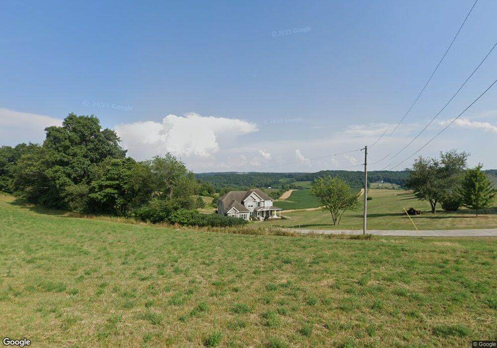
4362 Trone Rd Glenville, PA 17329
Estimated Value: $545,000 - $604,000
3
Beds
2
Baths
3,004
Sq Ft
$188/Sq Ft
Est. Value
About This Home
This home is located at 4362 Trone Rd, Glenville, PA 17329 and is currently estimated at $564,261, approximately $187 per square foot. 4362 Trone Rd is a home located in York County with nearby schools including South Western Senior High School.
Ownership History
Date
Name
Owned For
Owner Type
Purchase Details
Closed on
Jun 25, 2009
Sold by
Smith Harold D and Smith Linda I
Bought by
Bream Matthew O and Bream Stephanie L
Current Estimated Value
Home Financials for this Owner
Home Financials are based on the most recent Mortgage that was taken out on this home.
Original Mortgage
$258,580
Outstanding Balance
$170,642
Interest Rate
4.92%
Mortgage Type
Future Advance Clause Open End Mortgage
Estimated Equity
$393,619
Purchase Details
Closed on
Apr 16, 1979
Bought by
Smith Harold D and Smith Linda
Create a Home Valuation Report for This Property
The Home Valuation Report is an in-depth analysis detailing your home's value as well as a comparison with similar homes in the area
Home Values in the Area
Average Home Value in this Area
Purchase History
| Date | Buyer | Sale Price | Title Company |
|---|---|---|---|
| Bream Matthew O | $35,600 | None Available | |
| Smith Harold D | $3,000 | -- |
Source: Public Records
Mortgage History
| Date | Status | Borrower | Loan Amount |
|---|---|---|---|
| Open | Bream Matthew O | $258,580 |
Source: Public Records
Tax History Compared to Growth
Tax History
| Year | Tax Paid | Tax Assessment Tax Assessment Total Assessment is a certain percentage of the fair market value that is determined by local assessors to be the total taxable value of land and additions on the property. | Land | Improvement |
|---|---|---|---|---|
| 2025 | $10,232 | $330,590 | $43,430 | $287,160 |
| 2024 | $10,182 | $330,590 | $43,430 | $287,160 |
| 2023 | $9,984 | $330,590 | $43,430 | $287,160 |
| 2022 | $9,749 | $330,590 | $43,430 | $287,160 |
| 2021 | $9,214 | $330,590 | $43,430 | $287,160 |
| 2020 | $9,214 | $330,590 | $43,430 | $287,160 |
| 2019 | $9,019 | $330,590 | $43,430 | $287,160 |
| 2018 | $8,886 | $330,590 | $43,430 | $287,160 |
| 2017 | $8,695 | $330,590 | $43,430 | $287,160 |
| 2016 | $0 | $330,590 | $43,430 | $287,160 |
| 2015 | -- | $330,590 | $43,430 | $287,160 |
| 2014 | -- | $330,590 | $43,430 | $287,160 |
Source: Public Records
Map
Nearby Homes
- 0 Highland Ln Unit PAYK2087128
- 0 Arnold Rd Unit PAYK2091022
- 7925 Main St
- 5040 Rocky Rd
- 4340 Lee Rd
- 5566 Blue Hill Rd
- 3900 Blue Hill Rd
- 3744 Blue Hill Rd
- 3486 Hobart Rd
- 4073 Landis Rd
- 2777 Maple Ln
- 5007 Snyder Mill Rd
- 759 Glenville Rd
- 1075 Hobart Rd
- 0 Emily Plan at Hills at Valley View Unit PAYK2082076
- 6320 Liam Dr
- 6322 Liam Dr
- 0 Redbud Plan at Hills at Valley View Unit PAYK2082078
- 0 Black Cherry Plan at Hills at Valley View Unit PAYK2082012
- Emily Plan at Hills at Valley View
- 4466 Skyview Dr
- 4506 Skyview Dr
- 4554 Skyview Dr
- 4543 Skyview Dr
- 4564 Skyview Dr
- 4288 Trone Rd
- 4567 Skyview Dr
- 4593 Skyview Dr
- 4600 Skyview Dr
- 4629 Skyview Dr
- 4630 Skyview Dr
- 4659 Skyview Dr
- 0 Skyview Dr Unit 1002781911
- TBB Skyview Dr
- 0 Skyview Dr Unit 1002669059
- 4685 Skyview Dr
- 4676 Skyview Dr
- 0 Manheim Rd Unit 1007540984
- 0 Manheim Rd Unit 1000277062
- 0 Manheim Rd Unit 1002672183