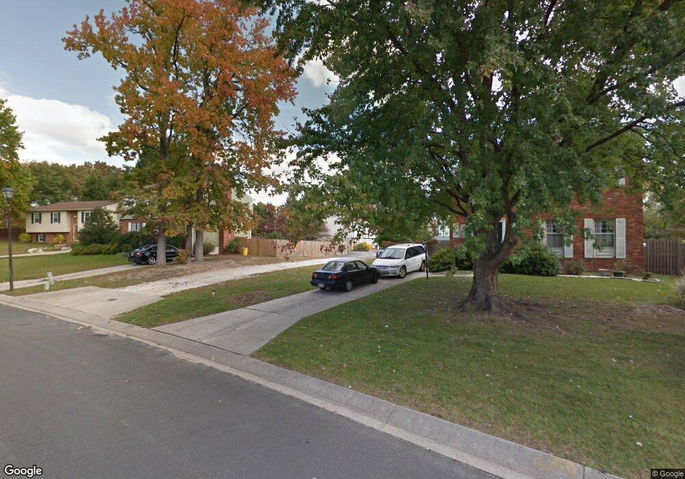
437 Mali Ct Millersville, MD 21108
Estimated Value: $413,514 - $479,000
--
Bed
2
Baths
1,108
Sq Ft
$415/Sq Ft
Est. Value
About This Home
This home is located at 437 Mali Ct, Millersville, MD 21108 and is currently estimated at $459,629, approximately $414 per square foot. 437 Mali Ct is a home located in Anne Arundel County with nearby schools including Rippling Woods Elementary School, Old Mill Middle School North, and Old Mill High School.
Ownership History
Date
Name
Owned For
Owner Type
Purchase Details
Closed on
May 11, 2018
Sold by
Matheke Robin E and Deuell Robin E
Bought by
Matheke Robin E and Matheke Otto G
Current Estimated Value
Home Financials for this Owner
Home Financials are based on the most recent Mortgage that was taken out on this home.
Original Mortgage
$162,600
Outstanding Balance
$140,643
Interest Rate
4.6%
Mortgage Type
New Conventional
Estimated Equity
$318,986
Purchase Details
Closed on
May 27, 2003
Sold by
Deuell Jessie J
Bought by
Deuell Robin E
Purchase Details
Closed on
Jun 23, 1987
Sold by
Kalb Marie J
Bought by
Deuell Jessie J
Home Financials for this Owner
Home Financials are based on the most recent Mortgage that was taken out on this home.
Original Mortgage
$93,950
Interest Rate
10.44%
Create a Home Valuation Report for This Property
The Home Valuation Report is an in-depth analysis detailing your home's value as well as a comparison with similar homes in the area
Home Values in the Area
Average Home Value in this Area
Purchase History
| Date | Buyer | Sale Price | Title Company |
|---|---|---|---|
| Matheke Robin E | -- | None Available | |
| Deuell Robin E | -- | -- | |
| Deuell Jessie J | $98,900 | -- |
Source: Public Records
Mortgage History
| Date | Status | Borrower | Loan Amount |
|---|---|---|---|
| Open | Matheke Robin E | $162,600 | |
| Previous Owner | Deuell Jessie J | $93,950 | |
| Closed | Deuell Robin E | -- |
Source: Public Records
Tax History Compared to Growth
Tax History
| Year | Tax Paid | Tax Assessment Tax Assessment Total Assessment is a certain percentage of the fair market value that is determined by local assessors to be the total taxable value of land and additions on the property. | Land | Improvement |
|---|---|---|---|---|
| 2025 | $3,165 | $407,600 | -- | -- |
| 2024 | $3,165 | $388,000 | $205,300 | $182,700 |
| 2023 | $3,077 | $379,367 | $0 | $0 |
| 2022 | $2,878 | $370,733 | $0 | $0 |
| 2021 | $5,658 | $362,100 | $180,300 | $181,800 |
| 2020 | $2,729 | $344,700 | $0 | $0 |
| 2019 | $5,229 | $327,300 | $0 | $0 |
| 2018 | $3,142 | $309,900 | $136,900 | $173,000 |
| 2017 | $2,471 | $296,700 | $0 | $0 |
| 2016 | -- | $283,500 | $0 | $0 |
| 2015 | -- | $270,300 | $0 | $0 |
| 2014 | -- | $268,500 | $0 | $0 |
Source: Public Records
Map
Nearby Homes
- 518 Kenora Dr
- 266 Nathan Way
- 258 Nathan Way
- 248 Michele Cir
- 8218 Sherbrooke Ct
- 8224 Bernard Dr N
- 268 Glenda Ct
- 429 Hardmoore Ct
- 326 Eagles Ridge Way
- 525 Old Mill Rd
- 494 Kenilworth Ct
- 462 Aventura Ct
- 529 Chalet Dr W
- 2664 Carver Rd
- 8251 Rupert Rd S
- 8333 Kippis Rd
- 8253 Rupert Rd S
- 460 Marianna Dr
- 307 Sorel Ct
- 8297 Kippis Rd