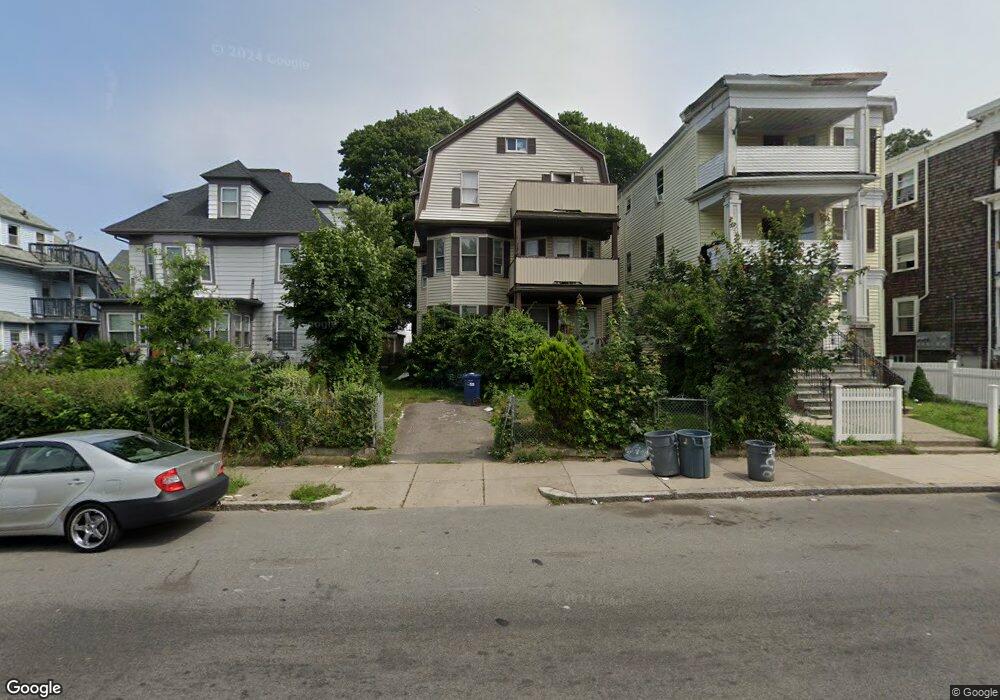
440 Norfolk St Mattapan, MA 02126
Wellington Hill NeighborhoodEstimated Value: $856,511 - $1,227,000
8
Beds
3
Baths
3,486
Sq Ft
$293/Sq Ft
Est. Value
About This Home
This home is located at 440 Norfolk St, Mattapan, MA 02126 and is currently estimated at $1,020,878, approximately $292 per square foot. 440 Norfolk St is a home located in Suffolk County with nearby schools including KIPP Academy Boston Charter School and Berea Seventh-day Adventist Academy.
Ownership History
Date
Name
Owned For
Owner Type
Purchase Details
Closed on
Feb 2, 1995
Sold by
Innocent Francois
Bought by
Innocent Margarette and Innocent Beraca
Current Estimated Value
Purchase Details
Closed on
Dec 31, 1987
Sold by
Lewis Sarah V
Bought by
Innocent Amelie S
Create a Home Valuation Report for This Property
The Home Valuation Report is an in-depth analysis detailing your home's value as well as a comparison with similar homes in the area
Home Values in the Area
Average Home Value in this Area
Purchase History
| Date | Buyer | Sale Price | Title Company |
|---|---|---|---|
| Innocent Margarette | $100,000 | -- | |
| Innocent Amelie S | $180,000 | -- |
Source: Public Records
Mortgage History
| Date | Status | Borrower | Loan Amount |
|---|---|---|---|
| Open | Innocent Amelie S | $322,500 | |
| Closed | Innocent Amelie S | $64,500 |
Source: Public Records
Tax History Compared to Growth
Tax History
| Year | Tax Paid | Tax Assessment Tax Assessment Total Assessment is a certain percentage of the fair market value that is determined by local assessors to be the total taxable value of land and additions on the property. | Land | Improvement |
|---|---|---|---|---|
| 2025 | $9,374 | $809,500 | $239,100 | $570,400 |
| 2024 | $7,702 | $706,600 | $236,700 | $469,900 |
| 2023 | $7,093 | $660,400 | $221,200 | $439,200 |
| 2022 | $6,532 | $600,400 | $201,100 | $399,300 |
| 2021 | $6,406 | $600,400 | $201,100 | $399,300 |
| 2020 | $5,902 | $558,900 | $210,500 | $348,400 |
| 2019 | $5,354 | $508,000 | $152,200 | $355,800 |
| 2018 | $4,752 | $453,400 | $152,200 | $301,200 |
| 2017 | $4,707 | $444,500 | $152,200 | $292,300 |
| 2016 | $4,445 | $404,100 | $152,200 | $251,900 |
| 2015 | $4,341 | $358,500 | $114,100 | $244,400 |
| 2014 | $4,027 | $320,100 | $114,100 | $206,000 |
Source: Public Records
Map
Nearby Homes
- 18 Astoria St
- 10 Sutton St
- 5 Sutton St
- 5 Sutton St Unit 3B
- 15-17 W Selden St
- 808 Morton St Unit 3
- 67 Wildwood St
- 10 Hosmer St
- 139 Selden St
- 124 Selden St
- 24 Marden Ave
- 68 Mascot St
- 567B Norfolk St
- 25 Fessenden St
- 23 Fessenden St
- 157 Delhi St
- 32 Crowell St
- 30 Glenhill Rd
- 6 Deering Rd
- 38 Mascot St Unit 3
- 444 Norfolk St
- 436 Norfolk St
- 448 Norfolk St
- 448 Norfolk St Unit 3
- 448 Norfolk St Unit 1
- 448 Norfolk St Unit 2
- 9 Flint St
- 434 Norfolk St
- 452 Norfolk St
- 452 Norfolk St Unit 3
- 9 Astoria St
- 9 Astoria St Unit 3
- 15 Astoria St
- 462 Norfolk St
- 464 Norfolk St
- 465 Norfolk St
- 465 Norfolk St Unit 4
- 465 Norfolk St Unit 3
- 449 Norfolk St
- 451 Norfolk St Unit 11