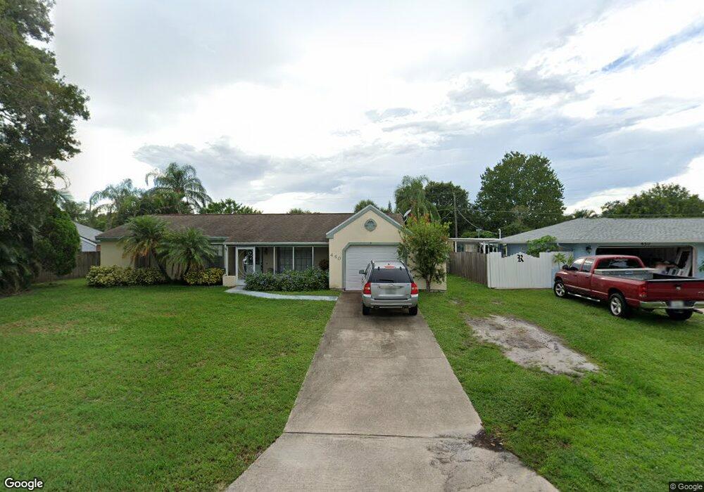
440 Plant Ave NE Palm Bay, FL 32907
Port Malabar NeighborhoodEstimated Value: $174,000 - $312,000
3
Beds
2
Baths
1,358
Sq Ft
$183/Sq Ft
Est. Value
About This Home
This home is located at 440 Plant Ave NE, Palm Bay, FL 32907 and is currently estimated at $248,785, approximately $183 per square foot. 440 Plant Ave NE is a home located in Brevard County with nearby schools including Port Malabar Elementary School, Stone Magnet Middle School, and Palm Bay Magnet Senior High School.
Ownership History
Date
Name
Owned For
Owner Type
Purchase Details
Closed on
Jun 27, 2013
Sold by
Keller Dana Tay and Chandler Tommie Allen
Bought by
Diamonhead Investments Inc
Current Estimated Value
Purchase Details
Closed on
Jun 4, 2010
Sold by
Hinson Kathleen M and Hinson William E
Bought by
Keller Dana and Scuoteguazza Debra
Purchase Details
Closed on
May 27, 1997
Sold by
Foti Kathleen M
Bought by
Hinson Kathleeen M
Create a Home Valuation Report for This Property
The Home Valuation Report is an in-depth analysis detailing your home's value as well as a comparison with similar homes in the area
Home Values in the Area
Average Home Value in this Area
Purchase History
| Date | Buyer | Sale Price | Title Company |
|---|---|---|---|
| Diamonhead Investments Inc | -- | Attorney | |
| Keller Dana | $62,000 | Supreme Title Closings Llc | |
| Hinson Kathleen M | -- | Supreme Title Closings Llc | |
| Hinson Kathleeen M | -- | -- |
Source: Public Records
Tax History Compared to Growth
Tax History
| Year | Tax Paid | Tax Assessment Tax Assessment Total Assessment is a certain percentage of the fair market value that is determined by local assessors to be the total taxable value of land and additions on the property. | Land | Improvement |
|---|---|---|---|---|
| 2025 | $3,182 | $184,850 | -- | -- |
| 2024 | $3,130 | $198,740 | -- | -- |
| 2023 | $3,130 | $210,890 | $0 | $0 |
| 2022 | $2,810 | $190,850 | $0 | $0 |
| 2021 | $2,415 | $121,220 | $19,500 | $101,720 |
| 2020 | $2,172 | $106,060 | $14,500 | $91,560 |
| 2019 | $2,258 | $105,560 | $14,500 | $91,060 |
| 2018 | $2,095 | $99,980 | $14,500 | $85,480 |
| 2017 | $1,980 | $88,860 | $12,500 | $76,360 |
| 2016 | $1,668 | $77,110 | $6,500 | $70,610 |
| 2015 | $1,541 | $65,260 | $6,500 | $58,760 |
| 2014 | $1,421 | $59,330 | $6,500 | $52,830 |
Source: Public Records
Map
Nearby Homes
- 401 Homestead Ave NE
- 1581 Charles Blvd NE
- 350 Riley Ave NE
- 312 Nogales Ave NE
- 1712 Apache St NE
- 430 Nogales Ave NE
- 1650 Alpha St NE
- 1651 Alpha St NE
- 282 Velvet Ave NE
- 255 Roman Ave NE
- 1563 Omega St NE
- 000 Pioneer Ave NE
- 1474 Nolan St NE
- 1811 Barker St NE
- 449 Brookdale Ave NE
- 481 Ralwood Ln NE
- 1303 Nolan St NE
- 584 Laurel Oak Ct NE
- 399 Epping Ct NE
- 1507 Meadowbrook Rd NE
- 430 Plant Ave NE
- 450 Plant Ave NE
- 427 Rome Ave NE Unit Port Malabar Unit 29
- 419 Rome Ave NE
- 435 Rome Ave NE
- 420 Plant Ave NE
- 460 Plant Ave NE
- 431 Plant Ave NE
- 441 Plant Ave NE
- 421 Plant Ave NE
- 443 Rome Ave NE
- 413 Rome Ave NE
- 451 Plant Ave NE
- 410 Plant Ave NE
- 470 Plant Ave NE
- 411 Plant Ave NE
- 471 Plant Ave NE
- 426 Rome Ave NE
- 457 Rome Ave NE
- 418 Rome Ave NE