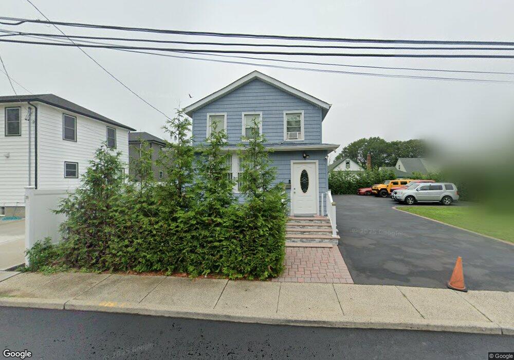
440 Scaneateles Ave West Hempstead, NY 11552
Estimated Value: $667,086 - $671,000
4
Beds
2
Baths
1,203
Sq Ft
$556/Sq Ft
Est. Value
About This Home
This home is located at 440 Scaneateles Ave, West Hempstead, NY 11552 and is currently estimated at $669,043, approximately $556 per square foot. 440 Scaneateles Ave is a home located in Nassau County with nearby schools including Davison Avenue Intermediate School, Maurice W. Downing Primary K-2 School, and Howard T Herber Middle School.
Ownership History
Date
Name
Owned For
Owner Type
Purchase Details
Closed on
May 13, 2021
Sold by
91 Overton Holding Corp
Bought by
R S 440 Llc
Current Estimated Value
Purchase Details
Closed on
Jul 3, 2020
Sold by
Puello Family Trust
Bought by
91 Overton Holding Corp
Purchase Details
Closed on
Jan 23, 2018
Sold by
Taveras Norberto J
Bought by
Puello Family Trust
Purchase Details
Closed on
Dec 12, 2005
Sold by
Young Patricia
Bought by
Taveras Norberto
Create a Home Valuation Report for This Property
The Home Valuation Report is an in-depth analysis detailing your home's value as well as a comparison with similar homes in the area
Home Values in the Area
Average Home Value in this Area
Purchase History
| Date | Buyer | Sale Price | Title Company |
|---|---|---|---|
| R S 440 Llc | $500,000 | Stewart Title | |
| 91 Overton Holding Corp | $215,000 | Fidelity National Title | |
| Puello Family Trust | $222,000 | None Available | |
| Taveras Norberto | $362,000 | -- |
Source: Public Records
Tax History Compared to Growth
Tax History
| Year | Tax Paid | Tax Assessment Tax Assessment Total Assessment is a certain percentage of the fair market value that is determined by local assessors to be the total taxable value of land and additions on the property. | Land | Improvement |
|---|---|---|---|---|
| 2025 | $6,722 | $382 | $185 | $197 |
| 2024 | $2,102 | $377 | $185 | $192 |
| 2023 | $6,151 | $203 | $185 | $18 |
| 2022 | $6,151 | $203 | $185 | $18 |
| 2021 | $8,620 | $366 | $185 | $181 |
| 2020 | $25,703 | $681 | $459 | $222 |
| 2019 | $4,405 | $681 | $459 | $222 |
| 2018 | $8,420 | $681 | $0 | $0 |
| 2017 | $7,609 | $681 | $459 | $222 |
| 2016 | $11,615 | $681 | $459 | $222 |
| 2015 | $3,748 | $681 | $459 | $222 |
| 2014 | $3,748 | $681 | $459 | $222 |
| 2013 | $3,530 | $681 | $459 | $222 |
Source: Public Records
Map
Nearby Homes
- 1070 Mahopac Rd
- 1024 Mahopac Rd
- 7 Hopatcong Ave
- 461 Pinebrook Ave
- 10 Pinebrook Ave
- 394 Pinebrook Ave
- 486 Champlain Ave
- 1025 Ontario Rd
- 419 Coolidge Ave
- 362 Langdon Blvd
- 924 Otsego Ct
- 402 Clinton Ave
- 529 Clinton Ave
- 26 Parkside Rd
- 5 Juliette Rd
- 919 Pinelake Dr
- 501 Lafayette Ave
- 312 Coventry Rd S
- 0 Rhodes Ln
- 492 Pershing Blvd
- 432 Scaneateles Ave
- 42 Scaneateles Ave
- 435 Canandaigua Ave
- 439 Canandaigua Ave
- 439 Canandaigua Ave Unit 1
- 429 Canandaigua Ave
- 1043 Mahopac Rd
- 449 Scaneateles Ave
- 424 Scaneateles Ave
- 11 Scaneateles Ave
- 423 Canandaigua Ave
- 455 Canandaigua Ave
- 427 Scaneateles Ave
- 418 Scaneateles Ave
- 1073 Mahopac Rd
- 421 Scaneateles Ave
- 415 Canandaigua Ave
- 1060 Mahopac Rd
- 1046 Mahopac Rd
- 442 Canandaigua Ave