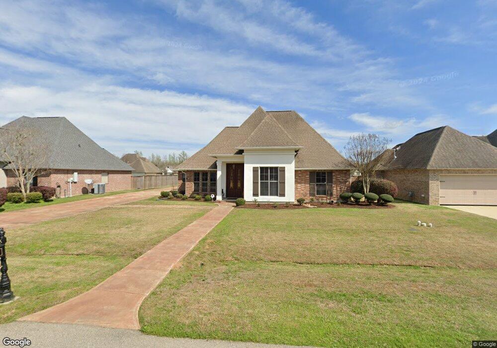
44464 Nicole Dr Hammond, LA 70403
Estimated Value: $242,628 - $295,000
--
Bed
--
Bath
2,133
Sq Ft
$121/Sq Ft
Est. Value
About This Home
This home is located at 44464 Nicole Dr, Hammond, LA 70403 and is currently estimated at $258,407, approximately $121 per square foot. 44464 Nicole Dr is a home located in Tangipahoa Parish with nearby schools including Hammond Westside Montessori, Hammond High Magnet School, and Courtney Christian School Inc.
Ownership History
Date
Name
Owned For
Owner Type
Purchase Details
Closed on
Jul 23, 2009
Sold by
Woodstone Homes & Development Llc
Bought by
Age Louis George
Current Estimated Value
Home Financials for this Owner
Home Financials are based on the most recent Mortgage that was taken out on this home.
Original Mortgage
$206,343
Outstanding Balance
$137,383
Interest Rate
5.71%
Mortgage Type
VA
Estimated Equity
$121,024
Create a Home Valuation Report for This Property
The Home Valuation Report is an in-depth analysis detailing your home's value as well as a comparison with similar homes in the area
Home Values in the Area
Average Home Value in this Area
Purchase History
| Date | Buyer | Sale Price | Title Company |
|---|---|---|---|
| Age Louis George | $202,000 | None Available |
Source: Public Records
Mortgage History
| Date | Status | Borrower | Loan Amount |
|---|---|---|---|
| Open | Age Louis George | $206,343 |
Source: Public Records
Tax History Compared to Growth
Tax History
| Year | Tax Paid | Tax Assessment Tax Assessment Total Assessment is a certain percentage of the fair market value that is determined by local assessors to be the total taxable value of land and additions on the property. | Land | Improvement |
|---|---|---|---|---|
| 2024 | $2,105 | $18,417 | $3,780 | $14,637 |
| 2023 | $2,105 | $18,286 | $3,500 | $14,786 |
| 2022 | $2,105 | $18,286 | $3,500 | $14,786 |
| 2021 | $1,247 | $18,286 | $3,500 | $14,786 |
| 2020 | $2,104 | $18,286 | $3,500 | $14,786 |
| 2019 | $2,099 | $18,286 | $3,500 | $14,786 |
| 2018 | $2,105 | $18,286 | $3,500 | $14,786 |
| 2017 | $2,105 | $18,286 | $3,500 | $14,786 |
| 2016 | $2,105 | $18,286 | $3,500 | $14,786 |
| 2015 | $1,260 | $18,435 | $3,500 | $14,935 |
| 2014 | $1,217 | $18,435 | $3,500 | $14,935 |
Source: Public Records
Map
Nearby Homes
- 11427 Copper Hill Dr
- 44483 Hayley Dr
- 0 Bankston Rd Unit 2024016122
- 0 Bankston Rd
- 11117 Regency Ave
- 11036 Audubon Dr
- 0 Crisp Rd
- 44113 Crisp Rd
- 11139 Old Baton Rouge Hwy
- 10475 Kellie Dr
- 10372 Old Baton Rouge Hwy
- 12173 W Hwy 190 None
- 12173 U S Highway 190
- 45379 Tanglewood Dr
- 44410 Hood Rd
- 12073 Old Baton Rouge Hwy
- 45380 Tanglewood Dr
- 45380 Tanglewood Drive None
- 0 Louisiana 1040
- 43139 N Billville Rd
- 44472 Nicole Dr
- 44456 Nicole Dr
- 11312 Copper Hill Dr
- 44424 Nicole Dr
- 11320 Copper Hill Dr
- 44448 Nicole Dr
- 44480 Nicole Dr
- 11304 Copper Hill Dr
- 44465 Nicole Dr
- 44457 Nicole Dr
- 11328 Copper Hill Dr
- 11296 Copper Hill Dr
- 44473 Nicole Dr
- 44440 Nicole Dr
- 44449 Nicole Dr
- 44486 Nicole Dr
- 11336 Copper Hill Dr
- 44441 Nicole Dr
- 11307 Copper Hill Dr
- 11288 Copper Hill Dr