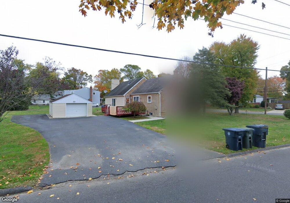
449 Chestnut St Williamstown, NJ 08094
Estimated Value: $274,876 - $371,000
--
Bed
--
Bath
1,465
Sq Ft
$225/Sq Ft
Est. Value
About This Home
This home is located at 449 Chestnut St, Williamstown, NJ 08094 and is currently estimated at $330,219, approximately $225 per square foot. 449 Chestnut St is a home located in Gloucester County with nearby schools including Williamstown High School, St. Mary School, and Finest of the Wheat Christian.
Ownership History
Date
Name
Owned For
Owner Type
Purchase Details
Closed on
Oct 18, 2013
Sold by
Carucci Concetta
Bought by
Carucci Antonio
Current Estimated Value
Purchase Details
Closed on
Feb 19, 2010
Sold by
Carucci Antonio
Bought by
Carucci Concetta
Purchase Details
Closed on
Sep 10, 2009
Sold by
Mason Patrick S
Bought by
Carucci Antonio
Purchase Details
Closed on
Jul 31, 2001
Sold by
Mason Joseph G
Bought by
Mason Patrick S
Purchase Details
Closed on
Jul 8, 1999
Sold by
Mason Patrick S
Bought by
Mason Joseph G
Purchase Details
Closed on
Dec 29, 1997
Sold by
Mason Patrick S
Bought by
Mason Joseph G
Purchase Details
Closed on
Sep 29, 1997
Sold by
Dirienzi Joseph and Dirienzi Deborah E
Bought by
Mason Patrick
Create a Home Valuation Report for This Property
The Home Valuation Report is an in-depth analysis detailing your home's value as well as a comparison with similar homes in the area
Home Values in the Area
Average Home Value in this Area
Purchase History
| Date | Buyer | Sale Price | Title Company |
|---|---|---|---|
| Carucci Antonio | -- | -- | |
| Carucci Concetta | -- | None Available | |
| Carucci Antonio | $125,000 | Foundation Title Llc | |
| Mason Patrick S | -- | -- | |
| Mason Joseph G | -- | -- | |
| Mason Joseph G | -- | -- | |
| Mason Patrick | $120,000 | Freedom Title & Abstract |
Source: Public Records
Tax History Compared to Growth
Tax History
| Year | Tax Paid | Tax Assessment Tax Assessment Total Assessment is a certain percentage of the fair market value that is determined by local assessors to be the total taxable value of land and additions on the property. | Land | Improvement |
|---|---|---|---|---|
| 2025 | $5,878 | $160,500 | $44,100 | $116,400 |
| 2024 | $5,834 | $160,500 | $44,100 | $116,400 |
| 2023 | $5,834 | $160,500 | $44,100 | $116,400 |
| 2022 | $5,807 | $160,500 | $44,100 | $116,400 |
| 2021 | $5,844 | $160,500 | $44,100 | $116,400 |
| 2020 | $5,837 | $160,500 | $44,100 | $116,400 |
| 2019 | $5,802 | $160,500 | $44,100 | $116,400 |
| 2018 | $5,707 | $160,500 | $44,100 | $116,400 |
| 2017 | $5,979 | $168,800 | $50,400 | $118,400 |
| 2016 | $5,903 | $168,800 | $50,400 | $118,400 |
| 2015 | $5,734 | $168,800 | $50,400 | $118,400 |
| 2014 | $5,567 | $168,800 | $50,400 | $118,400 |
Source: Public Records
Map
Nearby Homes
- 30 Tool Ln
- 308 Oak St
- 221 Oak St
- 647 Chestnut St
- 112 Shisler Ave
- 549 Maidstone Dr
- 640 Ironwood Dr
- 18 Bodine Ave
- 632 Clayton Rd
- 520 S Main St
- 354 S Main St
- 934 N Beecham Rd
- 13 S Main St
- 304 Thackeray Ln
- 1017 Micawber Dr
- 1008 London Cir
- 109 Poplar St
- 1361 Black Horse Pike
- 1011 S Beecham Rd
- 943 Sykesville Rd
- 435 Chestnut St
- 435 Sykesville Rd
- 445 Chestnut St
- 425 Sykesville Rd
- 450 Chestnut St
- 445 Sykesville Rd
- 436 Chestnut St
- 417 Sykesville Rd
- 600 Sykesville Rd
- 419 Chestnut St
- 442 Oak St
- 426 Chestnut St
- 411 Sykesville Rd
- 418 Chestnut St
- 404 Chestnut St
- 33 Marion Ave
- 329 Sykesville Rd
- 403 Sykesville Rd
- 840 Rosetree Dr
- 842 Rosetree Dr