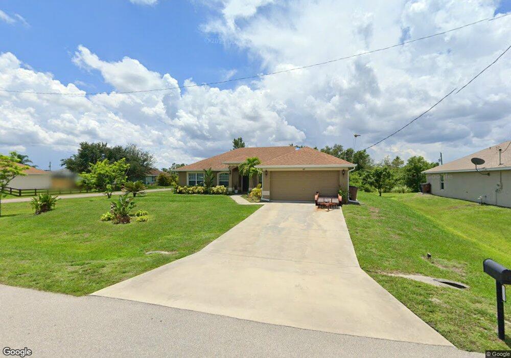
449 Westdale Ave Lehigh Acres, FL 33972
Richmond NeighborhoodEstimated Value: $315,000 - $370,000
3
Beds
2
Baths
1,858
Sq Ft
$188/Sq Ft
Est. Value
About This Home
This home is located at 449 Westdale Ave, Lehigh Acres, FL 33972 and is currently estimated at $348,394, approximately $187 per square foot. 449 Westdale Ave is a home located in Lee County with nearby schools including Lehigh Elementary School, The Alva School, and Gateway Elementary School.
Ownership History
Date
Name
Owned For
Owner Type
Purchase Details
Closed on
Dec 14, 2012
Sold by
Adams Homes Of Northwest Florida Inc
Bought by
Ramos Jesus A Colon
Current Estimated Value
Home Financials for this Owner
Home Financials are based on the most recent Mortgage that was taken out on this home.
Original Mortgage
$103,700
Outstanding Balance
$71,881
Interest Rate
3.38%
Mortgage Type
VA
Estimated Equity
$276,513
Create a Home Valuation Report for This Property
The Home Valuation Report is an in-depth analysis detailing your home's value as well as a comparison with similar homes in the area
Home Values in the Area
Average Home Value in this Area
Purchase History
| Date | Buyer | Sale Price | Title Company |
|---|---|---|---|
| Ramos Jesus A Colon | $103,700 | Jewel Stone Title Insurance |
Source: Public Records
Mortgage History
| Date | Status | Borrower | Loan Amount |
|---|---|---|---|
| Open | Ramos Jesus A Colon | $103,700 |
Source: Public Records
Tax History Compared to Growth
Tax History
| Year | Tax Paid | Tax Assessment Tax Assessment Total Assessment is a certain percentage of the fair market value that is determined by local assessors to be the total taxable value of land and additions on the property. | Land | Improvement |
|---|---|---|---|---|
| 2025 | $1,766 | $122,011 | -- | -- |
| 2024 | $1,766 | $118,572 | -- | -- |
| 2023 | $1,649 | $110,118 | $0 | $0 |
| 2022 | $1,526 | $111,765 | $0 | $0 |
| 2021 | $1,443 | $177,880 | $3,900 | $173,980 |
| 2020 | $1,434 | $107,012 | $0 | $0 |
| 2019 | $1,431 | $104,606 | $0 | $0 |
| 2018 | $1,399 | $102,656 | $0 | $0 |
| 2017 | $1,356 | $100,545 | $0 | $0 |
| 2016 | $1,319 | $121,598 | $3,700 | $117,898 |
| 2015 | $1,311 | $97,792 | $2,640 | $95,152 |
| 2014 | -- | $98,704 | $2,540 | $96,164 |
| 2013 | -- | $77,094 | $2,100 | $74,994 |
Source: Public Records
Map
Nearby Homes
- 441 Thelma Ct
- 507 Willowbrook Dr
- 505 Willowbrook Dr
- 1909 Milstead Ave
- 473 Willowbrook Dr
- 475 Westdale Ave
- 1909 Vesper Ct
- 423 Windermere Dr
- 479 Windermere Dr
- 1928 Vesper Ct
- 1857 Welk St
- 483 Willowbrook Dr
- 421 Yolanda St
- 1870 Valmont St
- 490 Windermere Dr
- 406 Muriel St
- 1917 Holyoke Ave Unit 11
- 1927 Holyoke Ave
- 1850 Valmont St
- 426 Mercedes Ct
- 451 Westdale Ave
- 445 Thelma Ct
- 453 Westdale Ave
- 444 Willowbrook Dr
- 452 Willowbrook Dr
- 455 Westdale Ave
- 444 Thelma Ct
- 442 Willowbrook Dr
- 454 Willowbrook Dr
- 434 Thelma Ct
- 457 Westdale Ave
- 440 Willowbrook Dr
- 451 Willowbrook Dr
- 456 Willowbrook Dr
- 453 Windermere Dr
- 445 Windermere Dr
- 456 Westdale Ave
- 440 Thelma Ct
- 455 Windermere Dr
- 459 Westdale Ave