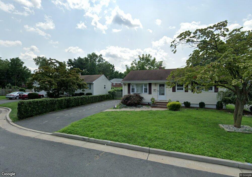
45 Deborah Ct Unit 47 Plainfield, NJ 07062
Estimated Value: $413,248 - $463,000
--
Bed
--
Bath
912
Sq Ft
$480/Sq Ft
Est. Value
About This Home
This home is located at 45 Deborah Ct Unit 47, Plainfield, NJ 07062 and is currently estimated at $438,062, approximately $480 per square foot. 45 Deborah Ct Unit 47 is a home located in Union County with nearby schools including Emerson Community School, Maxson Middle School, and Plainfield High School.
Ownership History
Date
Name
Owned For
Owner Type
Purchase Details
Closed on
Jun 19, 2015
Sold by
Crestar Real Estate Investments Llc
Bought by
Briceno Alfonso R Lopez and Ceda Milagros
Current Estimated Value
Purchase Details
Closed on
Jan 20, 2015
Sold by
Us Bank Cust For Crestar Capital
Bought by
To Crestar Real Estate Investments Llc
Purchase Details
Closed on
Apr 22, 2010
Sold by
Trani Joann and Hepworth Raymond H
Bought by
Hepworth Raymond H
Create a Home Valuation Report for This Property
The Home Valuation Report is an in-depth analysis detailing your home's value as well as a comparison with similar homes in the area
Home Values in the Area
Average Home Value in this Area
Purchase History
| Date | Buyer | Sale Price | Title Company |
|---|---|---|---|
| Briceno Alfonso R Lopez | $65,000 | Attorney | |
| To Crestar Real Estate Investments Llc | -- | None Available | |
| Hepworth Raymond H | -- | None Available |
Source: Public Records
Tax History Compared to Growth
Tax History
| Year | Tax Paid | Tax Assessment Tax Assessment Total Assessment is a certain percentage of the fair market value that is determined by local assessors to be the total taxable value of land and additions on the property. | Land | Improvement |
|---|---|---|---|---|
| 2025 | $8,191 | $93,800 | $36,800 | $57,000 |
| 2024 | $8,110 | $93,800 | $36,800 | $57,000 |
| 2023 | $8,110 | $93,800 | $36,800 | $57,000 |
| 2022 | $7,935 | $93,800 | $36,800 | $57,000 |
| 2021 | $7,865 | $93,800 | $36,800 | $57,000 |
| 2020 | $7,843 | $93,800 | $36,800 | $57,000 |
| 2019 | $7,843 | $93,800 | $36,800 | $57,000 |
| 2018 | $7,678 | $93,800 | $36,800 | $57,000 |
| 2017 | $7,491 | $93,800 | $36,800 | $57,000 |
| 2016 | $7,338 | $93,800 | $36,800 | $57,000 |
| 2015 | $7,121 | $93,800 | $36,800 | $57,000 |
| 2014 | -- | $93,800 | $36,800 | $57,000 |
Source: Public Records
Map
Nearby Homes
- 11 Raymond Ave Unit 13
- 1243 E Front St Unit 49
- 58 Raymond Ave
- 56-58 Raymond Ave
- 1254 E Front St
- 116 Sumner Ave Unit 18
- 104 Graybar Dr
- 93 Raymond Ave
- 99 Raymond Ave
- 125 Leland Ave Unit 27
- 14-16 Netherwood Ave
- 153-55 Leland Ave
- 1003 E Front St Unit A
- 1206 E 2nd St Unit 8
- 225 Sumner Ave Unit 27
- 949 E Front St
- 949 E Front St Unit A
- 1368 E 2nd St
- 190 Carlisle Terrace Unit 94
- 935 E Front St Unit C
- 45-47 Deborah Ct
- 49 Deborah Ct Unit 51
- 41 Deborah Ct Unit 43
- 53 Deborah Ct Unit 55
- 46 Deborah Ct Unit 48
- 39 Deborah Ct
- 50 Deborah Ct Unit 52
- 42 Deborah Ct Unit 44
- 40 Deborah Ct
- 57 Deborah Ct Unit 59
- 54 Deborah Ct Unit 56
- 58 Deborah Ct Unit 60
- 31 Raymond Ave Unit 37
- 27 Raymond Ave Unit 29
- 62 Deborah Ct Unit 64
- 23 Raymond Ave Unit 25
- 65 Deborah Ct Unit 67
- 19 Raymond Ave Unit 21
- 1251 E Front St Unit 61
- 47 Raymond Ave Unit 49