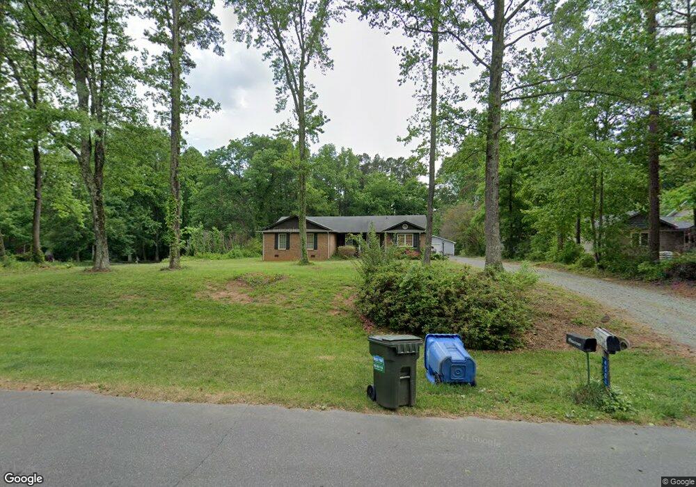
4501 Chuckwood Dr Mint Hill, NC 28227
Estimated Value: $449,599 - $534,000
4
Beds
2
Baths
2,174
Sq Ft
$220/Sq Ft
Est. Value
About This Home
This home is located at 4501 Chuckwood Dr, Mint Hill, NC 28227 and is currently estimated at $477,650, approximately $219 per square foot. 4501 Chuckwood Dr is a home located in Mecklenburg County with nearby schools including Bain Elementary, Mint Hill Middle School, and Independence High.
Ownership History
Date
Name
Owned For
Owner Type
Purchase Details
Closed on
Apr 3, 2007
Sold by
Jamison Ronald Price and Jamison Patricia F
Bought by
Harrison Ii Paul Bernard and Harrison Cheri F
Current Estimated Value
Home Financials for this Owner
Home Financials are based on the most recent Mortgage that was taken out on this home.
Original Mortgage
$198,000
Outstanding Balance
$119,913
Interest Rate
6.18%
Mortgage Type
Purchase Money Mortgage
Estimated Equity
$357,737
Create a Home Valuation Report for This Property
The Home Valuation Report is an in-depth analysis detailing your home's value as well as a comparison with similar homes in the area
Home Values in the Area
Average Home Value in this Area
Purchase History
| Date | Buyer | Sale Price | Title Company |
|---|---|---|---|
| Harrison Ii Paul Bernard | $198,000 | None Available |
Source: Public Records
Mortgage History
| Date | Status | Borrower | Loan Amount |
|---|---|---|---|
| Open | Harrison Ii Paul Bernard | $198,000 |
Source: Public Records
Tax History Compared to Growth
Tax History
| Year | Tax Paid | Tax Assessment Tax Assessment Total Assessment is a certain percentage of the fair market value that is determined by local assessors to be the total taxable value of land and additions on the property. | Land | Improvement |
|---|---|---|---|---|
| 2025 | $2,890 | $401,200 | $99,000 | $302,200 |
| 2024 | $2,890 | $401,200 | $99,000 | $302,200 |
| 2023 | $2,845 | $401,200 | $99,000 | $302,200 |
| 2022 | $2,273 | $256,200 | $66,000 | $190,200 |
| 2021 | $2,273 | $256,200 | $66,000 | $190,200 |
| 2020 | $2,273 | $256,200 | $66,000 | $190,200 |
| 2019 | $2,267 | $256,200 | $66,000 | $190,200 |
| 2018 | $1,956 | $176,400 | $36,000 | $140,400 |
| 2017 | $1,939 | $176,400 | $36,000 | $140,400 |
| 2016 | $1,936 | $176,400 | $36,000 | $140,400 |
| 2015 | $1,932 | $176,400 | $36,000 | $140,400 |
| 2014 | $1,930 | $176,400 | $36,000 | $140,400 |
Source: Public Records
Map
Nearby Homes
- 4401 Quail Ridge Dr
- 4027 Mintwood Dr
- 5918 Foxcrest Dr
- 4500 Matthews Mint Hill Rd
- 6525 Robin Hollow Dr
- 13105 Odell Heights Dr
- 3985 Well Rd
- 11632 Barnard St
- 5344 Saddlewood Ln
- 5420 Saddlewood Ln
- 7113 Short Stirrup Ln
- 11401 Home Place Ln
- 8233 Franklin Trail St
- 8237 Franklin Trail St
- 3728 Piaffe Ave
- 8245 Franklin Trail St
- 2141 Moss Bluff Dr
- 7023 Short Stirrup Ln
- 7019 Short Stirrup Ln
- 8234 Franklin Trail St
- 4511 Chuckwood Dr
- 4423 Chuckwood Dr
- 4521 Chuckwood Dr
- 4502 Quail Ridge Dr
- 4502 Quail Ridge Dr Unit 57g
- 4512 Quail Ridge Dr
- 4411 Chuckwood Dr
- 4500 Chuckwood Dr
- 4510 Chuckwood Dr
- 4522 Quail Ridge Dr
- 4422 Quail Ridge Dr
- 4424 Chuckwood Dr
- 4531 Chuckwood Dr
- 4401 Chuckwood Dr
- 4532 Quail Ridge Dr
- 4412 Quail Ridge Dr
- 4412 Chuckwood Dr
- 4534 Chuckwood Dr
- 4541 Chuckwood Dr
- 4400 Quail Ridge Dr