Estimated Value: $254,547 - $404,000
--
Bed
2
Baths
1,520
Sq Ft
$197/Sq Ft
Est. Value
About This Home
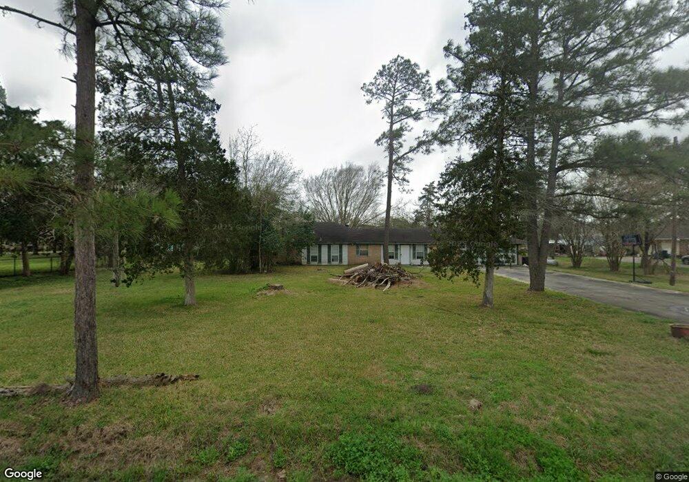
This home is located at 451 County Road 545, Alvin, TX 77511 and is currently estimated at $299,137, approximately $196 per square foot. 451 County Road 545 is a home located in Brazoria County with nearby schools including G.W. Harby Junior High School, Alvin High School, and Living Stones Christian School.
Ownership History
Date
Name
Owned For
Owner Type
Purchase Details
Closed on
Jul 6, 2018
Sold by
Browder Theodore H
Bought by
Browder Kathleen
Current Estimated Value
Purchase Details
Closed on
Oct 14, 2005
Sold by
Burton Phillip D
Bought by
Molley Kathleen
Purchase Details
Closed on
Aug 26, 2005
Sold by
Burton Phillip D
Bought by
Molley Kathleen
Purchase Details
Closed on
Apr 10, 2002
Sold by
Burton Kathleen and Huff Kathleen Molley
Bought by
Burton Phillip and Burton Kathleen
Home Financials for this Owner
Home Financials are based on the most recent Mortgage that was taken out on this home.
Original Mortgage
$63,440
Interest Rate
6.83%
Mortgage Type
Credit Line Revolving
Create a Home Valuation Report for This Property
The Home Valuation Report is an in-depth analysis detailing your home's value as well as a comparison with similar homes in the area
Home Values in the Area
Average Home Value in this Area
Purchase History
| Date | Buyer | Sale Price | Title Company |
|---|---|---|---|
| Browder Kathleen | -- | None Available | |
| Molley Kathleen | -- | -- | |
| Molley Kathleen | -- | -- | |
| Burton Phillip | -- | -- |
Source: Public Records
Mortgage History
| Date | Status | Borrower | Loan Amount |
|---|---|---|---|
| Previous Owner | Burton Phillip | $63,440 |
Source: Public Records
Tax History Compared to Growth
Tax History
| Year | Tax Paid | Tax Assessment Tax Assessment Total Assessment is a certain percentage of the fair market value that is determined by local assessors to be the total taxable value of land and additions on the property. | Land | Improvement |
|---|---|---|---|---|
| 2025 | $4,934 | $260,520 | $52,660 | $207,860 |
| 2023 | $4,934 | $250,000 | $63,190 | $186,810 |
| 2022 | $3,803 | $178,470 | $55,290 | $123,180 |
| 2021 | $3,319 | $149,590 | $51,350 | $98,240 |
| 2020 | $3,162 | $140,600 | $47,400 | $93,200 |
| 2019 | $3,518 | $151,960 | $39,500 | $112,460 |
| 2018 | $3,625 | $156,200 | $47,400 | $108,800 |
| 2017 | $3,819 | $162,550 | $45,420 | $117,130 |
| 2016 | $2,608 | $111,000 | $28,460 | $82,540 |
| 2015 | $2,507 | $108,000 | $23,710 | $84,290 |
| 2014 | $2,507 | $105,910 | $23,710 | $82,200 |
Source: Public Records
Map
Nearby Homes
- 860 Farm To Market Road 517
- 609 County Road 351 Beers
- 2702 Silver Maple Dr
- 1176 Fm 517 Rd
- 1483 E Highway 6
- 691 County Road 351
- 3373 E Highway 6
- 2002 E Highway 6
- 3150 E Highway 6
- 2112 Washington Ave
- 3610 E Highway 6
- 2126 County Road 367
- 1300 Dickinson Rd
- 1018 Bluegill Ln
- 1021 Bluegill Dr
- 1016 Bluegill Dr
- 1024 Bluegill Ln
- Estero Plan at Watermark
- Franklin Plan at Watermark
- Barton Plan at Watermark
- 473 County Road 545
- 468 County Road 545
- 467 County Road 545
- 447 County Road 545
- 1005 Fm 517 Rd
- 1013 Fm 517 Rd
- 1029 Fm 517 Rd
- 522 County Road 351
- 448 County Road 142
- 1006 Fm 517 Rd Unit H
- 1006 Fm 517 Rd Unit F
- 1006 Fm 517 Rd
- 436 County Road 545
- 456 County Road 142
- 415 County Road 545
- 486 County Road 142
- 524 County Road 351
- 412 County Road 545
- 1030 Fm 517 Rd
- 535 County Road 351