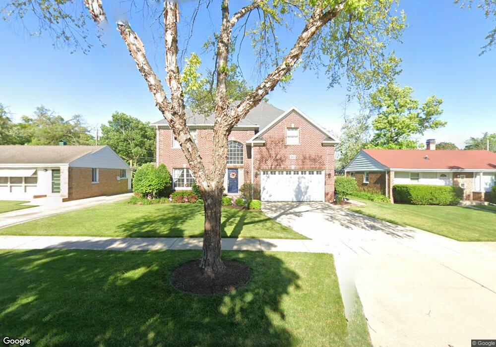
451 N Walnut St Elmhurst, IL 60126
Estimated Value: $1,115,000 - $1,189,000
4
Beds
3
Baths
3,366
Sq Ft
$343/Sq Ft
Est. Value
About This Home
This home is located at 451 N Walnut St, Elmhurst, IL 60126 and is currently estimated at $1,156,183, approximately $343 per square foot. 451 N Walnut St is a home located in DuPage County with nearby schools including Emerson Elementary School, Churchville Middle School, and York Community High School.
Ownership History
Date
Name
Owned For
Owner Type
Purchase Details
Closed on
Sep 11, 2022
Sold by
Reedy Leo P and Reedy Adeline P
Bought by
L & A Reedy Family Limited Partnership
Current Estimated Value
Purchase Details
Closed on
Sep 22, 2008
Sold by
Magas Ellen and Papadimitriou Michael
Bought by
Magas Ellen and Papadimitriou Michael
Purchase Details
Closed on
Apr 21, 2008
Sold by
North Star Trust Co
Bought by
Magas Ellen
Home Financials for this Owner
Home Financials are based on the most recent Mortgage that was taken out on this home.
Original Mortgage
$556,000
Interest Rate
5.5%
Mortgage Type
Purchase Money Mortgage
Purchase Details
Closed on
Jun 7, 2004
Sold by
L & A Reedy Family Lp
Bought by
National Bank Of Commerce and Trust #9913
Purchase Details
Closed on
Sep 4, 2003
Sold by
Reedy Leo P
Bought by
L & A Reedy Family Lp
Home Financials for this Owner
Home Financials are based on the most recent Mortgage that was taken out on this home.
Original Mortgage
$168,000
Interest Rate
5.3%
Mortgage Type
Purchase Money Mortgage
Purchase Details
Closed on
Jul 23, 2003
Sold by
L & A Reedy Family Limited Partnership
Bought by
Reedy Leo P
Home Financials for this Owner
Home Financials are based on the most recent Mortgage that was taken out on this home.
Original Mortgage
$168,000
Interest Rate
5.3%
Mortgage Type
Purchase Money Mortgage
Purchase Details
Closed on
Sep 18, 2002
Sold by
Reedy Leo P
Bought by
L & A Reedy Family Ltd Partnership
Purchase Details
Closed on
Nov 16, 1999
Sold by
Reedy Leo P
Bought by
Reedy Leo P and Leo P Reedy Trust
Home Financials for this Owner
Home Financials are based on the most recent Mortgage that was taken out on this home.
Original Mortgage
$116,000
Interest Rate
8.5%
Purchase Details
Closed on
Nov 1, 1999
Sold by
Old Kent Bank
Bought by
Reedy Leo P
Home Financials for this Owner
Home Financials are based on the most recent Mortgage that was taken out on this home.
Original Mortgage
$116,000
Interest Rate
8.5%
Purchase Details
Closed on
Jan 7, 1998
Sold by
Bretz Dorothy W
Bought by
Old Kent Bank and Dorothy Bretz Living Trust
Create a Home Valuation Report for This Property
The Home Valuation Report is an in-depth analysis detailing your home's value as well as a comparison with similar homes in the area
Home Values in the Area
Average Home Value in this Area
Purchase History
| Date | Buyer | Sale Price | Title Company |
|---|---|---|---|
| L & A Reedy Family Limited Partnership | -- | -- | |
| Magas Ellen | -- | Chicago Title Insurance Co | |
| Magas Ellen | $695,000 | Git | |
| National Bank Of Commerce | $285,000 | Ctic | |
| L & A Reedy Family Lp | -- | -- | |
| Reedy Leo P | -- | 1St American Title | |
| L & A Reedy Family Ltd Partnership | -- | -- | |
| Reedy Leo P | -- | -- | |
| Reedy Leo P | $145,000 | -- | |
| Old Kent Bank | -- | -- |
Source: Public Records
Mortgage History
| Date | Status | Borrower | Loan Amount |
|---|---|---|---|
| Previous Owner | Magas Ellen | $556,000 | |
| Previous Owner | Reedy Leo P | $168,000 | |
| Previous Owner | Reedy Leo P | $116,000 |
Source: Public Records
Tax History Compared to Growth
Tax History
| Year | Tax Paid | Tax Assessment Tax Assessment Total Assessment is a certain percentage of the fair market value that is determined by local assessors to be the total taxable value of land and additions on the property. | Land | Improvement |
|---|---|---|---|---|
| 2024 | $17,836 | $299,243 | $70,816 | $228,427 |
| 2023 | $16,484 | $275,090 | $65,100 | $209,990 |
| 2022 | $16,194 | $270,360 | $62,300 | $208,060 |
| 2021 | $15,515 | $258,960 | $59,670 | $199,290 |
| 2020 | $14,611 | $248,040 | $57,150 | $190,890 |
| 2019 | $14,475 | $238,500 | $54,950 | $183,550 |
| 2018 | $13,724 | $225,130 | $52,340 | $172,790 |
| 2017 | $13,471 | $215,160 | $50,020 | $165,140 |
| 2016 | $12,930 | $198,650 | $46,180 | $152,470 |
| 2015 | $12,704 | $183,510 | $42,660 | $140,850 |
| 2014 | $12,203 | $162,730 | $35,200 | $127,530 |
| 2013 | $12,145 | $166,050 | $35,920 | $130,130 |
Source: Public Records
Map
Nearby Homes
- 251 W Armitage Ave
- 456 N Elm Ave
- 442 N Oak St
- 468 N Highland Ave
- 412 N Ridgeland Ave
- 322 N Highland Ave
- 407 W North Ave
- 284 N Highland Ave
- 285 N Ridgeland Ave
- 262 N Addison Ave
- 260 N Addison Ave
- 258 N Addison Ave
- 254 N Addison Ave
- 196 N Walnut St
- 193 N Elm Ave
- 634 N Kenilworth Ave
- 656 W Comstock Ave
- 210 N Addison Ave Unit 202
- 655 W Comstock Ave
- 183 E Grantley Ave
- 455 N Walnut St
- 447 N Walnut St
- 459 N Walnut St
- 476 N Myrtle Ave
- 465 N Walnut St
- 452 N Walnut St
- 456 N Walnut St
- 448 N Walnut St
- 439 N Walnut St
- 468 N Myrtle Ave
- 483 N Myrtle Ave
- 487 N Myrtle Ave
- 460 N Walnut St
- 444 N Walnut St
- 477 N Myrtle Ave
- 466 N Walnut St
- 435 N Walnut St
- 469 N Walnut St
- 298 W Armitage Ave
- 464 N Myrtle Ave