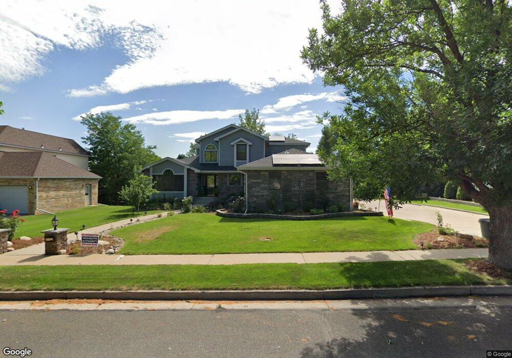
452 N Wyndham Ave Greeley, CO 80634
Estimated Value: $667,414 - $850,000
3
Beds
6
Baths
3,212
Sq Ft
$236/Sq Ft
Est. Value
About This Home
This home is located at 452 N Wyndham Ave, Greeley, CO 80634 and is currently estimated at $759,104, approximately $236 per square foot. 452 N Wyndham Ave is a home located in Weld County with nearby schools including Winograd K-8 Elementary School, Northridge High School, and West Ridge Academy Charter.
Ownership History
Date
Name
Owned For
Owner Type
Purchase Details
Closed on
Jun 19, 1992
Sold by
Keberlein Tom
Bought by
Andre Paul L and Andre Karen M
Current Estimated Value
Purchase Details
Closed on
Jan 29, 1992
Purchase Details
Closed on
Dec 13, 1991
Sold by
Tech Center Properties
Bought by
Andre Paul L and Andre Karen M
Purchase Details
Closed on
Aug 30, 1990
Create a Home Valuation Report for This Property
The Home Valuation Report is an in-depth analysis detailing your home's value as well as a comparison with similar homes in the area
Home Values in the Area
Average Home Value in this Area
Purchase History
| Date | Buyer | Sale Price | Title Company |
|---|---|---|---|
| Andre Paul L | $156,200 | -- | |
| -- | -- | -- | |
| Andre Paul L | $26,000 | -- | |
| -- | -- | -- |
Source: Public Records
Tax History Compared to Growth
Tax History
| Year | Tax Paid | Tax Assessment Tax Assessment Total Assessment is a certain percentage of the fair market value that is determined by local assessors to be the total taxable value of land and additions on the property. | Land | Improvement |
|---|---|---|---|---|
| 2025 | $2,938 | $41,500 | $5,630 | $35,870 |
| 2024 | $2,938 | $41,500 | $5,630 | $35,870 |
| 2023 | $2,803 | $45,310 | $6,090 | $39,220 |
| 2022 | $2,250 | $32,640 | $4,870 | $27,770 |
| 2021 | $2,321 | $33,580 | $5,010 | $28,570 |
| 2020 | $2,281 | $33,180 | $3,930 | $29,250 |
| 2019 | $2,287 | $33,180 | $3,930 | $29,250 |
| 2018 | $1,980 | $30,990 | $3,670 | $27,320 |
| 2017 | $1,991 | $30,990 | $3,670 | $27,320 |
| 2016 | $1,063 | $22,260 | $3,820 | $18,440 |
| 2015 | $1,059 | $22,260 | $3,820 | $18,440 |
| 2014 | $1,012 | $21,280 | $3,820 | $17,460 |
Source: Public Records
Map
Nearby Homes
- 419 N Brisbane Ave
- 7141 W Canberra St
- 7200 W Canberra Street Dr
- 608 Riverside Ct
- 6911 W 3rd St Unit 920
- 6911 W 3rd St Unit 810
- 525 Sage Ave
- 117 N 66th Ave
- 317 N 64th Ave
- 6603 W 3rd St Unit 1620
- BRIDGEPORT Plan at Northridge Estates
- 6618 2nd St
- HENNESSY Plan at Northridge Estates
- HENLEY Plan at Northridge Estates
- 6806 W 3rd St Unit 38
- 6614 2nd St
- 102 65th Ave
- 106 65th Ave
- 6608 W 3rd St Unit 69
- 6608 W 3rd St Unit 35-58
- 460 N Wyndham Ave
- 444 N Wyndham Ave
- 451 N Brisbane Ave
- 443 N Brisbane Ave
- 459 N Brisbane Ave
- 468 N Wyndham Ave
- 449 N Wyndham Ave
- 436 N Wyndham Ave
- 457 N Wyndham Ave
- 467 N Brisbane Ave
- 435 N Brisbane Ave
- 441 N Wyndham Ave
- 465 N Wyndham Ave
- 473 N Wyndham Ave
- 433 N Wyndham Ave
- 427 N Brisbane Ave
- 442 N Brisbane Ave
- 450 N Brisbane Ave
- 428 N Wyndham Ave
- 434 N Brisbane Ave