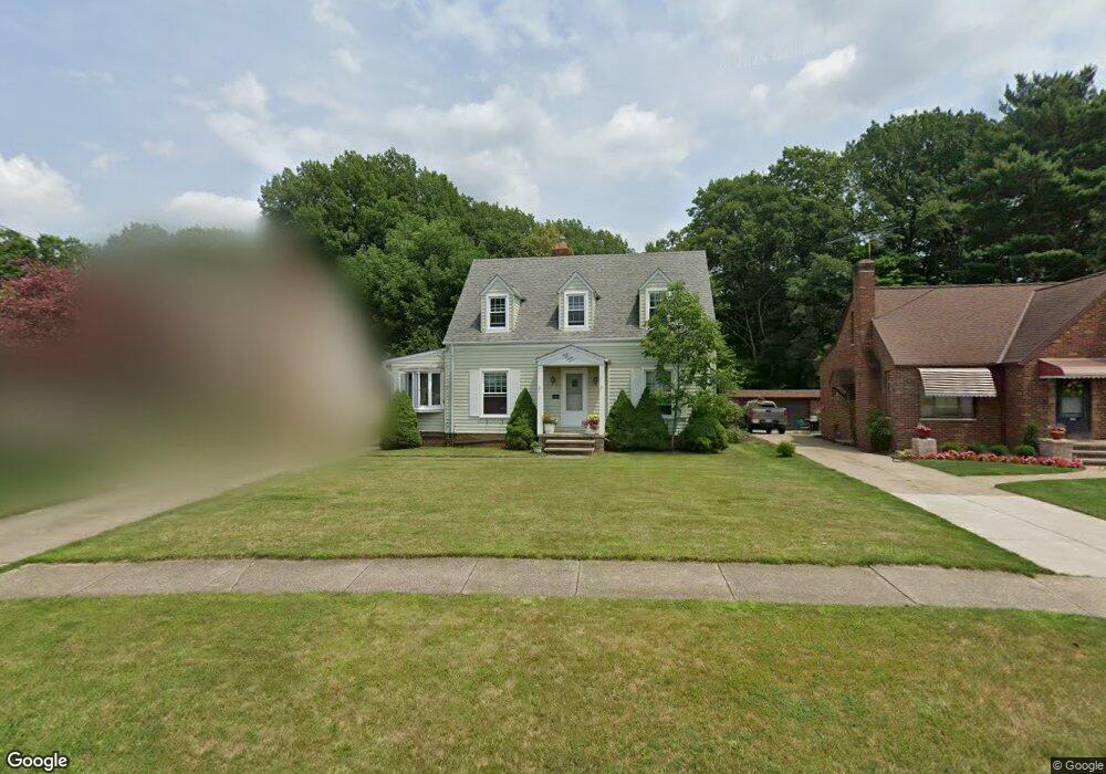
4527 Angela Dr Cleveland, OH 44126
Estimated Value: $259,000 - $300,000
4
Beds
3
Baths
1,419
Sq Ft
$197/Sq Ft
Est. Value
About This Home
This home is located at 4527 Angela Dr, Cleveland, OH 44126 and is currently estimated at $279,187, approximately $196 per square foot. 4527 Angela Dr is a home located in Cuyahoga County with nearby schools including Gilles-Sweet Elementary School, Lewis F Mayer Middle School, and Fairview High School.
Ownership History
Date
Name
Owned For
Owner Type
Purchase Details
Closed on
Jul 15, 2025
Sold by
Salim Sam
Bought by
Sam F Salim Trust and Salim
Current Estimated Value
Purchase Details
Closed on
Sep 30, 2008
Sold by
Us Bank Na
Bought by
Salim Sam
Purchase Details
Closed on
Apr 27, 2007
Sold by
Weir Linda L
Bought by
Wachovia Bank Na and Asset Backed Pass Through Certificates S
Purchase Details
Closed on
Dec 29, 2003
Sold by
Weir Paul D
Bought by
Weir Linda L
Purchase Details
Closed on
Apr 12, 1985
Sold by
Weir Paul D and Weir Linda L
Bought by
Weir Paul D and Weir Linda L
Purchase Details
Closed on
Feb 4, 1985
Sold by
Laughlin Ray
Bought by
Weir Paul D and Weir Linda L
Purchase Details
Closed on
Jan 31, 1984
Sold by
Laughlin Ray and Laughlin Helen
Bought by
Laughlin Ray
Purchase Details
Closed on
Jan 1, 1975
Bought by
Laughlin Ray and Laughlin Helen
Create a Home Valuation Report for This Property
The Home Valuation Report is an in-depth analysis detailing your home's value as well as a comparison with similar homes in the area
Home Values in the Area
Average Home Value in this Area
Purchase History
| Date | Buyer | Sale Price | Title Company |
|---|---|---|---|
| Sam F Salim Trust | -- | Simplifile (Recording Service) | |
| Salim Sam | $87,000 | Prism Title & Closing Servic | |
| Wachovia Bank Na | $135,000 | Attorney | |
| Weir Linda L | -- | -- | |
| Weir Paul D | -- | -- | |
| Weir Paul D | -- | -- | |
| Laughlin Ray | -- | -- | |
| Laughlin Ray | -- | -- |
Source: Public Records
Tax History Compared to Growth
Tax History
| Year | Tax Paid | Tax Assessment Tax Assessment Total Assessment is a certain percentage of the fair market value that is determined by local assessors to be the total taxable value of land and additions on the property. | Land | Improvement |
|---|---|---|---|---|
| 2024 | $5,370 | $77,840 | $19,005 | $58,835 |
| 2023 | $4,769 | $59,050 | $15,580 | $43,470 |
| 2022 | $4,651 | $59,050 | $15,580 | $43,470 |
| 2021 | $4,746 | $59,050 | $15,580 | $43,470 |
| 2020 | $4,368 | $47,640 | $12,570 | $35,070 |
| 2019 | $3,885 | $136,100 | $35,900 | $100,200 |
| 2018 | $3,652 | $47,640 | $12,570 | $35,070 |
| 2017 | $3,565 | $39,340 | $11,900 | $27,440 |
| 2016 | $3,542 | $39,340 | $11,900 | $27,440 |
| 2015 | $3,359 | $39,340 | $11,900 | $27,440 |
| 2014 | $3,359 | $37,450 | $11,340 | $26,110 |
Source: Public Records
Map
Nearby Homes
- 4243 W 212th St
- 21143 Westwood Rd
- 4291 W 215th St
- 21237 Westwood Rd
- 4298 W 215th St
- 21503 Hillsdale Ave
- 20187 Grannis Rd
- 20778 Woodstock Ave
- 21236 Northwood Ave
- 20688 Belvidere Ave
- 4036 W 219th St
- 4140 W 220th St
- 4291 W 197th St
- 4235 W 222nd St
- 3826 W 210th St
- 21888 Eaton Rd
- 20930 Mastick Rd
- 4336 W 196th St
- 3712 Addington Ct
- 3733 River Ln
- 4519 Angela Dr
- 4535 Angela Dr
- 4511 Angela Dr
- 4543 Angela Dr
- 4503 Angela Dr
- 4495 Angela Dr
- 4551 Angela Dr
- 4522 Angela Dr
- 4530 Angela Dr
- 4559 Angela Dr
- 4514 Angela Dr
- 4487 Angela Dr
- 4504 Angela Dr
- 4567 Angela Dr
- 4479 Angela Dr
- 4496 Angela Dr
- 4582 Angela Dr
- 4470 Angela Dr
- 4575 Angela Dr
- 20933 Parklane Dr