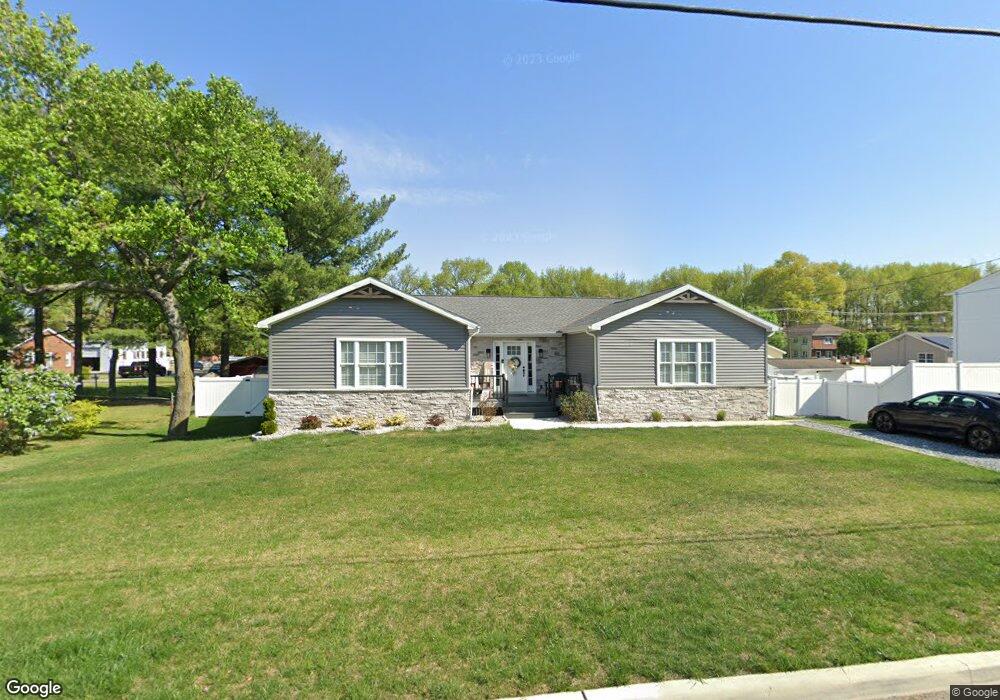
453 Lock Ave Gibbstown, NJ 08027
Greenwich Township NeighborhoodEstimated Value: $365,818 - $403,000
--
Bed
--
Bath
2,032
Sq Ft
$190/Sq Ft
Est. Value
About This Home
This home is located at 453 Lock Ave, Gibbstown, NJ 08027 and is currently estimated at $385,955, approximately $189 per square foot. 453 Lock Ave is a home with nearby schools including Nehaunsey Middle School and Guardian Angels Regional School.
Ownership History
Date
Name
Owned For
Owner Type
Purchase Details
Closed on
Mar 30, 2021
Sold by
Cama Sdira Llc
Bought by
Rotoli Edmond P and Rotoli Gina
Current Estimated Value
Home Financials for this Owner
Home Financials are based on the most recent Mortgage that was taken out on this home.
Original Mortgage
$110,000
Outstanding Balance
$81,449
Interest Rate
2.3%
Mortgage Type
New Conventional
Estimated Equity
$304,506
Purchase Details
Closed on
Jun 30, 2020
Sold by
Shannon James L and Hanna Lynda M
Bought by
Cama Sdira Llc
Purchase Details
Closed on
Jul 17, 2019
Sold by
Hanna Lynda M
Bought by
Shannon James L and Hanna Lynda M
Create a Home Valuation Report for This Property
The Home Valuation Report is an in-depth analysis detailing your home's value as well as a comparison with similar homes in the area
Home Values in the Area
Average Home Value in this Area
Purchase History
| Date | Buyer | Sale Price | Title Company |
|---|---|---|---|
| Rotoli Edmond P | $260,000 | Homestead Title Agency Inc | |
| Rotoli Edmond P | $260,000 | Homestead Title Agency Inc | |
| Rotoli Edmond P | $260,000 | Homestead Title | |
| Cama Sdira Llc | $25,000 | Homestead Title Agency Inc | |
| Shannon James L | -- | None Available |
Source: Public Records
Mortgage History
| Date | Status | Borrower | Loan Amount |
|---|---|---|---|
| Open | Rotoli Edmond P | $110,000 | |
| Closed | Rotoli Edmond P | $110,000 |
Source: Public Records
Tax History Compared to Growth
Tax History
| Year | Tax Paid | Tax Assessment Tax Assessment Total Assessment is a certain percentage of the fair market value that is determined by local assessors to be the total taxable value of land and additions on the property. | Land | Improvement |
|---|---|---|---|---|
| 2025 | $7,733 | $224,600 | $34,400 | $190,200 |
| 2024 | $7,326 | $224,600 | $34,400 | $190,200 |
| 2023 | $7,326 | $224,600 | $34,400 | $190,200 |
| 2022 | $7,331 | $224,600 | $34,400 | $190,200 |
| 2021 | $5,206 | $34,400 | $34,400 | $0 |
| 2020 | $1,127 | $34,400 | $34,400 | $0 |
Source: Public Records
Map
Nearby Homes
- 836 E Broad St
- 330 Croce Ave
- 219 Vanneman Blvd
- 344 W Washington St
- 335 W Buck St
- L18 20 W Broad St
- 255 Elizabeth Ave
- 269 W Broad St
- 1043 Penn Line Rd
- 227 W Buck St
- 1214 Walter Ave
- 1224 Heddon Ave
- 0 Swedesboro Ave Unit NJGL2061592
- 0 S Democrat Rd Unit NJGL2065008
- 140 142 W Jefferson St
- 122 W Washington St
- 1534 Pine St
- 1519 Pine St
- 53-55 Roosevelt St
- 46 Roosevelt St