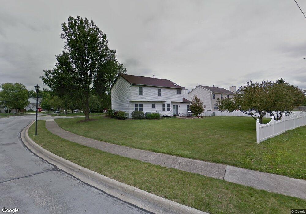
454 Burns Dr N Westerville, OH 43082
Genoa NeighborhoodEstimated Value: $440,000 - $469,000
4
Beds
3
Baths
2,264
Sq Ft
$199/Sq Ft
Est. Value
About This Home
This home is located at 454 Burns Dr N, Westerville, OH 43082 and is currently estimated at $451,143, approximately $199 per square foot. 454 Burns Dr N is a home located in Delaware County with nearby schools including Robert Frost Elementary School, Heritage Middle School, and Westerville-North High School.
Ownership History
Date
Name
Owned For
Owner Type
Purchase Details
Closed on
Apr 10, 1995
Sold by
Bayati Mohammed
Bought by
Lehman William J and Lehman Mary E
Current Estimated Value
Home Financials for this Owner
Home Financials are based on the most recent Mortgage that was taken out on this home.
Original Mortgage
$136,000
Interest Rate
9%
Mortgage Type
VA
Create a Home Valuation Report for This Property
The Home Valuation Report is an in-depth analysis detailing your home's value as well as a comparison with similar homes in the area
Home Values in the Area
Average Home Value in this Area
Purchase History
| Date | Buyer | Sale Price | Title Company |
|---|---|---|---|
| Lehman William J | $144,000 | -- |
Source: Public Records
Mortgage History
| Date | Status | Borrower | Loan Amount |
|---|---|---|---|
| Closed | Lehman William J | $136,000 |
Source: Public Records
Tax History Compared to Growth
Tax History
| Year | Tax Paid | Tax Assessment Tax Assessment Total Assessment is a certain percentage of the fair market value that is determined by local assessors to be the total taxable value of land and additions on the property. | Land | Improvement |
|---|---|---|---|---|
| 2024 | $6,175 | $121,210 | $23,520 | $97,690 |
| 2023 | $6,105 | $121,210 | $23,520 | $97,690 |
| 2022 | $5,284 | $81,170 | $16,100 | $65,070 |
| 2021 | $5,329 | $81,170 | $16,100 | $65,070 |
| 2020 | $5,365 | $81,170 | $16,100 | $65,070 |
| 2019 | $4,628 | $66,890 | $14,000 | $52,890 |
| 2018 | $4,550 | $66,890 | $14,000 | $52,890 |
| 2017 | $4,439 | $61,470 | $10,190 | $51,280 |
| 2016 | $4,562 | $61,470 | $10,190 | $51,280 |
| 2015 | $4,364 | $61,470 | $10,190 | $51,280 |
| 2014 | $4,407 | $61,470 | $10,190 | $51,280 |
| 2013 | $4,200 | $58,560 | $10,190 | $48,370 |
Source: Public Records
Map
Nearby Homes
- 718 Sugar Ct
- 656 Olde Mill Dr
- 547 County Line Rd
- 672 Stonefield Dr
- 754 Kingsmead Rd Unit 18754
- 267 Windemere Place
- 175 Nottingham Ct
- 223 Dogwood Ln
- 150 Matthew Ave
- 348 Buck Run Trail
- 912 Lakeway Ct E
- 137 Abbeycross Ln
- 589 E College Ave
- 974 Lakeland Dr
- 368 E College Ave
- 364 E College Ave
- 129 Abbeycross Ln Unit 129
- 114 Canterbrick Dr
- 705 N State St Unit 211
- 66 Abbeycross Ln
- 462 Burns Dr N
- 438 Chestnut Ave
- 470 Burns Dr N
- 572 Legacy Dr
- 465 Burns Dr N
- 434 Burns Dr N
- 452 Chestnut Ave
- 605 Big Rock Dr
- 577 Legacy Dr
- 478 Burns Dr N
- 483 Chestnut Ave
- 560 Legacy Dr
- 473 Burns Dr N
- 429 Burns Dr N
- 428 Burns Dr N
- 472 Chestnut Ave
- 569 Legacy Dr
- 490 Burns Dr N
- 527 Grist Run Rd
- 537 Grist Run Rd