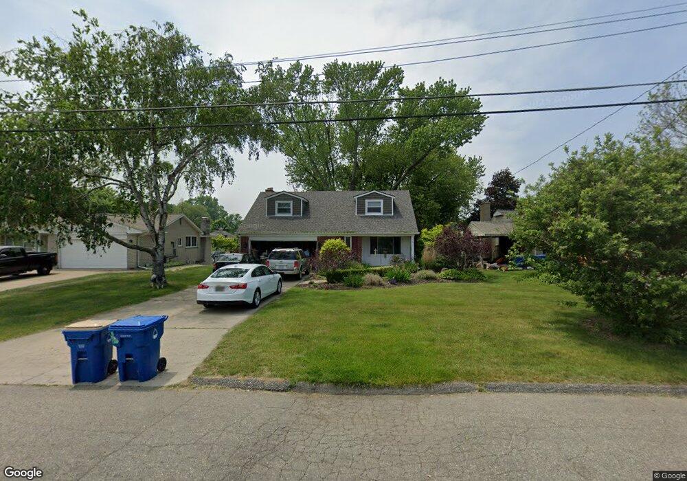
458 Beverly Island Dr Waterford, MI 48328
Waterford Township NeighborhoodEstimated Value: $446,000 - $524,733
4
Beds
3
Baths
1,758
Sq Ft
$276/Sq Ft
Est. Value
About This Home
This home is located at 458 Beverly Island Dr, Waterford, MI 48328 and is currently estimated at $485,683, approximately $276 per square foot. 458 Beverly Island Dr is a home located in Oakland County with nearby schools including Donelson Hills Elementary School, Mason Middle School, and Waterford Mott High School.
Ownership History
Date
Name
Owned For
Owner Type
Purchase Details
Closed on
Jun 29, 2020
Sold by
Urban Keith A
Bought by
Urban Keith A and Urban Simone I
Current Estimated Value
Home Financials for this Owner
Home Financials are based on the most recent Mortgage that was taken out on this home.
Original Mortgage
$329,400
Outstanding Balance
$292,090
Interest Rate
3.1%
Mortgage Type
New Conventional
Estimated Equity
$193,593
Purchase Details
Closed on
Oct 17, 2008
Sold by
Mcintosh John A and Mcintosh Sharon L
Bought by
Urban Keith A
Create a Home Valuation Report for This Property
The Home Valuation Report is an in-depth analysis detailing your home's value as well as a comparison with similar homes in the area
Home Values in the Area
Average Home Value in this Area
Purchase History
| Date | Buyer | Sale Price | Title Company |
|---|---|---|---|
| Urban Keith A | -- | None Available | |
| Urban Keith A | $280,000 | Fidelity Natl Title Ins Co |
Source: Public Records
Mortgage History
| Date | Status | Borrower | Loan Amount |
|---|---|---|---|
| Open | Urban Keith A | $329,400 |
Source: Public Records
Tax History Compared to Growth
Tax History
| Year | Tax Paid | Tax Assessment Tax Assessment Total Assessment is a certain percentage of the fair market value that is determined by local assessors to be the total taxable value of land and additions on the property. | Land | Improvement |
|---|---|---|---|---|
| 2024 | $3,412 | $205,340 | $0 | $0 |
| 2023 | $3,255 | $194,750 | $0 | $0 |
| 2022 | $6,241 | $175,400 | $0 | $0 |
| 2021 | $6,095 | $173,760 | $0 | $0 |
| 2020 | $2,979 | $172,890 | $0 | $0 |
| 2019 | $5,796 | $172,470 | $0 | $0 |
| 2018 | $5,778 | $172,220 | $0 | $0 |
| 2017 | $5,517 | $172,220 | $0 | $0 |
| 2016 | $5,519 | $173,760 | $0 | $0 |
| 2015 | -- | $169,210 | $0 | $0 |
| 2014 | -- | $136,760 | $0 | $0 |
| 2011 | -- | $119,970 | $0 | $0 |
Source: Public Records
Map
Nearby Homes
- 321 Beverly Estates Dr Unit 5
- 345 Beverly Island Dr
- 3014 Edgewater Dr
- 433 Hogarth St
- 425 Hogarth St
- 424 Hogarth St
- The Dover Plan at Hogarth
- The Dawson Plan at Hogarth
- The Concord Plan at Hogarth
- The Everest Plan at Hogarth
- 3066 W Huron St
- 540 Lake Village Ave
- 603 Woodingham Ave
- 581 S Winding Dr
- 3313 Harbours Blvd
- 715 Woodingham Ave
- 2918 Woodbine Dr
- 445 Lakeside Dr
- 3860 Lawley Ave
- 1035 Wyman Dr
- 450 Beverly Island Dr
- 466 Beverly Island Dr
- 442 Beverly Island Dr
- 474 Beverly Island Dr
- 457 Beverly Island Dr
- 465 Beverly Island Dr
- 482 Beverly Island Dr
- 434 Beverly Island Dr
- 449 Beverly Island Dr
- 441 Beverly Island Dr
- 426 Beverly Island Dr
- 433 Beverly Island Dr
- 490 Beverly Island Dr
- 473 Beverly Island Dr
- 359 Beverly Estates Dr Unit 10
- 367 Beverly Estates Dr
- 425 Beverly Island Dr
- 481 Beverly Island Dr
- 418 Beverly Island Dr
- 498 Beverly Island Dr