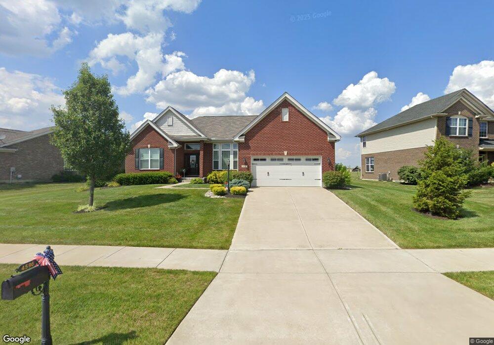
4596 Osprey Pointe Dr Liberty Township, OH 45011
Estimated Value: $527,000 - $582,000
3
Beds
3
Baths
2,264
Sq Ft
$245/Sq Ft
Est. Value
About This Home
This home is located at 4596 Osprey Pointe Dr, Liberty Township, OH 45011 and is currently estimated at $554,442, approximately $244 per square foot. 4596 Osprey Pointe Dr is a home with nearby schools including Cherokee Elementary School, Heritage Early Childhood School, and Lakota Plains Junior School.
Ownership History
Date
Name
Owned For
Owner Type
Purchase Details
Closed on
Jan 17, 2018
Sold by
Bryant Willard G and Bryant Patricia A
Bought by
Scaggs Wendy L and Bryant Preservation Trust
Current Estimated Value
Purchase Details
Closed on
Feb 8, 2016
Sold by
Old Kyle Station Llc
Bought by
Invester Grop Inc
Home Financials for this Owner
Home Financials are based on the most recent Mortgage that was taken out on this home.
Original Mortgage
$20,000,000
Interest Rate
3.93%
Mortgage Type
Stand Alone Refi Refinance Of Original Loan
Create a Home Valuation Report for This Property
The Home Valuation Report is an in-depth analysis detailing your home's value as well as a comparison with similar homes in the area
Home Values in the Area
Average Home Value in this Area
Purchase History
| Date | Buyer | Sale Price | Title Company |
|---|---|---|---|
| Scaggs Wendy L | -- | None Available | |
| Invester Grop Inc | $59,900 | None Available |
Source: Public Records
Mortgage History
| Date | Status | Borrower | Loan Amount |
|---|---|---|---|
| Previous Owner | Invester Grop Inc | $20,000,000 |
Source: Public Records
Tax History Compared to Growth
Tax History
| Year | Tax Paid | Tax Assessment Tax Assessment Total Assessment is a certain percentage of the fair market value that is determined by local assessors to be the total taxable value of land and additions on the property. | Land | Improvement |
|---|---|---|---|---|
| 2024 | $6,948 | $175,020 | $18,490 | $156,530 |
| 2023 | $6,861 | $175,020 | $18,490 | $156,530 |
| 2022 | $6,204 | $123,780 | $18,490 | $105,290 |
| 2021 | $6,172 | $123,780 | $18,490 | $105,290 |
| 2020 | $6,328 | $123,780 | $18,490 | $105,290 |
| 2019 | $6,062 | $107,970 | $20,070 | $87,900 |
| 2018 | $6,173 | $107,970 | $20,070 | $87,900 |
| 2017 | $1,009 | $15,000 | $15,000 | $0 |
| 2016 | $894 | $13,040 | $13,040 | $0 |
Source: Public Records
Map
Nearby Homes
- 4706 Oakview Ct
- 4821 Osprey Pointe Dr
- 4830 Cobblestone Ln
- 4926 Pebble Ct
- 4930 Pebble Ct
- 4934 Pebble Ct
- 4938 Pebble Ct
- 4946 Pebble Ct
- Allen Plan at Callaway Place - Townhomes
- Avery Plan at Callaway Place - Villas
- 5603 Callaway Dr
- 4895 Osprey Pointe Dr
- Cameron Plan at Callaway Place - Villas
- Bristol Plan at Callaway Place - Villas
- 0 Liberty Square Dr
- 4902 Harrier Ln
- 5765 Keshena Dr
- 4897 Osprey Pointe Dr
- 5567 Eagle Ct
- 5565 Eagle Ct
- 4606 Osprey Pointe Dr
- 4576 Osprey Pointe Dr
- 4574 Osprey Pointe Dr
- 4595 Osprey Pointe Dr
- 4616 Osprey Pointe Dr
- 4566 Osprey Pointe Dr
- 4605 Osprey Pointe Dr
- 4626 Osprey Pointe Dr
- 4626 Osprey Pointe Dr
- 4575 Osprey Pointe Dr
- 4615 Osprey Pointe Dr
- 4585 Osprey Pointe Dr
- 5279 Mariners Way
- 4625 Osprey Pointe Dr
- 4565 Osprey Pointe Dr
- 4642 Osprey Pointe Dr
- 5299 Mariners Way
- 5309 Mariners Way
- 4568 Randall Dr
- 4548 Randall Dr