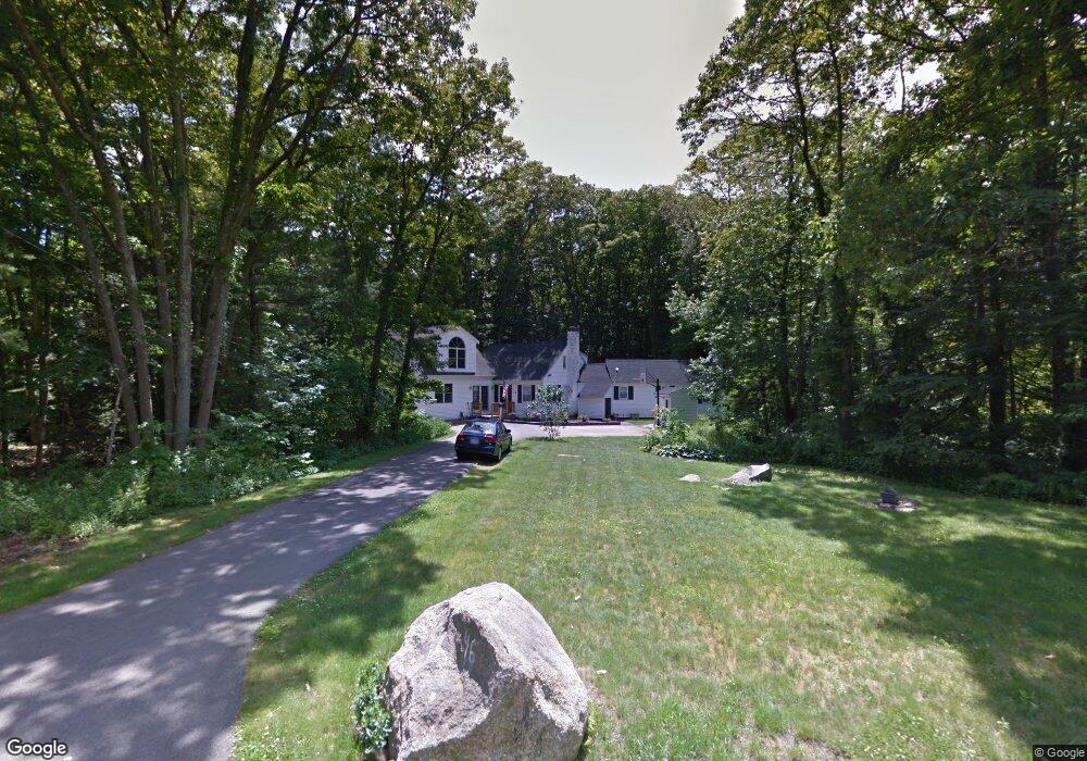
46 Colonel Hunt Dr Abington, MA 02351
Estimated Value: $629,000 - $711,988
2
Beds
3
Baths
2,696
Sq Ft
$250/Sq Ft
Est. Value
About This Home
This home is located at 46 Colonel Hunt Dr, Abington, MA 02351 and is currently estimated at $673,747, approximately $249 per square foot. 46 Colonel Hunt Dr is a home located in Plymouth County with nearby schools including Beaver Brook Elementary School, Abington Middle School, and Woodsdale School.
Ownership History
Date
Name
Owned For
Owner Type
Purchase Details
Closed on
Oct 27, 2000
Sold by
Nickley Joseph T and Nickley Rhonda Z
Bought by
Lawson Thomas R and Lawson Gabrielle N
Current Estimated Value
Home Financials for this Owner
Home Financials are based on the most recent Mortgage that was taken out on this home.
Original Mortgage
$213,750
Outstanding Balance
$78,482
Interest Rate
7.83%
Mortgage Type
Purchase Money Mortgage
Estimated Equity
$595,265
Purchase Details
Closed on
Sep 16, 1994
Sold by
Madigan Patrick J and Madigan Janet M
Bought by
Nickley Joseph T and Nickley Rhonda Z
Home Financials for this Owner
Home Financials are based on the most recent Mortgage that was taken out on this home.
Original Mortgage
$119,900
Interest Rate
8.38%
Mortgage Type
Purchase Money Mortgage
Purchase Details
Closed on
Apr 22, 1988
Sold by
Haskins F S Maud
Bought by
Madigan Patrick J
Create a Home Valuation Report for This Property
The Home Valuation Report is an in-depth analysis detailing your home's value as well as a comparison with similar homes in the area
Home Values in the Area
Average Home Value in this Area
Purchase History
| Date | Buyer | Sale Price | Title Company |
|---|---|---|---|
| Lawson Thomas R | $225,000 | -- | |
| Nickley Joseph T | $149,900 | -- | |
| Madigan Patrick J | $165,000 | -- |
Source: Public Records
Mortgage History
| Date | Status | Borrower | Loan Amount |
|---|---|---|---|
| Open | Madigan Patrick J | $213,750 | |
| Previous Owner | Madigan Patrick J | $48,210 | |
| Previous Owner | Madigan Patrick J | $122,000 | |
| Previous Owner | Madigan Patrick J | $119,900 |
Source: Public Records
Tax History Compared to Growth
Tax History
| Year | Tax Paid | Tax Assessment Tax Assessment Total Assessment is a certain percentage of the fair market value that is determined by local assessors to be the total taxable value of land and additions on the property. | Land | Improvement |
|---|---|---|---|---|
| 2025 | $7,909 | $605,600 | $279,600 | $326,000 |
| 2024 | $7,834 | $585,500 | $255,700 | $329,800 |
| 2023 | $7,958 | $560,000 | $234,000 | $326,000 |
| 2022 | $7,596 | $499,100 | $197,700 | $301,400 |
| 2021 | $7,116 | $431,800 | $181,600 | $250,200 |
| 2020 | $7,358 | $432,800 | $182,800 | $250,000 |
| 2019 | $7,319 | $420,900 | $175,900 | $245,000 |
| 2018 | $7,205 | $404,300 | $175,900 | $228,400 |
| 2017 | $6,929 | $377,600 | $175,900 | $201,700 |
| 2016 | $6,518 | $363,500 | $161,700 | $201,800 |
| 2015 | $5,964 | $350,800 | $161,700 | $189,100 |
Source: Public Records
Map
Nearby Homes
- 89 Andrew Ford Way
- 133 Andrew Ford Way
- 10 Bank St
- 64 Centre Ave Unit 1
- 37 Rockland St
- 40 Bedford St
- 87 Summer St
- 257 Rockland St Unit 257
- 676 Bedford St
- 1210 Washington St
- 20 Cleverly St Unit B2
- 0 Bedford St
- 158 Central St
- 116 Hancock St
- 1353 Washington St
- 209 Hancock St
- 164 Hancock St
- 28 Sylvan Ct
- 28 Nevens Cir
- 332 Hancock St
- 36 Colonel Hunt Dr
- 58 Colonel Hunt Dr
- 49 Colonel Hunt Dr
- 49 Pinetree Ln
- 28 Colonel Hunt Dr
- 29 Colonel Hunt Dr
- 65 Pinetree Ln
- 70 Colonel Hunt Dr
- 67 Colonel Hunt Dr
- 33 Pinetree Ln
- 35 Colonel Hunt Dr
- 226 Colonel Hunt Dr
- 236 Colonel Hunt Dr
- 6 Colonel Hunt Dr
- 30 Pinetree Ln
- 86 Colonel Hunt Dr
- 762 Washington St
- 5 Colonel Hunt Dr
- 216 Colonel Hunt Dr
- 40 Pinetree Ln