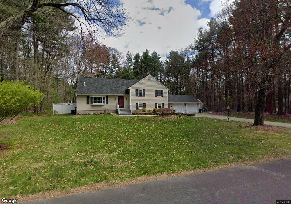
46 Rambling Rd Sudbury, MA 01776
Estimated Value: $1,231,000 - $1,351,000
4
Beds
3
Baths
3,336
Sq Ft
$383/Sq Ft
Est. Value
About This Home
This home is located at 46 Rambling Rd, Sudbury, MA 01776 and is currently estimated at $1,277,851, approximately $383 per square foot. 46 Rambling Rd is a home located in Middlesex County with nearby schools including Israel Loring Elementary School, Ephraim Curtis Middle School, and Lincoln-Sudbury Regional High School.
Ownership History
Date
Name
Owned For
Owner Type
Purchase Details
Closed on
Dec 29, 2010
Sold by
Baltimore James R and Baltimore Marliese K
Bought by
Weidenbach Joseph C and Weidenbach Mary L
Current Estimated Value
Home Financials for this Owner
Home Financials are based on the most recent Mortgage that was taken out on this home.
Original Mortgage
$520,000
Outstanding Balance
$347,496
Interest Rate
4.37%
Mortgage Type
Purchase Money Mortgage
Estimated Equity
$930,355
Create a Home Valuation Report for This Property
The Home Valuation Report is an in-depth analysis detailing your home's value as well as a comparison with similar homes in the area
Home Values in the Area
Average Home Value in this Area
Purchase History
| Date | Buyer | Sale Price | Title Company |
|---|---|---|---|
| Weidenbach Joseph C | $650,000 | -- |
Source: Public Records
Mortgage History
| Date | Status | Borrower | Loan Amount |
|---|---|---|---|
| Open | Weidenbach Joseph C | $520,000 |
Source: Public Records
Tax History Compared to Growth
Tax History
| Year | Tax Paid | Tax Assessment Tax Assessment Total Assessment is a certain percentage of the fair market value that is determined by local assessors to be the total taxable value of land and additions on the property. | Land | Improvement |
|---|---|---|---|---|
| 2025 | $16,354 | $1,117,100 | $503,000 | $614,100 |
| 2024 | $15,764 | $1,079,000 | $488,600 | $590,400 |
| 2023 | $15,390 | $975,900 | $436,600 | $539,300 |
| 2022 | $14,512 | $804,000 | $400,600 | $403,400 |
| 2021 | $13,902 | $738,300 | $400,600 | $337,700 |
| 2020 | $13,622 | $738,300 | $400,600 | $337,700 |
| 2019 | $13,223 | $738,300 | $400,600 | $337,700 |
| 2018 | $12,750 | $711,100 | $426,200 | $284,900 |
| 2017 | $12,221 | $688,900 | $422,600 | $266,300 |
| 2016 | $11,922 | $669,800 | $406,600 | $263,200 |
| 2015 | $11,225 | $637,800 | $395,000 | $242,800 |
| 2014 | $11,179 | $620,000 | $383,400 | $236,600 |
Source: Public Records
Map
Nearby Homes
- 84 Hopestill Brown Rd
- 0 Wagonwheel Rd
- 14 Eisenhower Rd
- 63 Landham Rd
- 91 Eaton Rd W
- 19 Nob Hill Dr
- 32 Eaton Rd W
- 216 Landham Rd
- 1011 Boston Post Rd
- 14 Francine Rd
- 41 James St
- 40 Gregory Rd
- 53 Davidson Rd
- 23 Massasoit Ave
- 8 Clara Rd
- 78 Apple d or Rd
- 36 Concord Rd
- 106 Baldwin Ave
- 24 Pinewood Dr
- 24 Woodland Rd