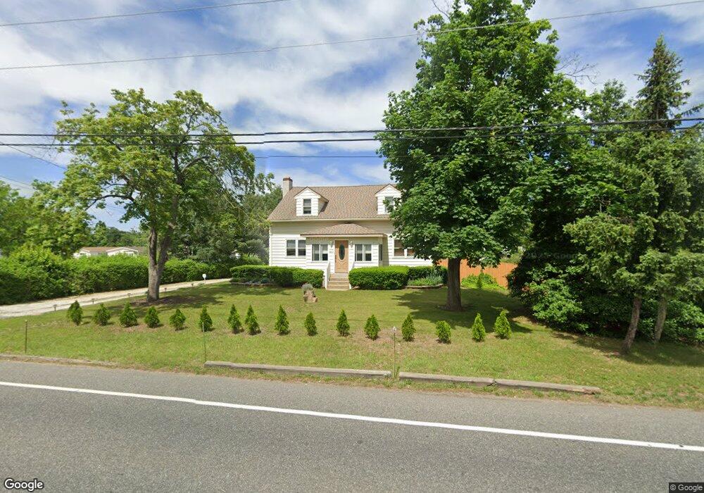
460 Harrison Ave Mantua, NJ 08051
Mantua Township NeighborhoodEstimated Value: $301,000 - $380,000
--
Bed
--
Bath
1,945
Sq Ft
$173/Sq Ft
Est. Value
About This Home
This home is located at 460 Harrison Ave, Mantua, NJ 08051 and is currently estimated at $337,151, approximately $173 per square foot. 460 Harrison Ave is a home located in Gloucester County with nearby schools including Centre City School, Clearview Regional Middle School, and Clearview Regional High School.
Ownership History
Date
Name
Owned For
Owner Type
Purchase Details
Closed on
Oct 5, 2018
Sold by
Mcglinchey Michael D and Mcglinchey Elaine
Bought by
Mcglinchey Michael D and Mcglinchey Elaine
Current Estimated Value
Purchase Details
Closed on
Nov 29, 1993
Sold by
Banff James
Bought by
Mcgunchey Michael and Nardello Elaine
Home Financials for this Owner
Home Financials are based on the most recent Mortgage that was taken out on this home.
Original Mortgage
$91,000
Interest Rate
6.69%
Create a Home Valuation Report for This Property
The Home Valuation Report is an in-depth analysis detailing your home's value as well as a comparison with similar homes in the area
Home Values in the Area
Average Home Value in this Area
Purchase History
| Date | Buyer | Sale Price | Title Company |
|---|---|---|---|
| Mcglinchey Michael D | -- | None Available | |
| Mcgunchey Michael | $96,000 | -- |
Source: Public Records
Mortgage History
| Date | Status | Borrower | Loan Amount |
|---|---|---|---|
| Closed | Mcgunchey Michael | $91,000 |
Source: Public Records
Tax History Compared to Growth
Tax History
| Year | Tax Paid | Tax Assessment Tax Assessment Total Assessment is a certain percentage of the fair market value that is determined by local assessors to be the total taxable value of land and additions on the property. | Land | Improvement |
|---|---|---|---|---|
| 2025 | $7,164 | $278,200 | $56,800 | $221,400 |
| 2024 | $7,089 | $278,200 | $56,800 | $221,400 |
| 2023 | $7,089 | $278,200 | $56,800 | $221,400 |
| 2022 | $6,244 | $178,500 | $43,300 | $135,200 |
| 2021 | $6,290 | $178,500 | $43,300 | $135,200 |
| 2020 | $6,240 | $178,500 | $43,300 | $135,200 |
| 2019 | $6,135 | $178,500 | $43,300 | $135,200 |
| 2018 | $6,048 | $178,500 | $43,300 | $135,200 |
| 2017 | $5,957 | $178,500 | $43,300 | $135,200 |
| 2016 | $5,889 | $178,500 | $43,300 | $135,200 |
| 2015 | $5,744 | $178,500 | $43,300 | $135,200 |
| 2014 | $5,551 | $178,500 | $43,300 | $135,200 |
Source: Public Records
Map
Nearby Homes
- 261 Tony Cir
- 204 W Landing Rd
- 36 Bluebird Rd
- 190 Mockingbird Ln
- 485 Harrison Ave
- 19 Marathon Dr
- 155 Whippoorwill Way
- 131 Firth Dr
- 1433 Tristram Cir
- 205 Redbud Ln Unit 205
- 325 Bridgeton Pike
- 106 Firth Dr
- 433 Berkley Rd
- 119 Monroe Ave
- 465 Berkley Rd
- 1147 Tristram Cir Unit 1147
- 1145 Tristram Cir
- 590 Bridgeton Pike
- 1215 Tristram Cir
- 26 Woodstream Ct
- 462 Harrison Ave
- 464 Harrison Ave
- 205 Appleblossom Ln
- 41 Bobolink Ave
- 201 Appleblossom Ln
- 209 Appleblossom Ln
- 211 Appleblossom Ln
- 470 Harrison Ave
- 16 Goldfinch Dr
- 18 Goldfinch Dr
- 208 Appleblossom Ln
- 215 Appleblossom Ln
- 275 Tony Cir
- 10 Blue Jay Dr
- 82 Bobolink Ave
- 450 Harrison Ave
- 75 Bobolink Ave
- 250 Andrew Ave
- 245 Andrew Ave
- 271 Tony Cir