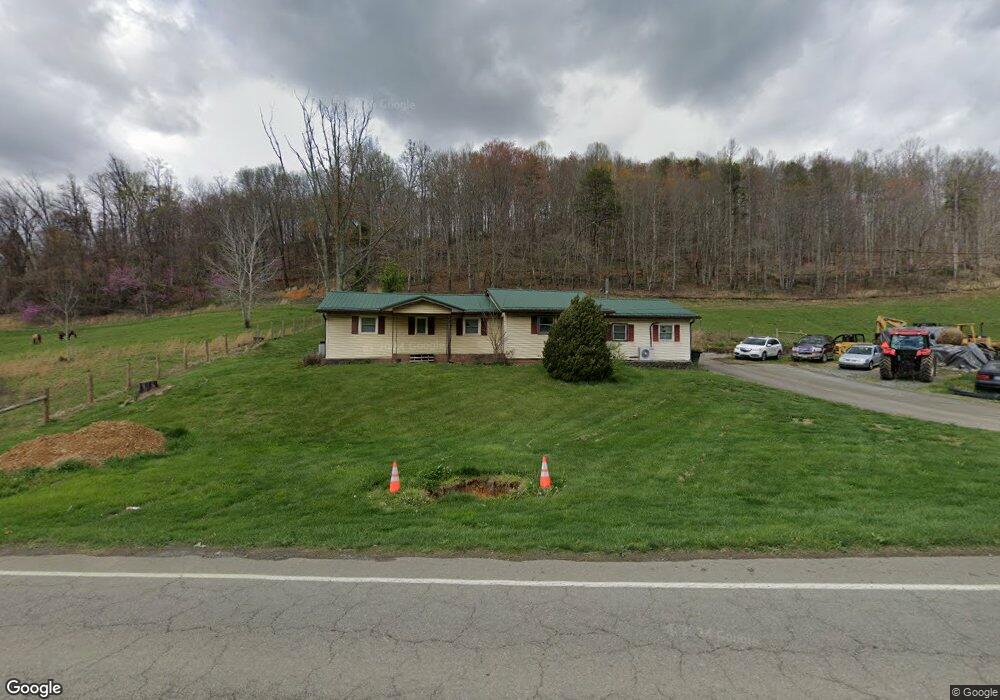
461 Highway 394 Blountville, TN 37617
Estimated Value: $199,549 - $326,000
--
Bed
2
Baths
1,426
Sq Ft
$193/Sq Ft
Est. Value
About This Home
This home is located at 461 Highway 394, Blountville, TN 37617 and is currently estimated at $275,637, approximately $193 per square foot. 461 Highway 394 is a home located in Sullivan County with nearby schools including Central Heights Elementary School and Sullivan Central Middle School.
Ownership History
Date
Name
Owned For
Owner Type
Purchase Details
Closed on
May 23, 2025
Sold by
Brown William A
Bought by
Brown Gregory Scott
Current Estimated Value
Purchase Details
Closed on
Oct 14, 2004
Sold by
Fleenor Kenneth L and Fleenor Joyce A
Bought by
Brown William A
Home Financials for this Owner
Home Financials are based on the most recent Mortgage that was taken out on this home.
Original Mortgage
$78,000
Interest Rate
5.64%
Create a Home Valuation Report for This Property
The Home Valuation Report is an in-depth analysis detailing your home's value as well as a comparison with similar homes in the area
Home Values in the Area
Average Home Value in this Area
Purchase History
| Date | Buyer | Sale Price | Title Company |
|---|---|---|---|
| Brown Gregory Scott | -- | None Listed On Document | |
| Brown Gregory Scott | -- | None Listed On Document | |
| Brown William A | $97,500 | -- |
Source: Public Records
Mortgage History
| Date | Status | Borrower | Loan Amount |
|---|---|---|---|
| Previous Owner | Brown William A | $78,000 |
Source: Public Records
Tax History Compared to Growth
Tax History
| Year | Tax Paid | Tax Assessment Tax Assessment Total Assessment is a certain percentage of the fair market value that is determined by local assessors to be the total taxable value of land and additions on the property. | Land | Improvement |
|---|---|---|---|---|
| 2024 | $757 | $30,325 | $5,750 | $24,575 |
| 2023 | $730 | $30,325 | $5,750 | $24,575 |
| 2022 | $730 | $30,325 | $5,750 | $24,575 |
| 2021 | $730 | $30,325 | $5,750 | $24,575 |
| 2020 | $751 | $30,325 | $5,750 | $24,575 |
| 2019 | $751 | $29,225 | $5,750 | $23,475 |
| 2018 | $745 | $29,225 | $5,750 | $23,475 |
| 2017 | $745 | $29,225 | $5,750 | $23,475 |
| 2016 | $611 | $23,725 | $5,800 | $17,925 |
| 2014 | $547 | $23,730 | $0 | $0 |
Source: Public Records
Map
Nearby Homes
- 4020 Highway 11 W
- 2892 Island Rd
- 1084 Highway 394
- 252 Leonard Ln
- 255 Central Heights Rd
- 252 Scott Ln
- 640 Oakwood Rd
- 680 Oakwood Rd
- 343 Barr Rd
- 13 Highland Meadows Dr
- 723 Central Heights Rd
- 468 Akard Ln
- 4080 Highway 126
- 590 County Home Rd
- 238 Eula Private Dr
- 217 Polo Dr
- 209 Polo Dr
- 222 Polo Dr
- 100 Polo Dr
- 4401 Hwy 11w
- 453 Tennessee 394
- 513 Highway 394
- 238 Hunters Trail
- 394 Tennessee 394 Unit na
- 539 Highway 394
- 247 Hunters Trail
- 369 Highway 394
- 369 Tennessee 394
- 571 St Rt 37 Unit LOT
- 572 Ogan Private Dr
- 372 Highway 394
- 557 Tennessee 394
- 238 Harr Ln
- 244 Harr Ln
- 252 Harr Ln
- 567 Tennessee 394
- 306 Harr Ln Unit 310
- 264 Harr Ln
- 592 Highway 394
- 595 Tennessee 394