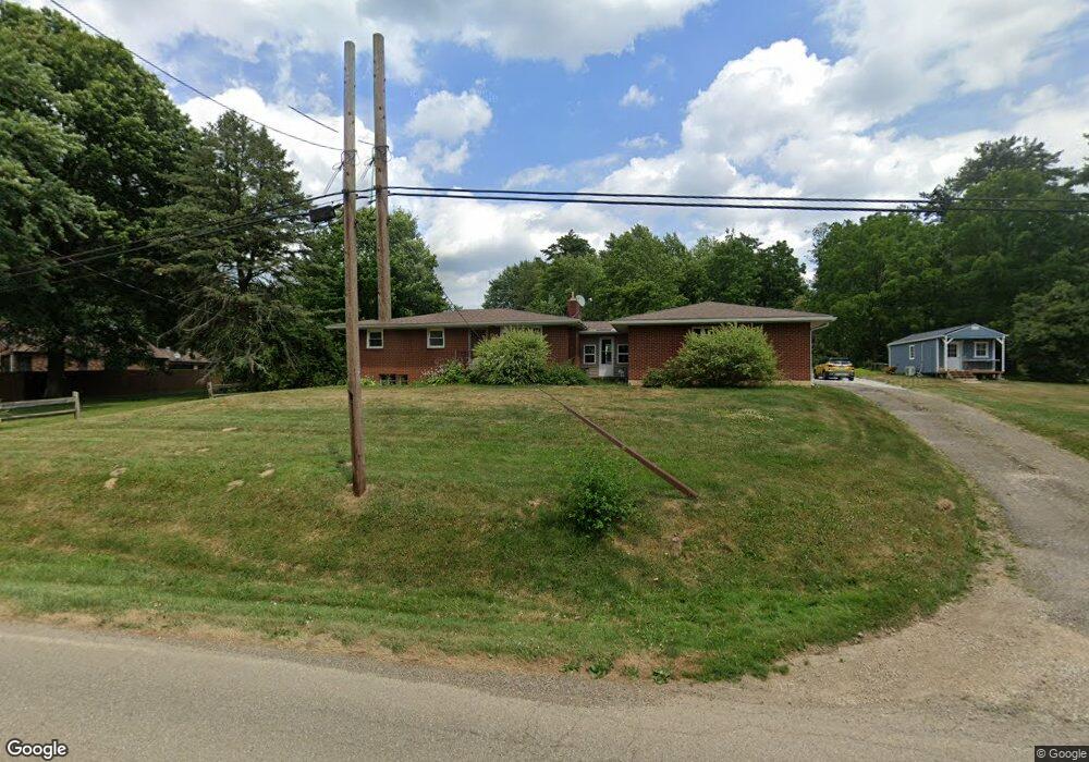
4626 Meese Rd Louisville, OH 44641
Estimated Value: $149,000 - $213,000
3
Beds
2
Baths
1,008
Sq Ft
$185/Sq Ft
Est. Value
About This Home
This home is located at 4626 Meese Rd, Louisville, OH 44641 and is currently estimated at $186,761, approximately $185 per square foot. 4626 Meese Rd is a home located in Stark County with nearby schools including Louisville High School and St. Thomas Aquinas High School & Middle School.
Ownership History
Date
Name
Owned For
Owner Type
Purchase Details
Closed on
Nov 3, 2022
Sold by
Stenger Willard J and Stenger Allison F
Bought by
Evans Jason and Evans Maranda
Current Estimated Value
Home Financials for this Owner
Home Financials are based on the most recent Mortgage that was taken out on this home.
Original Mortgage
$139,194
Outstanding Balance
$134,979
Interest Rate
7.08%
Mortgage Type
FHA
Estimated Equity
$51,782
Purchase Details
Closed on
May 27, 2004
Sold by
Oberlin Roberta E and Oberlin Glenn R
Bought by
Stenger Willard J and Stenger Allison F
Home Financials for this Owner
Home Financials are based on the most recent Mortgage that was taken out on this home.
Original Mortgage
$89,250
Interest Rate
6.52%
Mortgage Type
Unknown
Create a Home Valuation Report for This Property
The Home Valuation Report is an in-depth analysis detailing your home's value as well as a comparison with similar homes in the area
Home Values in the Area
Average Home Value in this Area
Purchase History
| Date | Buyer | Sale Price | Title Company |
|---|---|---|---|
| Evans Jason | $115,000 | -- | |
| Stenger Willard J | $105,000 | -- |
Source: Public Records
Mortgage History
| Date | Status | Borrower | Loan Amount |
|---|---|---|---|
| Open | Evans Jason | $139,194 | |
| Previous Owner | Stenger Willard J | $89,250 |
Source: Public Records
Tax History Compared to Growth
Tax History
| Year | Tax Paid | Tax Assessment Tax Assessment Total Assessment is a certain percentage of the fair market value that is determined by local assessors to be the total taxable value of land and additions on the property. | Land | Improvement |
|---|---|---|---|---|
| 2025 | -- | $42,950 | $13,130 | $29,820 |
| 2024 | -- | $42,950 | $13,130 | $29,820 |
| 2023 | $2,078 | $41,760 | $11,590 | $30,170 |
| 2022 | $2,402 | $48,130 | $11,590 | $36,540 |
| 2021 | $2,408 | $48,130 | $11,590 | $36,540 |
| 2020 | $2,028 | $42,710 | $10,470 | $32,240 |
| 2019 | $2,038 | $42,710 | $10,470 | $32,240 |
| 2018 | $2,032 | $42,710 | $10,470 | $32,240 |
| 2017 | $1,978 | $39,690 | $9,800 | $29,890 |
| 2016 | $1,936 | $39,690 | $9,800 | $29,890 |
| 2015 | $1,872 | $38,260 | $9,800 | $28,460 |
| 2014 | $1,764 | $33,360 | $8,540 | $24,820 |
| 2013 | $886 | $33,360 | $8,540 | $24,820 |
Source: Public Records
Map
Nearby Homes
- 2015 E Main St
- 1812 E Broad St
- 1413 Washington Blvd
- 0 Michigan Blvd
- 2110 Edmar St
- 308 Superior St
- 520 S Silver St
- 5495 Meese Rd NE
- 728 E Broad St
- 910 Crosswyck Cir
- 8896 Rue Helena St
- 325 Lincoln Ave
- 3390 Meese Rd NE
- 210 E Gorgas St
- 204 E Broad St
- 107 E Broad St
- 344 E Reno Dr
- 316 E Reno Dr
- 908 Sand Lot Cir
- 428 Honeycrisp Dr NE
- 4625 Meese Rd
- 4651 Meese Rd
- 4625 Meese Rd NE
- 4672 Meese Rd
- 4574 Meese Rd
- 4601 Meese Rd
- 8874 Louisville St
- 8812 Louisville St NE
- 8812 Louisville St
- 4566 Meese Rd NE
- 4575 Meese Rd
- 126 Brookfield St
- 118 Brookfield St
- 8888 Louisville St
- 134 Brookfield St
- 2120 E Main St
- 4554 Meese Rd NE
- 136 Brookfield St
- 150 Brookfield St
- 2110 E Main St