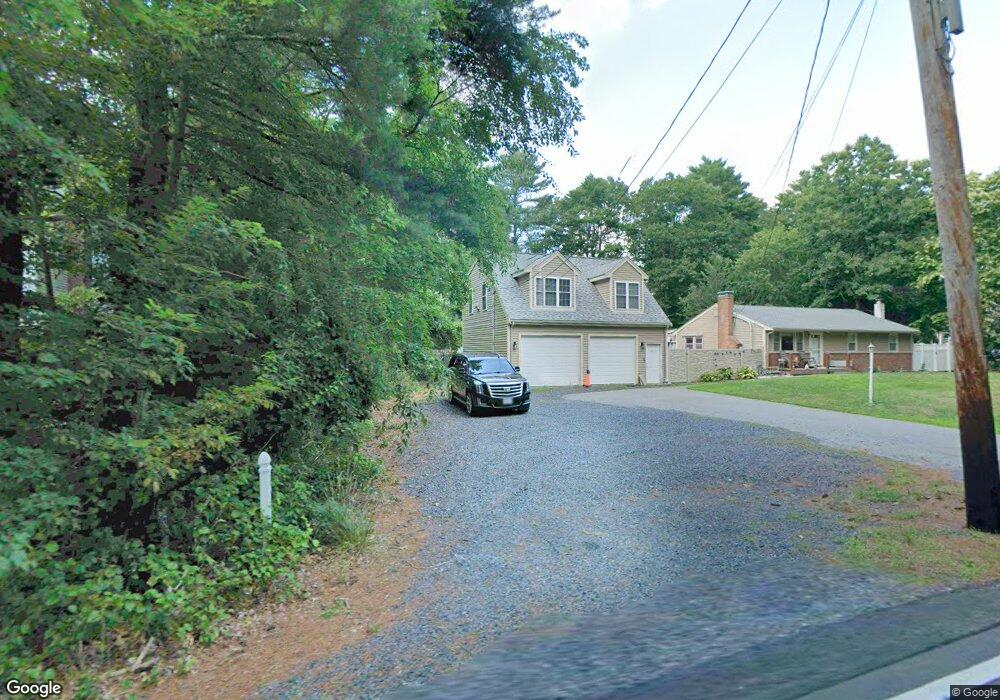
464 Whitman St Hanson, MA 02341
Estimated Value: $500,000 - $585,000
3
Beds
1
Bath
1,302
Sq Ft
$420/Sq Ft
Est. Value
About This Home
This home is located at 464 Whitman St, Hanson, MA 02341 and is currently estimated at $546,474, approximately $419 per square foot. 464 Whitman St is a home located in Plymouth County.
Ownership History
Date
Name
Owned For
Owner Type
Purchase Details
Closed on
Dec 1, 2021
Sold by
Garneau Edward T and Whitten Kirsten D
Bought by
Garneau Ft
Current Estimated Value
Purchase Details
Closed on
Apr 9, 2007
Sold by
Whitten Kirsten D
Bought by
Whitten Kirsten D and Garneau Edward T
Purchase Details
Closed on
Jul 18, 2003
Sold by
Whitten Kirsten D and Whitten Jacqueline A
Bought by
Whitten Kirsten D
Purchase Details
Closed on
Oct 3, 1997
Sold by
Williams Stephen J and Williams Patricia M
Bought by
Whitten Jacqueline A and Whitten Kirsten D
Purchase Details
Closed on
Jul 30, 1993
Sold by
Fhlmc
Bought by
Williams Stephen J and Williams Patricia M
Purchase Details
Closed on
May 21, 1993
Sold by
Cruickshank Robert J
Bought by
Quincy Sb
Purchase Details
Closed on
Apr 21, 1989
Sold by
Conroy Thias A
Bought by
Cruickshank Robert J
Create a Home Valuation Report for This Property
The Home Valuation Report is an in-depth analysis detailing your home's value as well as a comparison with similar homes in the area
Home Values in the Area
Average Home Value in this Area
Purchase History
| Date | Buyer | Sale Price | Title Company |
|---|---|---|---|
| Garneau Ft | -- | None Available | |
| Whitten Kirsten D | -- | -- | |
| Whitten Kirsten D | -- | -- | |
| Whitten Jacqueline A | $135,000 | -- | |
| Williams Stephen J | $121,900 | -- | |
| Quincy Sb | $115,000 | -- | |
| Quincy Sb | $115,000 | -- | |
| Cruickshank Robert J | $143,000 | -- | |
| Cruickshank Robert J | $143,000 | -- |
Source: Public Records
Mortgage History
| Date | Status | Borrower | Loan Amount |
|---|---|---|---|
| Previous Owner | Cruickshank Robert J | $35,000 | |
| Previous Owner | Cruickshank Robert J | $244,000 |
Source: Public Records
Tax History Compared to Growth
Tax History
| Year | Tax Paid | Tax Assessment Tax Assessment Total Assessment is a certain percentage of the fair market value that is determined by local assessors to be the total taxable value of land and additions on the property. | Land | Improvement |
|---|---|---|---|---|
| 2025 | $5,867 | $438,500 | $172,000 | $266,500 |
| 2024 | $5,744 | $429,300 | $167,000 | $262,300 |
| 2023 | $5,756 | $405,900 | $167,000 | $238,900 |
| 2022 | $5,613 | $372,000 | $151,800 | $220,200 |
| 2021 | $5,126 | $339,500 | $146,000 | $193,500 |
| 2020 | $5,068 | $331,900 | $141,000 | $190,900 |
| 2019 | $4,956 | $319,100 | $138,300 | $180,800 |
| 2018 | $4,885 | $308,600 | $133,000 | $175,600 |
| 2017 | $4,767 | $298,300 | $126,700 | $171,600 |
| 2016 | $4,778 | $288,700 | $126,700 | $162,000 |
| 2015 | $4,534 | $284,800 | $126,700 | $158,100 |
Source: Public Records
Map
Nearby Homes
- 248 E Washington St
- 168 Spring St
- 418 E Washington St
- Lot 5 Princeton Way
- 33 Tavern Way
- 57 Liberty St
- 22 Howland Trail Unit 34
- 13 Hayford Trail Unit 15
- 12 Hayford Trail Unit 17
- 8 Hayford Trail Unit 19
- 7 Hayford Trail Unit 12
- 5 Hayford Trail Unit 11
- 842 Whitman St
- 37 Brook St
- 417 Birchbark Dr
- 1057 Whitman St
- 842 E Washington St
- 55 Plymouth St Unit A5
- Lot 2 Harvard Rd
- Lot 6 Way
- 470 Whitman St
- 450 Whitman St
- 469 Whitman St
- 480 Whitman St
- 451 Whitman St
- 473 Whitman St
- 436 Whitman St
- 3 Capt Nathaniel Dr
- 8 Capt Nathaniel Dr
- 28 Commons Ln
- 439 Whitman St
- 35 Captain Nathaniel Dr
- 25 Commons Ln
- 422 Whitman St
- 18 Capt Nathaniel Dr
- 423 Whitman St
- 22 Captain Nathaniel Dr
- 500 Whitman St
- 524 Whitman St
- 12 Commons Ln