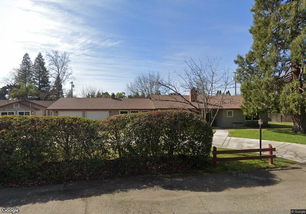
4674 S Park Dr Sacramento, CA 95821
Greenwood NeighborhoodEstimated Value: $534,000 - $787,000
4
Beds
2
Baths
2,451
Sq Ft
$278/Sq Ft
Est. Value
About This Home
This home is located at 4674 S Park Dr, Sacramento, CA 95821 and is currently estimated at $681,900, approximately $278 per square foot. 4674 S Park Dr is a home located in Sacramento County with nearby schools including Starr King K-8, Rio Americano High School, and Visions In Education School.
Ownership History
Date
Name
Owned For
Owner Type
Purchase Details
Closed on
Oct 6, 2014
Sold by
Reinwald Robert D and Reinwald Gayle
Bought by
The Reinwald Family Trust
Current Estimated Value
Purchase Details
Closed on
Jul 18, 1997
Sold by
Mcpeak Family Trust and Franklin C
Bought by
Reinwald Robert D and Reinwald Gayle
Home Financials for this Owner
Home Financials are based on the most recent Mortgage that was taken out on this home.
Original Mortgage
$144,000
Outstanding Balance
$21,241
Interest Rate
7.83%
Mortgage Type
Seller Take Back
Estimated Equity
$660,659
Purchase Details
Closed on
Sep 27, 1994
Sold by
Mcpeak Franklin C and Mcpeak Eleanor C
Bought by
Mcpeak Franklin C and Mcpeak Eleanor C
Create a Home Valuation Report for This Property
The Home Valuation Report is an in-depth analysis detailing your home's value as well as a comparison with similar homes in the area
Home Values in the Area
Average Home Value in this Area
Purchase History
| Date | Buyer | Sale Price | Title Company |
|---|---|---|---|
| The Reinwald Family Trust | -- | None Available | |
| Reinwald Robert D | $150,000 | First American Title Ins Co | |
| Mcpeak Franklin C | -- | -- |
Source: Public Records
Mortgage History
| Date | Status | Borrower | Loan Amount |
|---|---|---|---|
| Open | Reinwald Robert D | $144,000 |
Source: Public Records
Tax History Compared to Growth
Tax History
| Year | Tax Paid | Tax Assessment Tax Assessment Total Assessment is a certain percentage of the fair market value that is determined by local assessors to be the total taxable value of land and additions on the property. | Land | Improvement |
|---|---|---|---|---|
| 2025 | $4,661 | $396,344 | $90,362 | $305,982 |
| 2024 | $4,661 | $388,574 | $88,591 | $299,983 |
| 2023 | $4,535 | $380,955 | $86,854 | $294,101 |
| 2022 | $4,508 | $373,486 | $85,151 | $288,335 |
| 2021 | $4,440 | $366,164 | $83,482 | $282,682 |
| 2020 | $4,358 | $362,410 | $82,626 | $279,784 |
| 2019 | $4,270 | $355,305 | $81,006 | $274,299 |
| 2018 | $4,215 | $348,339 | $79,418 | $268,921 |
| 2017 | $4,177 | $341,510 | $77,861 | $263,649 |
| 2016 | $3,902 | $334,815 | $76,335 | $258,480 |
| 2015 | $3,834 | $329,787 | $75,189 | $254,598 |
| 2014 | $3,753 | $323,328 | $73,717 | $249,611 |
Source: Public Records
Map
Nearby Homes
- 0 El Camino Ave Unit 225117105
- 4905 Douvan Ct
- 2953 Leta Ln
- 2373 Mission Ave
- 4905 Heatherdale Ln
- 3113 Bertis Dr
- 2453 Via Camino Ave
- 2420 Via Camino Ave
- 2610 Watson St
- 4516 McDonald Dr
- 4205 Lyle St
- 4609 Nottingham Cir
- 4912 Melvin Dr
- 4213 Boone Ln
- 2800 Villa Vista Way
- 4341 Baywood Way
- 2809 Avalon Dr
- 5132 El Camino Ave Unit 108
- 5115 Whisper Oaks Ln
- 2919 Easy Way
- 2625 Mission Ave
- 2706 Wrendale Way
- 2718 Wrendale Way
- 2626 Wrendale Way
- 2700 Mission Ave
- 2621 Mission Ave
- 2712 Mission Ave
- 2725 Mission Ave
- 2624 Mission Ave
- 2622 Wrendale Way
- 2724 Mission Ave
- 2713 Doris Ct
- 2701 Doris Ct
- 4627 Hazelwood Ave
- 4623 Hazelwood Ave
- 2620 Mission Ave
- 4619 Hazelwood Ave
- 2728 Mission Ave
- 4704 Kenneth Ave
- 4665 S Park Dr