Estimated Value: $283,874 - $302,000
3
Beds
2
Baths
1,128
Sq Ft
$259/Sq Ft
Est. Value
About This Home
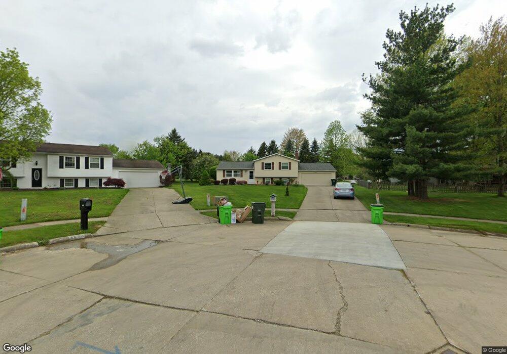
This home is located at 4676 Iroquois Cir, Stow, OH 44224 and is currently estimated at $291,719, approximately $258 per square foot. 4676 Iroquois Cir is a home located in Summit County with nearby schools including Stow-Munroe Falls High School, Primrose School of Hudson, and Holy Family Elementary School.
Ownership History
Date
Name
Owned For
Owner Type
Purchase Details
Closed on
Oct 10, 2005
Sold by
Schilling Dale C and Schilling Linda K
Bought by
Brittan James H and Brittan Margery R
Current Estimated Value
Home Financials for this Owner
Home Financials are based on the most recent Mortgage that was taken out on this home.
Original Mortgage
$159,500
Interest Rate
5.88%
Mortgage Type
Fannie Mae Freddie Mac
Create a Home Valuation Report for This Property
The Home Valuation Report is an in-depth analysis detailing your home's value as well as a comparison with similar homes in the area
Home Values in the Area
Average Home Value in this Area
Purchase History
| Date | Buyer | Sale Price | Title Company |
|---|---|---|---|
| Brittan James H | $167,900 | Land America-Lawyers Title |
Source: Public Records
Mortgage History
| Date | Status | Borrower | Loan Amount |
|---|---|---|---|
| Closed | Brittan James H | $159,500 |
Source: Public Records
Tax History Compared to Growth
Tax History
| Year | Tax Paid | Tax Assessment Tax Assessment Total Assessment is a certain percentage of the fair market value that is determined by local assessors to be the total taxable value of land and additions on the property. | Land | Improvement |
|---|---|---|---|---|
| 2025 | $4,409 | $78,092 | $13,440 | $64,652 |
| 2024 | $4,409 | $78,092 | $13,440 | $64,652 |
| 2023 | $4,409 | $78,092 | $13,440 | $64,652 |
| 2022 | $3,943 | $61,607 | $10,339 | $51,268 |
| 2021 | $3,531 | $61,607 | $10,339 | $51,268 |
| 2020 | $3,471 | $61,610 | $10,340 | $51,270 |
| 2019 | $3,247 | $53,820 | $9,040 | $44,780 |
| 2018 | $3,194 | $53,820 | $9,040 | $44,780 |
| 2017 | $2,897 | $53,820 | $9,040 | $44,780 |
| 2016 | $2,981 | $47,360 | $9,040 | $38,320 |
| 2015 | $2,897 | $47,360 | $9,040 | $38,320 |
| 2014 | $2,899 | $47,360 | $9,040 | $38,320 |
| 2013 | $2,975 | $48,940 | $9,040 | $39,900 |
Source: Public Records
Map
Nearby Homes
- 1511 Apollo Dr
- 0 Hibbard Dr
- 1470 Mac Dr
- V/L Housley Rd
- 1808 Higby Dr Unit A
- 4877 Cedar Crest Ln
- 4891 Cedar Crest Ln
- 1525 Spruce Hill Dr
- 1664 Cypress Ct
- V/L Lawnmark Dr
- 1668 Cypress Ct
- 1627 Cypress Ct
- 1938 Higby Dr
- 4630 Red Willow Rd
- 4321 Leewood Rd
- 4145 Darrow Rd
- 4024 Glenrich Cir
- 1620 Sapphire Dr
- V/L Diplomat Dr
- 1884 Village Ct Unit X66
- 4672 Iroquois Cir
- 1346 Hibbard Dr Unit J3
- 1346 Hibbard Dr Unit J2
- 1346 Hibbard Dr Unit J1
- 1346 Hibbard Dr Unit J4
- 1346 Hibbard Dr Unit D
- 1346 Hibbard Dr Unit C
- 1346 Hibbard Dr Unit A
- 1346 Hibbard Dr Unit 4J
- 1348 Hibbard Dr
- 1352 Hibbard Dr
- 1342 Hibbard Dr Unit I3
- 1342 Hibbard Dr Unit I2
- 1342 Hibbard Dr Unit I1
- 1342 Hibbard Dr Unit I4
- 1342 Hibbard Dr Unit B
- 1342 Hibbard Dr Unit A
- 1342 Hibbard Dr Unit D
- 1342 Hibbard Dr
- 1342 Hibbard Dr Unit C